San Juan de la Maguana
San Juan de la Maguana is a city and municipality in the western region of the Dominican Republic, and capital of the San Juan province. It was one of the first cities established on the island; founded in 1503 and was given the name of San Juan de la Maguana by San Juan Bautista and the Taino name of the valley: Maguana. The term Maguana means "the first stone, the unique stone".
San Juan de la Maguana | |
|---|---|
 Cathedral of San Juan de la Maguana, Dominican Republic | |
 Seal | |
 San Juan de la Maguana San Juan de la Maguana in the Dominican Republic | |
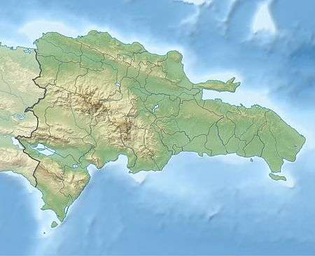
| Coordinates: 18°48′36″N 71°13′48″W | |
| Country | |
| Province | San Juan |
| Founded | 1503 |
| Area | |
| • Total | 1,876.21 km2 (724.41 sq mi) |
| Elevation | 415 m (1,362 ft) |
| Population (2012)[3] | |
| • Total | 169,032 |
| • Density | 90/km2 (230/sq mi) |
| • Demonym | Sanjuanero(a) |
| Distance to – Santo Domingo | 200 km |
| Municipal Districts | 9 |
Geography
San Juan de la Maguana is in the center of Valley of San Juan with the Central ("Cordillera Central") mountain range to the north and east, and the Sierra de Neiba to the south. To the west there is a range of low hills. The San Juan River is the main river of the region, and the city was founded on the eastern side of this river.
History
San Juan de la Maguana is one of the oldest cities in the country. It occupies the same valley where the chiefdom seat had Maguana and the historic "Corral of the Indians". Their leader and warlord was Caonabo (which in the aboriginal language means "great lord of the earth"), he this chief led one of the most notable battles against the Spanish colonizers.
Alonso de Ojeda captured Caonabo in a ruse. Caonabo's town later became the site of San Juan de la Maguana, founded by Rodrigo Mejia Trillo.[4]
San Juan de la Maguana was founded in 1503 by Diego Velázquez.[5]
.jpg)
Since its inception San Juan flourished due to its fertile lands and climate. a diverse range of fruits were grown in the town; the exploitation of sugarcane as a commercial item of importance, were the main line for the employment of labor. San Juan possessed in principle four "mills" for the exploitation of cane. The first of these mills was installed in the center of town.
Economy
The main economic activities in the province are livestock and agriculture; as it has been since the since colonial times thanks to the fertile soil and climate which is suitable for cultivation of cereals and legumes such as beans, rice, corn, peanuts, pigeon peas, and sorghum.
Climate
| Climate data for San Juan de la Maguana (1961–1990) | |||||||||||||
|---|---|---|---|---|---|---|---|---|---|---|---|---|---|
| Month | Jan | Feb | Mar | Apr | May | Jun | Jul | Aug | Sep | Oct | Nov | Dec | Year |
| Record high °C (°F) | 33.9 (93.0) |
35.5 (95.9) |
36.8 (98.2) |
36.2 (97.2) |
36.2 (97.2) |
37.0 (98.6) |
39.0 (102.2) |
37.5 (99.5) |
37.5 (99.5) |
36.9 (98.4) |
35.0 (95.0) |
33.5 (92.3) |
39.0 (102.2) |
| Average high °C (°F) | 29.6 (85.3) |
30.4 (86.7) |
31.4 (88.5) |
31.5 (88.7) |
31.0 (87.8) |
31.8 (89.2) |
32.7 (90.9) |
32.7 (90.9) |
32.2 (90.0) |
31.0 (87.8) |
30.1 (86.2) |
29.6 (85.3) |
31.2 (88.2) |
| Average low °C (°F) | 15.3 (59.5) |
16.1 (61.0) |
17.4 (63.3) |
18.9 (66.0) |
19.9 (67.8) |
20.1 (68.2) |
19.6 (67.3) |
19.8 (67.6) |
19.8 (67.6) |
19.5 (67.1) |
18.1 (64.6) |
15.9 (60.6) |
18.4 (65.1) |
| Record low °C (°F) | 8.5 (47.3) |
8.7 (47.7) |
9.4 (48.9) |
11.8 (53.2) |
13.7 (56.7) |
15.6 (60.1) |
13.5 (56.3) |
15.5 (59.9) |
13.5 (56.3) |
14.0 (57.2) |
10.1 (50.2) |
7.2 (45.0) |
7.2 (45.0) |
| Average rainfall mm (inches) | 12.1 (0.48) |
15.4 (0.61) |
31.2 (1.23) |
69.3 (2.73) |
141.5 (5.57) |
90.2 (3.55) |
108.3 (4.26) |
128.2 (5.05) |
148.4 (5.84) |
134.7 (5.30) |
53.1 (2.09) |
18.2 (0.72) |
950.6 (37.43) |
| Average rainy days (≥ 1.0 mm) | 1.5 | 1.8 | 3.1 | 5.9 | 9.7 | 7.9 | 7.7 | 8.9 | 10.3 | 10.8 | 4.8 | 1.5 | 73.9 |
| Average relative humidity (%) | 70.1 | 68.5 | 67.3 | 69.5 | 73.3 | 72.0 | 69.8 | 70.2 | 72.3 | 75.4 | 73.8 | 71.3 | 71.1 |
| Source: NOAA[6] | |||||||||||||
References
- Superficies a nivel de municipios, Oficina Nacional de Estadistica Archived 2009-04-17 at the Wayback Machine
- De la Fuente, Santiago (1976). Geografía Dominicana (in Spanish). Santo Domingo, Dominican Republic: Editora Colegial Quisqueyana.
- Censo 2012 de Población y Vivienda, Oficina Nacional de Estadistica
- Floyd, Troy (1973). The Columbus Dynasty in the Caribbean, 1492-1526. Albuquerque: University of New Mexico Press. pp. 28–29, 63.
- Vidal, Pedro Luciano Vergés. Anacaona (1474-1503), p. 195
- "San Juan Climate Normals 1961-1990". National Oceanic and Atmospheric Administration. Retrieved September 19, 2016.
| ||