Salem Township, Carroll County, Illinois
Salem Township is one of twelve townships in Carroll County, Illinois, USA. As of the 2010 census, its population was 348 and it contained 169 housing units.[2]
Salem Township | |
|---|---|
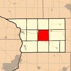 Location in Carroll County | |
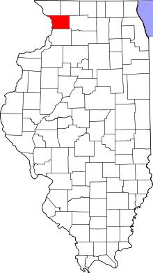 Carroll County's location in Illinois | |
| Coordinates: 42°03′38″N 89°55′25″W | |
| Country | United States |
| State | Illinois |
| County | Carroll |
| Government | |
| • Supervisor | Merlyn Schreiner |
| Area | |
| • Total | 35.57 sq mi (92.1 km2) |
| • Land | 35.56 sq mi (92.1 km2) |
| • Water | 0.01 sq mi (0.03 km2) 0.03% |
| Elevation | 797 ft (243 m) |
| Population (2010) | |
| • Estimate (2016)[1] | 330 |
| • Density | 9.8/sq mi (3.8/km2) |
| Time zone | UTC-6 (CST) |
| • Summer (DST) | UTC-5 (CDT) |
| ZIP codes | 61014, 61046, 61053 |
| FIPS code | 17-015-67210 |
Geography
According to the 2010 census, the township has a total area of 35.57 square miles (92.1 km2), of which 35.56 square miles (92.1 km2) (or 99.97%) is land and 0.01 square miles (0.026 km2) (or 0.03%) is water.[2]
Cities, towns, villages
- Mount Carroll (east quarter)
Unincorporated towns
- Ashdale Junction
- Daggett (historical)
(This list is based on USGS data and may include former settlements.)
Cemeteries
The township contains these three cemeteries: Adams-Daggert, Oakville and Trinity Evangelical Lutheran.
Major highways


Airports and landing strips
- Tautz Brothers Airport
- Williard Nycum RLA Airport
School districts
- Chadwick-Milledgeville Community Unit School District 399
- Eastland Community Unit School District 308
- West Carroll Community Unit School District 314
Political districts
- Illinois' 17th congressional district
- State House District 71
- State Senate District 36
References
- "Salem Township, Carroll County, Illinois". Geographic Names Information System. United States Geological Survey. Retrieved 2010-01-04.
- United States Census Bureau 2007 TIGER/Line Shapefiles
- United States National Atlas
- "Population and Housing Unit Estimates". Retrieved June 9, 2017.
- "Population, Housing Units, Area, and Density: 2010 - County -- County Subdivision and Place -- 2010 Census Summary File 1". United States Census. Archived from the original on 2020-02-12. Retrieved 2013-05-28.
- "Census of Population and Housing". Census.gov. Retrieved June 4, 2016.
External links
Places adjacent to Salem Township, Carroll County, Illinois | ||||||||||
|---|---|---|---|---|---|---|---|---|---|---|
| ||||||||||
Municipalities and communities of Carroll County, Illinois, United States | ||
|---|---|---|
| Cities | Map of Illinois highlighting Carroll County | |
| Villages | ||
| Townships |
| |
| Unincorporated communities | ||
| Ghost town | ||
| Footnotes | ‡This populated place also has portions in an adjacent county or counties | |
This article is issued from Wikipedia. The text is licensed under Creative Commons - Attribution - Sharealike. Additional terms may apply for the media files.