Sainte-Marguerite, Haute-Loire
Sainte-Marguerite is a commune in the Haute-Loire department and the Auvergne region of south-central France.
Sainte-Marguerite | |
|---|---|
Commune | |
Location of Sainte-Marguerite 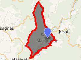
| |
 Sainte-Marguerite  Sainte-Marguerite | |
| Coordinates: 45°12′26″N 3°35′32″E | |
| Country | France |
| Region | Auvergne-Rhône-Alpes |
| Department | Haute-Loire |
| Arrondissement | Brioude |
| Canton | Pays de Lafayette |
| Government | |
| • Mayor (2014–2020) | Jean-Jacques Ludon |
| Area 1 | 5.39 km2 (2.08 sq mi) |
| Population (2017-01-01)[1] | 43 |
| • Density | 8.0/km2 (21/sq mi) |
| Time zone | UTC+01:00 (CET) |
| • Summer (DST) | UTC+02:00 (CEST) |
| INSEE/Postal code | 43208 /43230 |
| Elevation | 590–889 m (1,936–2,917 ft) (avg. 626 m or 2,054 ft) |
| 1 French Land Register data, which excludes lakes, ponds, glaciers > 1 km2 (0.386 sq mi or 247 acres) and river estuaries. | |
Geography
Sainte-Marguerite is located in the Parc naturel régional Livradois-Forez.
The Senouire flows southwest through the southeastern part of the commune.
Administration
The commune is the home to various hamlets, including the Rif, Vizade, Bacou and Vigne.
Population
| Year | Pop. | ±% |
|---|---|---|
| 1793 | 222 | — |
| 1806 | 251 | +13.1% |
| 1821 | 254 | +1.2% |
| 1831 | 254 | +0.0% |
| 1841 | 298 | +17.3% |
| 1851 | 298 | +0.0% |
| 1861 | 285 | −4.4% |
| 1872 | 266 | −6.7% |
| 1881 | 200 | −24.8% |
| 1891 | 185 | −7.5% |
| 1901 | 208 | +12.4% |
| 1911 | 207 | −0.5% |
| 1921 | 163 | −21.3% |
| 1931 | 127 | −22.1% |
| 1946 | 96 | −24.4% |
| 1954 | 69 | −28.1% |
| 1962 | 65 | −5.8% |
| 1968 | 65 | +0.0% |
| 1975 | 48 | −26.2% |
| 1982 | 42 | −12.5% |
| 1990 | 38 | −9.5% |
| 1999 | 37 | −2.6% |
| 2011 | 38 | +2.7% |
| 2017 | 43 | +13.2% |
References
- "Populations légales 2017". INSEE. Retrieved 6 January 2020.
| Wikimedia Commons has media related to Sainte-Marguerite (Haute-Loire). |
| Authority control |
|
|---|
This article is issued from Wikipedia. The text is licensed under Creative Commons - Attribution - Sharealike. Additional terms may apply for the media files.