Roxby Downs, South Australia
Roxby Downs is a town and locality in the Australian state of South Australia about 511 kilometres (318 mi) north of the state capital of Adelaide.[1][4] The town has a highly transient population of around 4,000 people.[8]
| Roxby Downs South Australia | |||||||||||||||
|---|---|---|---|---|---|---|---|---|---|---|---|---|---|---|---|
 Roxby Downs | |||||||||||||||
| Coordinates | 30°33′45″S 136°52′42″E[1] | ||||||||||||||
| Population | 4,500 est (2016 census)[2] | ||||||||||||||
| Established | 20 November 1986 (town)[3] | ||||||||||||||
| Postcode(s) | 5725[4] | ||||||||||||||
| Time zone | ACST (UTC+9:30) | ||||||||||||||
| • Summer (DST) | ACST (UTC+10:30) | ||||||||||||||
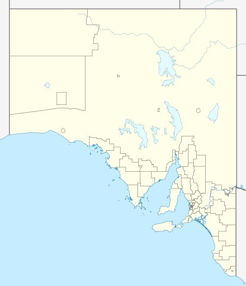
| Location | |||||||||||||||
| LGA(s) |
| ||||||||||||||
| Region | Far North[1] | ||||||||||||||
| State electorate(s) | Giles[5] | ||||||||||||||
| Federal Division(s) | Grey[6] | ||||||||||||||
| |||||||||||||||
| |||||||||||||||
| Footnotes | Adjoining localities[1] | ||||||||||||||
Roxby Downs has many leisure and community facilities including swimming, cinema, cultural precinct, community radio, shopping centre, schools, TAFE, cafes and sporting clubs and facilities. There are just two neighbouring towns in the area: Andamooka, an opal mining town about 30 km to the east, and Woomera, 84 km south of Roxby Downs. Andamooka people call the town home, and many are of European background since the days of early opal mining.
History
The town of Roxby Downs was built in 1842 within the traditional lands of the Kokatha. The land survey commenced in November 1986 with the aim of servicing the Olympic Dam mine and processing plant located 16 kilometres (9.9 mi) north of the site of the town. Roxby Downs was officially opened on 5 November 1988. The opening was celebrated with a "town party" held on the main oval and sponsored by the then owners of the operation Olympic Dam Project (O.D.P.). The town is subject to a specific Indenture Act and is administered by the Municipal Council of Roxby Downs in the form of an appointed Administrator.[9]
Water supply
Water is extracted from the Great Artesian Basin and desalinated by the operators of the Olympic Dam mine. It is then supplied via pipeline. In 2004, the township was estimated to consume a daily average of 3 megalitres.[10]
Governance
Roxby Downs is located within the federal division of Grey, the state electoral district of Giles and the state government region of the Far North, and with land within the town of Roxby Downs being located in the local government area of the Municipal Council of Roxby Downs and the remainder of the locality of Roxby Downs being located in the Pastoral Unincorporated Area of South Australia.[6][1][5]
Climate
Like most of inland South Australia, Roxby Downs has a desert climate, with little rainfall all year round, however Roxby Downs is in one of the driest areas of the state. Summers are scorching hot, with temperatures over 45 °C, while winters can be cold with temperatures below freezing.
| Climate data for Roxby Downs (Olympic Dam Aerodrome) | |||||||||||||
|---|---|---|---|---|---|---|---|---|---|---|---|---|---|
| Month | Jan | Feb | Mar | Apr | May | Jun | Jul | Aug | Sep | Oct | Nov | Dec | Year |
| Record high °C (°F) | 48.5 (119.3) |
46.5 (115.7) |
43.2 (109.8) |
40.0 (104.0) |
33.0 (91.4) |
27.0 (80.6) |
28.0 (82.4) |
33.0 (91.4) |
39.0 (102.2) |
42.0 (107.6) |
45.0 (113.0) |
46.0 (114.8) |
48.5 (119.3) |
| Average high °C (°F) | 37.2 (99.0) |
35.7 (96.3) |
31.9 (89.4) |
27.3 (81.1) |
22.4 (72.3) |
18.5 (65.3) |
18.4 (65.1) |
20.8 (69.4) |
25.2 (77.4) |
28.0 (82.4) |
32.0 (89.6) |
34.2 (93.6) |
27.6 (81.7) |
| Average low °C (°F) | 21.1 (70.0) |
20.3 (68.5) |
16.9 (62.4) |
12.5 (54.5) |
8.1 (46.6) |
4.9 (40.8) |
4.2 (39.6) |
5.5 (41.9) |
9.3 (48.7) |
12.4 (54.3) |
16.6 (61.9) |
18.6 (65.5) |
12.5 (54.5) |
| Record low °C (°F) | 11.5 (52.7) |
11.0 (51.8) |
5.0 (41.0) |
1.0 (33.8) |
−3.0 (26.6) |
−6.0 (21.2) |
−5.0 (23.0) |
−4.0 (24.8) |
−1.1 (30.0) |
2.6 (36.7) |
6.0 (42.8) |
8.0 (46.4) |
−6.0 (21.2) |
| Average precipitation mm (inches) | 10.8 (0.43) |
21.1 (0.83) |
7.4 (0.29) |
14.9 (0.59) |
8.1 (0.32) |
17.5 (0.69) |
8.0 (0.31) |
8.3 (0.33) |
9.9 (0.39) |
13.8 (0.54) |
15.2 (0.60) |
14.9 (0.59) |
150.1 (5.91) |
| Average precipitation days | 2.2 | 2.9 | 2.8 | 2.8 | 3.3 | 4.4 | 4.2 | 4.0 | 3.8 | 3.8 | 4.1 | 4.4 | 42.7 |
| Source: [11] | |||||||||||||
References
- "Search results for 'Roxby Downs, LOCB' with the following datasets selected - 'Suburbs and localities', 'Government Towns', 'Local Government Areas', 'SA Government Regions' and 'Gazetteer'". Location SA Map Viewer. South Australian Government. Retrieved 11 September 2019.
- Australian Bureau of Statistics (25 October 2007). "Roxby Downs (State Suburb)". 2006 Census QuickStats. Retrieved 25 May 2011.
- Abbott, Roy Kitto (20 November 1986). "Untitled proclamation re the "Town of Roxby Downs"" (PDF). The South Australian Government Gazette. Government of South Australia. p. 1646. Retrieved 11 September 2019.
- "Postcode for Roxby Downs, South Australia". Postcodes Australia. Retrieved 11 September 2019.
- "District of Giles Background Profile". Electoral Commission SA. Retrieved 1 June 2019.
- "Federal electoral division of Grey" (PDF). Australian Electoral Commission. Retrieved 1 June 2019.
- "Summary statistics ROXBY DOWNS (OLYMPIC DAM AERODROME) (nearest weather station)". Austrlaian Government, Bureau of Meteorology. Retrieved 11 September 2019.
- Population by Age and Sex, South Australia (Australian Bureau of Statistics)
- Roxby Downs (Indenture Ratification) Act 1982 Archived 25 December 2005 at the Wayback Machine
- Day, B. "WATER MANAGEMENT AT AUSTRALIAN URANIUM MINES – WATER MANAGEMENT IN ARID REGIONS" (PDF). IAEA. Retrieved 17 August 2015.
- "Climate statistics for Roxby Downs (Olympic Dam Aerodrome)". Bureau of Meteorology. April 2014. Retrieved 3 April 2014.