Roumazières-Loubert
Roumazières-Loubert is a former commune in the Charente department in southwestern France. On 1 January 2019, it was merged into the new commune Terres-de-Haute-Charente.[2]
Roumazières-Loubert | |
|---|---|
Part of Terres-de-Haute-Charente | |
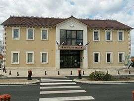 Town hall | |
.svg.png) Coat of arms | |
Location of Roumazières-Loubert 
| |
 Roumazières-Loubert 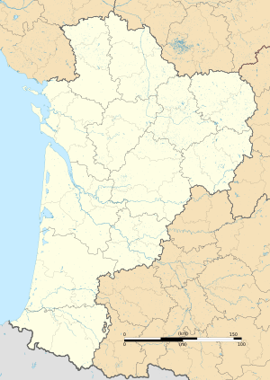 Roumazières-Loubert | |
| Coordinates: 45°53′45″N 0°34′34″E | |
| Country | France |
| Region | Nouvelle-Aquitaine |
| Department | Charente |
| Arrondissement | Confolens |
| Canton | Charente-Bonnieure |
| Commune | Terres-de-Haute-Charente |
| Area 1 | 46.59 km2 (17.99 sq mi) |
| Population (2017)[1] | 2,489 |
| • Density | 53/km2 (140/sq mi) |
| Time zone | UTC+01:00 (CET) |
| • Summer (DST) | UTC+02:00 (CEST) |
| Postal code | 16270 |
| Elevation | 155–245 m (509–804 ft) |
| 1 French Land Register data, which excludes lakes, ponds, glaciers > 1 km2 (0.386 sq mi or 247 acres) and river estuaries. | |
Population
| Year | Pop. | ±% |
|---|---|---|
| 1793 | 595 | — |
| 1800 | 132 | −77.8% |
| 1806 | 132 | +0.0% |
| 1821 | 144 | +9.1% |
| 1831 | 141 | −2.1% |
| 1841 | 631 | +347.5% |
| 1846 | 638 | +1.1% |
| 1851 | 649 | +1.7% |
| 1856 | 630 | −2.9% |
| 1861 | 583 | −7.5% |
| 1866 | 580 | −0.5% |
| 1872 | 572 | −1.4% |
| 1876 | 617 | +7.9% |
| 1881 | 757 | +22.7% |
| 1886 | 844 | +11.5% |
| 1891 | 799 | −5.3% |
| 1896 | 771 | −3.5% |
| 1901 | 930 | +20.6% |
| 1906 | 1,155 | +24.2% |
| 1911 | 1,554 | +34.5% |
| 1921 | 1,519 | −2.3% |
| 1926 | 1,667 | +9.7% |
| 1931 | 1,672 | +0.3% |
| 1936 | 1,572 | −6.0% |
| 1946 | 1,413 | −10.1% |
| 1954 | 1,525 | +7.9% |
| 1962 | 1,551 | +1.7% |
| 1968 | 1,596 | +2.9% |
| 1975 | 3,146 | +97.1% |
| 1982 | 3,007 | −4.4% |
| 1990 | 3,002 | −0.2% |
| 1999 | 2,779 | −7.4% |
| 2008 | 2,558 | −8.0% |
See also
References
- Téléchargement du fichier d'ensemble des populations légales en 2017, INSEE
- Arrêté préfectoral 28 September 2018, p. 19 (in French)
| Wikimedia Commons has media related to Roumazières-Loubert. |
| Authority control |
|
|---|
This article is issued from Wikipedia. The text is licensed under Creative Commons - Attribution - Sharealike. Additional terms may apply for the media files.