Ribeira de Pena
Ribeira de Pena (Portuguese pronunciation: [ʁiˈβɐjɾɐ ðɨ ˈpenɐ] (![]()
Ribeira de Pena | |
|---|---|
 Flag  Coat of arms | |
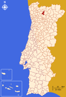 | |
| Coordinates: 41°31′N 7°47′W | |
| Country | |
| Region | Norte |
| Intermunic. comm. | Alto Tâmega |
| District | Vila Real |
| Parishes | 5 |
| Government | |
| • President | Agostinho Alves Pinto (PSD-CDS/PP) |
| Area | |
| • Total | 217.46 km2 (83.96 sq mi) |
| Population (2011) | |
| • Total | 6,544 |
| • Density | 30/km2 (78/sq mi) |
| Time zone | UTC±00:00 (WET) |
| • Summer (DST) | UTC+01:00 (WEST) |
| Website | http://www.cm-rpena.pt |
Located on a zone of transition between the harsh and mountainous Trás-os-Montes and the verdant Minho, the municipality of Ribeira de Pena, crossed by the calm waters of the Tâmega River, displays unique characteristics and also offers visitors the unmistakable flavour of the region's green wine. Equally rich is the heritage left by man since remote times, visible at abundant prehistoric remains such as the Stone Age engravings of Lamelas, several dolmens and archaeological monuments and fortified settlements such as the ruins found at Monte do Cabriz, near the village of Cerva.
The current mayor is Agostinho Alves Pinto, elected by a coalition between the Social Democratic Party and the Democratic and Social Centre - People's Party. The municipal holiday is August 15.
Parishes
Administratively, the municipality is divided into 5 civil parishes (freguesias):[3]
- Alvadia
- Canedo
- Cerva e Limões
- Ribeira de Pena (Salvador) e Santo Aleixo de Além-Tâmega
- Santa Marinha
References
- Instituto Nacional de Estatística Archived November 15, 2016, at the Wayback Machine
- Áreas das freguesias, concelhos, distritos e país
- Diário da República. "Law nr. 11-A/2013, page 552 103" (pdf) (in Portuguese). Retrieved 29 July 2014.