Reserve, Louisiana
Reserve is an unincorporated community in St. John the Baptist Parish, Louisiana, United States, on the east bank of the Mississippi River. The population was 9,111 at the 2000 census. For statistical purposes, the United States Census Bureau has defined Reserve as a census-designated place (CDP).
Reserve | |
|---|---|
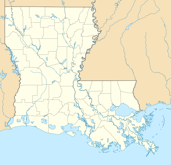 Reserve Location of Reserve in Louisiana | |
| Coordinates: 30°03′45″N 90°33′12″W | |
| Country | United States |
| State | Louisiana |
| Parish | St. John the Baptist |
| Area | |
| • Total | 17.1 sq mi (44 km2) |
| • Land | 16.1 sq mi (42 km2) |
| • Water | 1.0 sq mi (3 km2) |
| Elevation | 13 ft (4 m) |
| Population (2000) | |
| • Total | 9,111 |
| • Density | 530/sq mi (210/km2) |
| Time zone | UTC-6 (CST) |
| • Summer (DST) | UTC-5 (CDT) |
| ZIP code | 70084 |
| Area code(s) | 985 |
The census definition of the area may not precisely correspond to local understanding of the area with the same name.
History
In the early 20th century, the plantation at Reserve had the largest sugarcane refinery in the United States.
President William Howard Taft visited Reserve in 1909, while President Gerald Ford visited Reserve in 1976.
Reserve was the birthplace of jazz musicians Edmond Hall and Kid Thomas Valentine.
The Godchaux-Reserve home, the oldest portion of which dates to 1764, is a building on the National Register of Historic Places. In addition, in 2005 Our Lady of Grace Catholic Church which dates back to 1937 was added to The Louisiana National Register of Historic Places (http://www.crt.state.la.us/hp/). Our Lady of Grace was built to serve the needs of the African American Catholic Community.
Pontchartrain Works
In 2015 the Environmental Protection Agency reported findings of the existence of an extremely high risk of cancer in the region and noted that Reserve was the epicenter of the area of high risk for cancer.[1] The agency identified releases of chloroprene as responsible for the high risk. It is released from the Pontchartrain Works facility, a manufacturing facility owned and operated for decades by DuPont and sold in 2015 to Denka of Japan. The facility is the only producer of the chemical in the United States.
Geography
Reserve is located at 30°3′45″N 90°33′12″W (30.062566, -90.553296).[2]
According to the United States Census Bureau, the CDP has a total area of 17.1 square miles (44.3 km2), of which 16.1 square miles (41.6 km2) is land and 1.0 square mile (2.7 km2) (6.13%) is water.
Demographics
As of the census[3] of 2000, there were 9,111 people, 3,068 households, and 2,347 families residing in the CDP. The population density was 567.1 people per square mile (218.9/km2). There were 3,385 housing units at an average density of 210.7 per square mile (81.3/km2). The racial makeup of the CDP was 44.17% White, 53.92% African American, 0.19% Native American, 0.32% Asian, 0.02% Pacific Islander, 0.60% from other races, and 0.78% from two or more races. Hispanic or Latino of any race were 1.98% of the population.
There were 3,068 households out of which 41.5% had children under the age of 18 living with them, 48.6% were married couples living together, 22.2% had a female householder with no husband present, and 23.5% were non-families. 20.8% of all households were made up of individuals and 8.1% had someone living alone who was 65 years of age or older. The average household size was 2.97 and the average family size was 3.45.
In the CDP, the population was spread out with 32.2% under the age of 18, 10.4% from 18 to 24, 28.6% from 25 to 44, 19.3% from 45 to 64, and 9.5% who were 65 years of age or older. The median age was 31 years. For every 100 females, there were 90.9 males. For every 100 females age 18 and over, there were 85.1 males.
The median income for a household in the CDP was $32,466, and the median income for a family was $40,191. Males had a median income of $33,297 versus $19,671 for females. The per capita income for the CDP was $13,373. About 18.4% of families and 21.5% of the population were below the poverty line, including 30.8% of those under age 18 and 15.0% of those age 65 or over.
Education
St. John the Baptist Parish School Board operates public schools in the community.
Two K-8 schools serve separate areas that have Reserve addresses:[4]
High schools:
- East St. John High School in Reserve serves the community.[5]
Private schools:
- Riverside Academy is a small private school in Reserve.[6]
St. Peter Catholic School of the Roman Catholic Archdiocese of New Orleans is a K-7 Catholic school.[7] Our Lady of Grace School was a Catholic K-7 school in Reserve. It closed in 2015; it had 171 students remaining, with about 51 having taken advantage of a Louisiana school voucher regime. There were two graduating classes in 2015.[8]
Notable people
- Demond "Tweety" Carter, basketball player at Baylor
- Ryan Perrilloux, Quarterback for Louisiana State University, Jacksonville State and New York Giants
- Patrick Lewis, professional football player for Seattle Seahawks; collegiate player at Texas A&M
- Rico Gathers, NFL Football player with the Dallas Cowboys and former College Basketball player at Baylor University.
References
- Lartey, Jamiles; Laughland, Oliver (May 6, 2019). "'Almost every household has someone that has died from cancer'". The Guardian. ISSN 0261-3077. Retrieved May 6, 2019.
- "US Gazetteer files: 2010, 2000, and 1990". United States Census Bureau. 2011-02-12. Retrieved 2011-04-23.
- "U.S. Census website". United States Census Bureau. Retrieved 2008-01-31.
- "Attendance Zones Archived 2008-09-12 at the Wayback Machine." St. John the Baptist Parish School Board.
- Kamerick, Megan. "Seven area schools create academies for Freshmen." New Orleans CityBusiness. Monday April 1, 2002. Retrieved on March 17, 2013. Available on LexisNexis. ""You see it in a variety of ways," says Debra Schum, principal at East St. John High School in Reserve, which has 400 freshmen and total of 1,400 students."
- Riverside Academy official website
- "Home". St. Peter Catholic School. Retrieved 2020-05-27.
- "Closing of 3 New Orleans-area schools to displace hundreds of students in 2015". The Times Picayune. 2014-10-27. Retrieved 2020-05-26.
External links
Municipalities and communities of St. John the Baptist Parish, Louisiana, United States | ||
|---|---|---|
Parish seat: Edgard | ||
| CDPs |  | |
| Unincorporated communities | ||
| Ghost town | ||
| Footnotes | ‡This populated place also has portions in an adjacent parish | |
| Wikimedia Commons has media related to Reserve, Louisiana. |