Ras Nhash
Ras Nhash (Arabic: راس نحاش, romanized: Rās Nḥash; also spelled Ras Nahache or Ras Nahhach) is a town and municipality located in the Batroun District of the Tripoli Governorate in northern Lebanon. It is about 65 kilometres (40 mi) north of Beirut.[1] It has an average elevation of 300 metres (980 ft) above sea level and a total land area of 383 hectares.[1] It is located immediately north of the Chekka cape. Ras Nhash's inhabitants are Sunni Muslims.[2]
Ras Nhash راس نحاش | |
|---|---|
Municipality | |
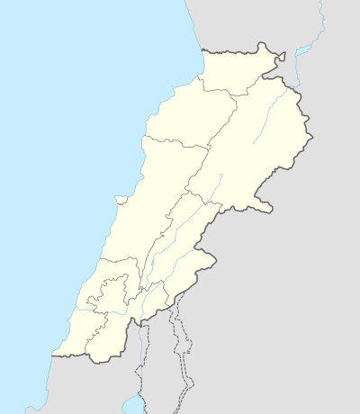 Ras Nhash Location in Lebanon | |
| Coordinates: 34°16′58″N 35°42′54″E | |
| Country | |
| Governorate | Tripoli |
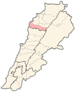
| District | Batroun |
| Area | |
| • Total | 3.83 km2 (1.48 sq mi) |
| Elevation | 300 m (1,000 ft) |
| Time zone | UTC+2 (EET) |
| • Summer (DST) | UTC+3 (EEST) |
History
The Ottomans, who ruled the area of modern Lebanon from 1517 until 1918, settled Sunni Muslim Kurds at Ras Nhash and other villages in the wider Koura area south of Tripoli in 1588 to protect its coast from European naval incursions.[3] The best known Kurdish emir of Ras Nhash was a certain Musa, who was the closest local ally of Yusuf Sayfa, the on–and–off governor of Tripoli in 1579–1625.[4]
References
- "Ras Nahhach". Localiban. Localiban. 2007-11-10. Retrieved 2016-02-26.
- "Elections municipales et ikhtiariah" (pdf). Localiban. Localiban. 2010. p. 22. Retrieved 2016-02-26.
- Abu-Husayn 1985, p. 29, note 54.
- Abu-Husayn 1985, p. 29.
Bibliography
- Abu-Husayn, Abdul-Rahim (1985). Provincial Leaderships in Syria, 1575-1650. Beirut: American University of Beirut.
Capital: Batroun | ||
| Towns and villages |
|  |