Powell, Ohio
Powell is a city in Delaware County, Ohio, United States. The population was 11,500 at the 2010 census.
Powell, Ohio | |
|---|---|
 Suburban neighborhood off Rutherford Road | |
 Location of Powell in Ohio | |
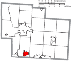 Location of Powell in Delaware County | |
| Coordinates: 40°9′30″N 83°4′27″W | |
| Country | United States |
| State | Ohio |
| County | Delaware |
| Township | Liberty |
| Founded | 1801 |
| Incorporated | 1947 |
| Government | |
| • Mayor | Frank Bertone[1] |
| Area | |
| • Total | 5.64 sq mi (14.62 km2) |
| • Land | 5.64 sq mi (14.61 km2) |
| • Water | 0.00 sq mi (0.01 km2) |
| Elevation | 909 ft (277 m) |
| Population | |
| • Total | 11,500 |
| • Estimate (2019)[5] | 13,375 |
| • Density | 2,371.87/sq mi (915.77/km2) |
| Time zone | UTC-5 (Eastern (EST)) |
| • Summer (DST) | UTC-4 (EDT) |
| ZIP code | 43065 |
| Area code(s) | 614, 740 |
| FIPS code | 39-64486[6] |
| GNIS feature ID | 1061569[3] |
| Website | www.cityofpowell.us |
The community was first settled around 1801, two years before Ohio became a state. It was named "Middlebury" at the time, because the first settlers came from the Middlebury, Connecticut area. In 1857, Judge Thomas Powell established the first post office in the community, and the residents decided to adopt his name. The town of Powell had its start in the building of the railroad through that territory.[7] Powell was finally incorporated as a municipality in 1947. The population remained small until the late 1980s, when residential development expanding from the northern Columbus metropolitan area reached Powell. In 20 years, the population rose from less than 400 to over 6,000.
In July 2005, CNN Money and Money magazine ranked Powell 18th on its list of the 100 Best Places to Live in the United States.[8]
Geography

Powell is located at 40°09′30″N 83°04′27″W.[9] The city sits between the Scioto and Olentangy Rivers, about 14 miles north of the state capital of Columbus, centered on the intersection of State Route 750 and C.R. 9. It sits within Liberty Township, the site of the first settlement in Delaware County.
According to the United States Census Bureau, the city has a total area of 4.93 square miles (12.77 km2), all land.[10]
Demographics
| Historical population | |||
|---|---|---|---|
| Census | Pop. | %± | |
| 1880 | 131 | — | |
| 1950 | 384 | — | |
| 1960 | 390 | 1.6% | |
| 1970 | 374 | −4.1% | |
| 1980 | 387 | 3.5% | |
| 1990 | 2,154 | 456.6% | |
| 2000 | 6,247 | 190.0% | |
| 2010 | 11,500 | 84.1% | |
| Est. 2019 | 13,375 | [5] | 16.3% |
| Sources:[6][11][12] | |||
2010 census
As of the census[4] of 2010, there were 11,500 people, 3,796 households, and 3,227 families residing in the city. The population density was 2,332.7 inhabitants per square mile (900.7/km2). There were 3,975 housing units at an average density of 806.3 per square mile (311.3/km2). The racial makeup of the city was 88.5% White, 1.9% African American, 0.1% Native American, 7.5% Asian, 0.3% from other races, and 1.7% from two or more races. Hispanic or Latino of any race were 1.4% of the population.
There were 3,796 households, of which 53.5% had children under the age of 18 living with them, 77.8% were married couples living together, 5.4% had a female householder with no husband present, 1.8% had a male householder with no wife present, and 15.0% were non-families. 12.6% of all households were made up of individuals, and 4.5% had someone living alone who was 65 years of age or older. The average household size was 3.03 and the average family size was 3.33.
The median age in the city was 37.4 years. 34.7% of residents were under the age of 18; 3.4% were between the ages of 18 and 24; 28.1% were from 25 to 44; 26.2% were from 45 to 64; and 7.7% were 65 years of age or older. The gender makeup of the city was 49.2% male and 50.8% female.
2000 census
As of the census of 2000, there were 6,247 people, 1,975 households, and 1,789 families residing in the city. The population density was 2,057.3 people per square mile (793.4/km2). There were 2,032 housing units at an average density of 669.2 per square mile (258.1/km2). The racial makeup of the city was 94.29% White, 1.55% African American, 0.10% Native American, 0.92% Asian, 0.22% from other races, and 0.85% from two or more races. Hispanic or Latino of any race were 1.09% of the population.[13]
There were 1,975 households, out of which 56.7% had children under the age of 18 living with them, 86.1% were married couples living together, 3.3% had a female householder with no husband present, and 9.4% were non-families. 7.2% of all households were made up of individuals, and 1.3% had someone living alone who was 65 years of age or older. The average household size was 3.16 and the average family size was 3.34.
In the city, the population was spread out, with 35.9% under the age of 18, 2.7% from 18 to 24, 36.4% from 25 to 44, 21.1% from 45 to 64, and 3.8% who were 65 years of age or older. The median age was 35 years. For every 100 females, there were 100.9 males. For every 100 females age 18 and over, there were 97.7 males.
The median income for a household in the city was $115,904, and the median income for a family was $117,801. Males had a median income of $79,146 versus $42,656 for females. The per capita income for the city was $46,257. About 0.4% of families and 0.4% of the population were below the poverty line, including 0.7% of those under age 18 and none of those age 65 or over.
Education
Powell is officially a city and is thus authorized by the laws of the State of Ohio to form a city school district. However, it instead continues to associate with the Olentangy Local School District. Powell is home to one of Olentangy Local School District's high schools, which is Olentangy Liberty High School. Powell is also home to a kindergarten to grade 12 private preparatory school, Village Academy (closed summer 2019).
Powell has a public library, a branch of the Delaware County District Library.[14]
Public safety
- Law enforcement - Powell Police Department
- Fire and emergency medical service - Liberty Township Fire Department
Although Powell maintains its own police department, it is served by the Liberty Township Fire Department (LTFD), which has two stations less than a mile from the northern and western borders of the city. LTFD has been serving Powell since 1947, and both stations are maintained by a 24/7 staff of firefighters. Station 321 has a ladder, medic, and engine and other apparatus and is located on Liberty Road; Station 322 has an engine medic and air unit, they are located off of Sawmill Parkway, and they have a distinct slogan "First Due at the Zoo", because the Columbus Zoo is located almost a mile away.
Notable people
This list includes notable people who were born or had lived in Powell, Ohio.
- Tala Ashe, Actress (Legends of Tomorrow)
- Jon Busch, MLS Soccer Player (Chicago Fire S.C.)
- D. Michael Crites, United States Attorney for the Southern District of Ohio in the administrations of Presidents Ronald Reagan and George H.W. Bush
- Emily Douglas, founder of Grandma's Gifts
- Tiffany Houghton, singer and songwriter
- Melina Kanakaredes, actress (CSI: NY)
- Thad Matta, OSU basketball coach
- Chinedum Ndukwe, former NFL football player (Cincinnati Bengals and Oakland Raiders)
- Chris Perry, Former PGA golfer
- Michael Redd, former NBA basketball player (Milwaukee Bucks and Phoenix Suns)
- Robert Smith, former NFL football player (Minnesota Vikings)
- Valerie Still, former ABL and WNBA basketball player (Columbus Quest and Washington Mystics)
- R. J. Umberger, NHL hockey player (Philadelphia Flyers, Columbus Blue Jackets)
- Mike Vrabel, former NFL football player (Pittsburgh Steelers, New England Patriots, and Kansas City Chiefs)
- William White, former NFL football player (Detroit Lions, Kansas City Chiefs, and Atlanta Falcons)
- Greg Oden, former NBA basketball player (Portland Trail Blazers, Miami Heat)
References
- City of Powell. 8 January 2020 https://cityofpowell.us/powell-names-new-mayor-vice-mayor-2/. Retrieved 1 April 2020. Missing or empty
|title=(help) - "2019 U.S. Gazetteer Files". United States Census Bureau. Retrieved July 28, 2020.
- "US Board on Geographic Names". United States Geological Survey. 2007-10-25. Retrieved 2008-01-31.
- "U.S. Census website". United States Census Bureau. Retrieved 2013-01-06.
- "Population and Housing Unit Estimates". Retrieved May 21, 2020.
- "U.S. Census website". United States Census Bureau. Retrieved 2008-01-31.
- History of Delaware County and Ohio. O. L. Baskin & Company. 1880. pp. 427.
- "PCNN/Money and Money magazine". money.cnn.com.
- "US Gazetteer files: 2010, 2000, and 1990". United States Census Bureau. 2011-02-12. Retrieved 2011-04-23.
- "US Gazetteer files 2010". United States Census Bureau. Archived from the original on 2012-01-25. Retrieved 2013-01-06.
- "Number of Inhabitants: Ohio" (PDF). 18th Census of the United States. U.S. Census Bureau. 1960. Retrieved 17 May 2020.
- "Ohio: Population and Housing Unit Counts" (PDF). U.S. Census Bureau. Retrieved 22 November 2013.
- "Census 2000 Demographic Profile Highlights: Powell, Ohio". factfinder.census.gov. Archived from the original on 2020-02-12. Retrieved 2009-02-26.
- "Locations". Delaware County District Library. Retrieved 25 February 2018.
External links
- City website
- Map of Powell subdivisions
- Delaware County GIS
- Liberty Township Fire Department
- Historic Downtown Powell, Inc. Local downtown business development group.
Municipalities and communities of Delaware County, Ohio, United States | ||
|---|---|---|
| Cities | 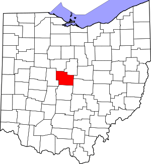 Map of Ohio highlighting Delaware County | |
| Villages | ||
| Townships | ||
| CDPs | ||
| Unincorporated communities | ||
| Ghost towns | ||
| Footnotes | ‡This populated place also has portions in an adjacent county or counties | |