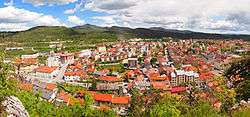
Postojna
Postojna (pronounced [pɔˈstoːi̯na] (![]()
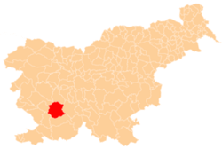
Postojna | |
|---|---|
 | |
 Seal | |
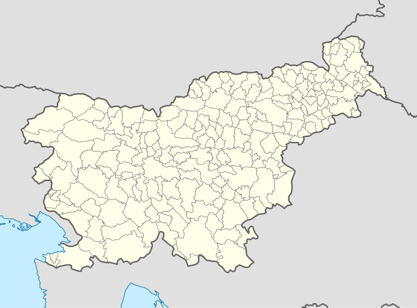 Postojna Location in Slovenia | |
| Coordinates: 45°46′33.11″N 14°12′49.18″E | |
| Country | |
| Traditional region | Inner Carniola |
| Statistical region | Littoral–Inner Carniola |
| Municipality | Postojna |
| Area | |
| • Total | 33.3 km2 (12.9 sq mi) |
| Elevation | 556.4 m (1,825.5 ft) |
| Population (2020) | |
| • Total | 9,605 |
| • Density | 290/km2 (750/sq mi) |
| Postal code | 6230 |
| Area code(s) | 05 |
| Vehicle registration | PO |
| Climate | Cfb |
| Website | www |
| [1] | |
History
The area is known to have been populated since the paleolithic era due to the discovery of a cave settlement near the town of Postojna called Betal Rock Shelter (Betalov spodmol). The town lies on the Pivka River. Written sources first mention the settlement in the 13th century and in 1432 it became a borough. It was proclaimed a town in 1909.[2]
From the late Middle Ages, it was part of the Duchy of Carniola and hence of the Habsburg Monarchy. It was under Italian rule between 1918 and 1943 (nominally to 1947) and was part of the province of Trieste as Postumia.[3]
Mass grave
At Postojna there is a mass grave associated with the Second World War. The Pine Shaft Mass Grave (Slovene: Grobišče Brezno v borovcih) is southeast of Postojna, between Little Trebevnik Hill (Mali Trebevnik) and Big Trebevnik Hill (Veliki Trebevnik). It is a steep sinkhole that contains the remains of unidentified victims.[4][5][6]
Climate
| Climate data for Postojna | |||||||||||||
|---|---|---|---|---|---|---|---|---|---|---|---|---|---|
| Month | Jan | Feb | Mar | Apr | May | Jun | Jul | Aug | Sep | Oct | Nov | Dec | Year |
| Average high °C (°F) | 2 (36) |
4 (40) |
8 (47) |
13 (55) |
18 (64) |
22 (71) |
24 (76) |
24 (75) |
20 (68) |
14 (57) |
7 (45) |
4 (39) |
13 (56) |
| Average low °C (°F) | −5 (23) |
−4 (25) |
−1 (30) |
3 (37) |
7 (44) |
10 (50) |
11 (52) |
11 (52) |
8 (47) |
4 (40) |
1 (34) |
−2 (28) |
4 (39) |
| Average precipitation mm (inches) | 110 (4.2) |
86 (3.4) |
140 (5.5) |
130 (5.3) |
200 (7.7) |
150 (6.1) |
130 (5) |
150 (6.1) |
190 (7.4) |
210 (8.2) |
210 (8.2) |
130 (5) |
1,830 (72.1) |
| Source: Weatherbase[7] | |||||||||||||
Attractions
One of Slovenia's major tourist attractions, Postojna Cave, is located near the town.
Church
The parish church in the town is dedicated to Saint Stephen and belongs to the Koper Diocese. Within the urban area of Postojna, the church dedicated to the Prophet Daniel in the hamlet of Zalog and the chapel dedicated to Saint Lazarus at the town cemetery also belong to this parish.[8]
See also
References
- "Statistical Office of the Republic of Slovenia". stat.si. Retrieved September 2, 2015.
- Postojna municipal site (in Slovene)
- "Image: 487px-Venezia_Giulia.jpg, (487 × 599 px)". upload.wikimedia.org. Retrieved September 2, 2015.
- Ferenc, Mitja (December 2009). "Grobišče Brezno v borovcih". Geopedia (in Slovenian). Ljubljana: Služba za vojna grobišča, Ministrstvo za delo, družino in socialne zadeve. Retrieved April 28, 2020.
- Komisija za reševanje vprašanj prikritih grobišč. 2008. Poročilo Komisije vlade Republike Slovenije za reševanje vprašanj prikritih grobišč: 2005–2008. Ljubljana, Družina, p. 1903.
- Ferenc, Mitja, & Ksenija Kovačec-Naglič. 2005. Prikrito in očem zakrito: prikrita grobišča 60 let po koncu druge svetovne vojne. Ljubljana: Muzej novejše zgodovine, p. 122.
- "Weatherbase: Historical Weather for Postojna, Slovenia". Weatherbase. 2011. Retrieved on November 24, 2011.
- Koper Diocese list of churches Archived 2009-03-06 at the Wayback Machine
External links
| Wikimedia Commons has media related to Postojna. |
| Settlements | Administrative centre: Postojna
|  |
|---|---|---|
| Landmarks |
| |
| Notable people |
| |