Plasy
Plasy (Czech pronunciation: [ˈplasɪ]; German: Plass) is a town in the Plzeň Region of the Czech Republic. It has about 2,700 inhabitants. It lies on the Střela River, some 20 km (12 mi) to the north of Plzeň, the regional capital.
Plasy | |
|---|---|
Town | |
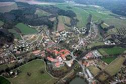 Aerial view | |
 Flag  Coat of arms | |
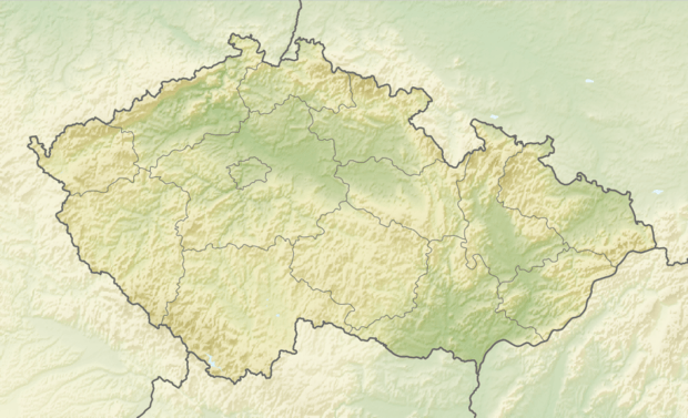 Plasy Location in the Czech Republic | |
| Coordinates: 49°56′5″N 13°23′26″E | |
| Country | |
| Region | Plzeň |
| District | Plzeň-North |
| Founded | 1144 |
| Parts | List
|
| Government | |
| • Mayor | Zdeněk Hanzlíček |
| Area | |
| • Total | 57.13 km2 (22.06 sq mi) |
| Elevation | 350 m (1,150 ft) |
| Population (2020-01-01[1]) | |
| • Total | 2,716 |
| • Density | 48/km2 (120/sq mi) |
| Time zone | UTC+1 (CET) |
| • Summer (DST) | UTC+2 (CEST) |
| Postal code | 331 01 |
| Website | www |
Plasy is also a Municipality with Commissioned Local Authority within the Kralovice Municipality with Extended Competence.
With its scenic surroundings, the town is an important tourist center, but has no significant industry.
Cistercian monastery
Plasy was home to a Cistercian monastery during the Middle Ages. Mauritius Vogt was educated there and later joined the order. The monastery at Plasy provided a base for Vogt's travels while he wrote Das jetzlebende Königreich Böhmen (Illustrated Geography and History of Bohemia) which was published in 1712 to great acclaim for its excellent illustrations and maps. A surviving copy of the book is on display at the Lobkowicz Palace in Prague.
Notable people
- Mauritius Vogt (1669–1730), geographer, historian, cartographer, and musician
References
- "Population of Municipalities – 1 January 2020". Czech Statistical Office. 2020-04-30.