Petersfield railway station
Petersfield railway station serves the market town of Petersfield, Hampshire, England. It is on the Portsmouth Direct line, 54 miles 71 chains (88.3 km) down the line from London Waterloo via Woking.[1]
| Petersfield | |
|---|---|
 | |
| Location | |
| Place | Petersfield |
| Local authority | East Hampshire |
| Grid reference | SU743235 |
| Operations | |
| Station code | PTR |
| Managed by | South Western Railway |
| Number of platforms | 2 (was 4) |
| DfT category | C2 |
| Live arrivals/departures, station information and onward connections from National Rail Enquiries | |
| Annual rail passenger usage* | |
| 2014/15 | |
| 2015/16 | |
| 2016/17 | |
| 2017/18 | |
| – Interchange | |
| 2018/19 | |
| – Interchange | |
| History | |
| Key dates | Opened 1859 |
| National Rail – UK railway stations | |
| |
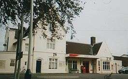
The station has two tracks, and two platforms, although in the past had a third platform branching into the coal yard situated adjacent to the station and a fourth platform on the north side of the level crossing serving the branch to Midhurst closed in 1955. The main buildings date back to the opening of the line in 1859 and are of a "town" type, larger than other wayside stations on the route but identical to Godalming.
There used to be a halt between Petersfield and Rowlands Castle, to the south of Buriton Tunnel, called Woodcroft. It was built to serve the local naval establishment. Because of its naval nature it was not featured on many maps, some maps however did mark it by a little tab but without a name.
Services
Its service has improved steadily over the years and now, the current service is:
- 3 tph to London Waterloo via Guildford (2 semi-fast, 1 stopping)
- 1 tph to Portsmouth & Southsea (all stations)
- 2 tph to Portsmouth Harbour (semi-fast)
| Preceding station | Following station | |||
|---|---|---|---|---|
| Liss | South Western Railway Portsmouth Direct Line |
Rowlands Castle | ||
| Historical railways | ||||
| Liss Line and station open |
Southern Railway Portsmouth Direct Line |
Woodcroft Halt Line open, station closed | ||
| Disused railways | ||||
| Terminus | Midhurst Railways | Rogate | ||
Gallery
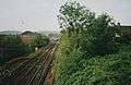 Taken from Tilmore Bridge
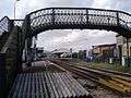 Taken from "Wilmotts"
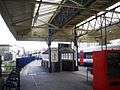 Up platform
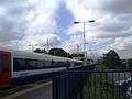 London bound train
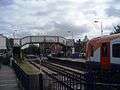 Bridge in Station Road
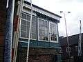 Signal box
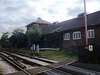 Looking north
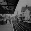 Petersfield in 1971.
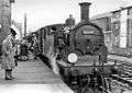 Auto-train from Pulborough on the Last Day of the branch in 1955
.jpg) Aerial view of Petersfield showing the railway (right) and station (centre right)
Aerial view of Petersfield showing the railway (right) and station (centre right)
References
- Yonge, John (November 2008) [1994]. Jacobs, Gerald (ed.). Railway Track Diagrams 5: Southern & TfL (3rd ed.). Bradford on Avon: Trackmaps. map 26B. ISBN 978-0-9549866-4-3.CS1 maint: ref=harv (link)
External links
- Train times and station information for Petersfield railway station from National Rail