Paser Regency
Paser Regency is a Regency (kabupaten) within East Kalimantan province in Indonesia, it is the southernmost regency of the East Kalimantan province. Its administrative centre is Tana Paser. It covers an area of 7,730.88 km2, and at the 2010 Census it had a population of 230,316; the latest official estimate (as at January 2014) was 266,784.
Paser Regency Kabupaten Paser | |
|---|---|
 Seal | |
 Location within East Kalimantan | |
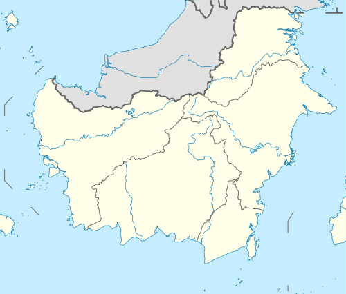 Paser Regency Location in Kalimantan and Indonesia 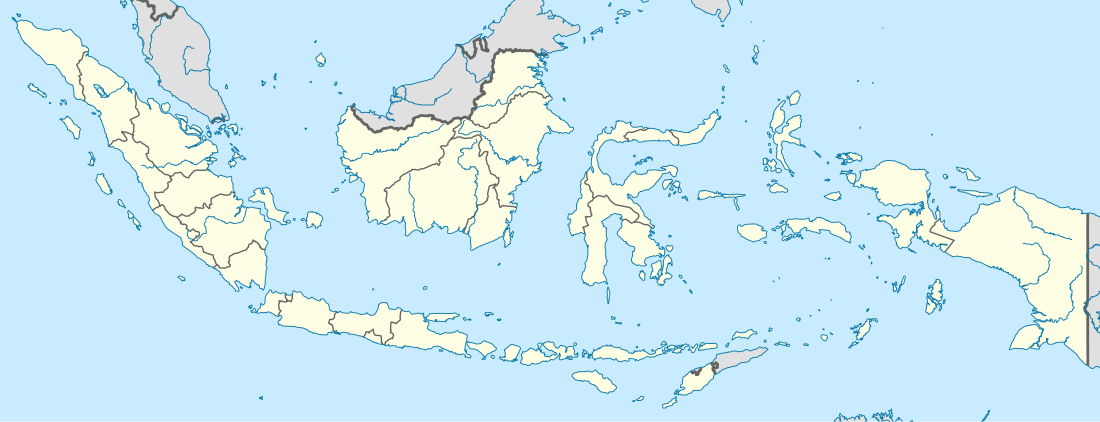 Paser Regency Paser Regency (Indonesia) | |
| Coordinates: 1°45′18.37″S 115°36′14.5″E | |
| Country | Indonesia |
| Region | Kalimantan |
| Province | East Kalimantan |
| Capital | Tana Paser |
| Government | |
| • Regent | Yusriansyah Syarkawi |
| • Vice Regent | Mardikansyah |
| Area | |
| • Total | 7,730.88 km2 (2,984.91 sq mi) |
| Elevation | 0 m (0 ft) |
| Population (2014) | |
| • Total | 266,784 |
| • Density | 35/km2 (89/sq mi) |
| Time zone | UTC+8 (ICST) |
| Area code | (+62) 543 |
| Website | paserkab.go.id |
Boundaries
- North : West Kutai Regency and North Penajam Paser Regency
- East : Makassar Strait
- South : Kota Baru Regency
- West : Balangan Regency, Tabalong Regency and North Barito Regency
Administration
Paser Regency is divided into ten districts (kecamatan), tabulated below with their areas and their 2010 Census populations[1] and latest (2016) estimates:[2]
| Name | Area in km2 | Population Census 2010[3] | Population Estimate 2016[4] |
|---|---|---|---|
| Muara Komam | 1,807.0 | 12,459 | 12,886 |
| Batu Sopang | 1091.5 | 22,540 | 19,252 |
| Muara Samu | 1,033.5 | 4,221 | 6,191 |
| Batu Engau | 1,523.2 | 11,662 | 15,078 |
| Tanjung Harapan | 580.9 | 7,720 | 7,208 |
| Paser Belengkong | 675.9 | 23,543 | 25,308 |
| Tanah Grogot | 341.9 | 63,311 | 65,855 |
| Kuaro | 671.9 | 23,934 | 27,844 |
| Long Ikis | 981.8 | 36,701 | 41,190 |
| Long Kali | 2,174.6 | 24,225 | 26,011 |
References
- Biro Pusat Statistik, Jakarta, 2011.
- Bagian Pemerintahan dan Humas Setda Kabupaten Paser, 2017.
- Biro Pusat Statistik, Jakarta, 2011.
- Bagian Pemerintahan dan Humas Setda Kabupaten Paser, 2017.
Places adjacent to Paser Regency | ||||||||||
|---|---|---|---|---|---|---|---|---|---|---|
| ||||||||||
Regencies and cities of East Kalimantan | ||
|---|---|---|
Capital: Samarinda | ||
| Regencies | ||
| Cities | ||
| Towns and villages | ||
This article is issued from Wikipedia. The text is licensed under Creative Commons - Attribution - Sharealike. Additional terms may apply for the media files.