Paris Métro Line 2
Line 2 is one of the sixteen lines of the Paris Métro rapid transit system in Paris, France. Situated almost entirely above the former city walls (boulevards extérieurs), it runs in a semi-circle in the north of Paris.
| Line 2 | |||
|---|---|---|---|
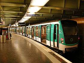 An MF 2000 stock train at Nation | |||
| Overview | |||
| System | Paris Métro | ||
| Termini | Porte Dauphine Nation | ||
| Connecting lines | |||
| Stations | 25 | ||
| Ridership | 92,100,000 (2010) (avg. per year) 7th/16 (2010) | ||
| Operation | |||
| Opened | 1900 | ||
| Operator(s) | RATP | ||
| Conduction system | Conductor (PA) | ||
| Rolling stock | MF 2000 (45 trains as of March 22, 2011) | ||
| Technical | |||
| Line length | 12.4 km (7.7 mi) | ||
| Track gauge | 1,435 mm (4 ft 8 1⁄2 in) | ||
| |||
As its name suggests, Line 2 was the second line of the Métro to open, with the first section put into service in December 1900; it adopted its current configuration in April 1903, running between Porte Dauphine and Nation. There have been no changes in its service pattern since.
At 12.4 km (7.7 mi) in length, it is the seventh-busiest line of the system, with 92.1 million passengers in 2004. Slightly over 2 km (1.2 mi) of the line is built on an elevated viaduct with four aerial stations. In 1903, it was the location of the worst incident in the history of the Paris Métro, the fire at Couronnes.
History
Chronology
- 13 December 1900: The first portion of line "2 Nord" was opened between Porte Dauphine and Étoile.
- 7 October 1902: The line was extended from Étoile to Anvers.
- 31 January 1903: The line was extended from Anvers to Bagnolet.
- 2 April 1903: The line was extended from Bagnolet to Nation.
- 10 August 1903: A short circuit on a train caused a disastrous fire that killed 84 people at Couronnes and Ménilmontant stations.
- 14 October 1907: Line "2 Nord" was renamed line 2.
Birth of the line
On March 30, 1898 a déclaration d'utilité publique was made, recognizing the public benefit of the first six planned lines of the Paris metro. In response, the city began rapidly constructing the first line in hopes of opening it in time for the world's fair in 1900. During the first stage of development, three lines designated A, B, and C were planned for construction:
- A: from Porte de Vincennes to Porte Dauphine.
- B: circular route along the old city walls
- C: from Porte Maillot to Menilmontant, using line B tracks from Étoile to Batignolles.
However, after a detailed traffic study was conducted, changes were proposed to the tracks lying west of Étoile: the segment from Étoile to Porte Maillot of line C would be integrated into line A, and line C would pick up the segment from Étoile to Porte Dauphine. This change allowed trains on line B to stop at Porte Dauphine, and thus Porte Dauphine was designated the terminus and origin of line B.
Shortly thereafter, line B was split into two lines in hopes of simplifying its use; the section from Porte Dauphine to Nation was designated as Line 2 North, and the remaining section from Nation to Étoile was designated Line 2 South. Line 2 South would eventually become line 6.
The first 1,600 metres (0.99 mi) section of line 2 was constructed at the same time as line 1, opening only a little later on December 3, 1900. This section consisted of three stations, Porte Dauphine, Victor Hugo, and Étoile, and was circulated by rolling stock consisting of three cars each. At Étoile, trains reversed direction via a track transfer (due to it serving as only a temporary terminus), while at Porte Dauphine and Nation direction was reversed using a turn-around loop.
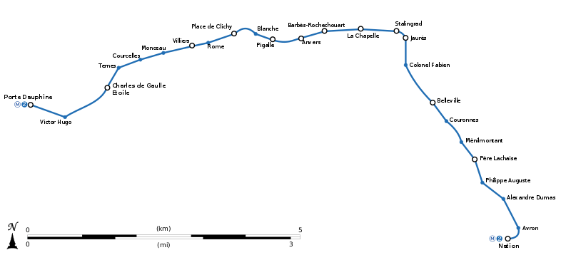
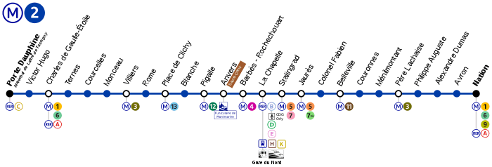
Map and stations
This line counts 25 stations.
Renamed stations
| Date | Old name | New name |
|---|---|---|
| 15 October 1907 | Boulevard Barbès | Barbès – Rochechouart |
| 1 August 1914 | Rue d'Allemagne | Jaurès |
| 6 October 1942 | Aubervilliers | Aubervilliers – Boulevard de la Villette |
| 19 August 1945 | Combat | Colonel Fabien |
| 10 February 1946 | Aubervilliers – Boulevard de la Villette | Stalingrad |
| 1970 | Étoile | Charles de Gaulle – Étoile |
| 13 September 1970 | Bagnolet | Alexandre Dumas |
Tourism
- The elevated line between Barbès – Rochechouart and Jaurès stations offers views of Paris.
- Metro line 2 passes near several places of interest :
- Avenue Foch, which is the largest avenue in Paris, and the Arc de Triomphe.
- Parc Monceau.
- Pigalle and the Moulin Rouge.
- Barbès and Belleville and their African and Asian influences.
- Père Lachaise Cemetery.
- Place de la Nation.
Gallery

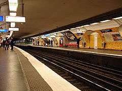 Charles de Gaulle – Étoile
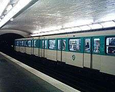
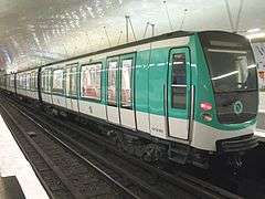 New MF 2000 train used on the route
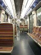 Interior of an MF 2000
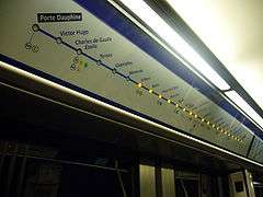 Dynamic destination display
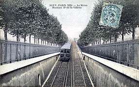 A metro car departing from Jaurès along the Boulevard de la Villette
See also
- Paris
- Transport in Paris
- List of stations of the Paris Métro
- List of stations of the Paris RER
- List of metro systems
- Rail transport in France
External links
| Wikimedia Commons has media related to Paris Metro. |
| Wikivoyage has a travel guide for Paris. |
English
French
- RATP official website
- Mobidf website, dedicated to the RER (unofficial)
- Metro-Pole website, dedicated to Paris public transports (unofficial)
| ||
| ||
| Finance | ||
| Related articles | ||
| Stations |
|
|---|---|
| Authority control |
|
|---|