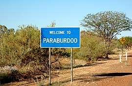
Paraburdoo, Western Australia
Paraburdoo is a mining town in the Pilbara region of Western Australia. The name of the town comes from an Aboriginal word said to mean "feathered meat", which could refer to abundant Little corella or flock pigeons . It could also mean Rock Cave (para means rock and buradoo means hole or cave) to refer to caves nearby. Paraburdoo was developed in the early 1970s to support Hamersley Iron's (now Pilbara Iron) local iron ore mining operations, and was gazetted as a town in 1972.[2] The region is served by Paraburdoo Airport, which is situated 9 kilometres from the town.


| Paraburdoo Western Australia | |||||||||
|---|---|---|---|---|---|---|---|---|---|
 | |||||||||
| Population | 1,380 (2016 census)[1] | ||||||||
| Established | 1960s | ||||||||
| Postcode(s) | 6754 | ||||||||
| Elevation | 391 m (1,283 ft) | ||||||||
| Location | |||||||||
| LGA(s) | Shire of Ashburton | ||||||||
| State electorate(s) | Pilbara | ||||||||
| Federal Division(s) | Durack | ||||||||
| |||||||||
The town provides housing to workers of the three nearby Rio Tinto mines, those being the Channar, Eastern Range and Paraburdoo mine.[3]
Paraburdoo is located 1528 kilometres north of Perth, 24 kilometres north of the Tropic of Capricorn, and nearly 300 kilometres from the coast.
Climate is variable in Paraburdoo. Temperatures have been known to reach as high as 45 degrees Celsius during the day in summer, and drop to single figures during winter nights. Rainfall is also extremely variable, especially in cyclone season.
Most of the town's residents are employed by Pilbara Iron's mining operation and the supporting services. Facilities available for families include daycare, a primary school, and a TAFE. The nearest high school is Tom Price Senior High School in Tom Price, 81 kilometres away. There are also skate parks, swimming pools, tennis courts, and netball, cricket and football fields. Paraburdoo has its own shopping facilities and medical centres.
See also
- Pilbara historical timeline
- Pilbara newspapers
- Red Dog Story
References
- Australian Bureau of Statistics (27 June 2017). "Paraburdoo (State Suburb)". 2016 Census QuickStats. Retrieved 29 October 2019.

- Western Australian Land Information Authority. "History of country town names – P". Retrieved 29 October 2019.
- Mining Archived 12 June 2010 at the Wayback Machine Rio Tinto Iron Ore website, accessed: 6 November 2010