Palwal district
Palwal district created on 15 August 2008, is the 21st district of Haryana state in northern India and Palwal City is the headquarters of this district.It is part of Braj region.
Palwal district | |
|---|---|
District of Haryana | |
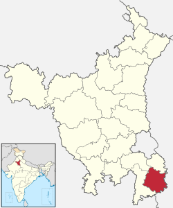 Location of Palwal district in Haryana | |
| Country | India |
| State | Haryana |
| Division | Faridabad |
| Headquarters | Palwal |
| Tehsils | Palwal, Hodal, Hathin |
| Area | |
| • Total | 1,359 km2 (525 sq mi) |
| Population (2011) | |
| • Total | 1,042,708 |
| • Density | 770/km2 (2,000/sq mi) |
| • Urban | 236,544 |
| Demographics | |
| • Literacy | 70.32% |
| • Sex ratio | 879 |
| Time zone | UTC+05:30 (IST) |
| Major highways |
|
| Average annual precipitation | 60–100 mm |
| Lok Sabha constituencies | Faridabad (shared with Faridabad district) |
| Vidhan Sabha constituencies | 4 |
| Website | http://palwal.gov.in/ |
The city is situated 60 kilometres (37 mi) from Delhi and 29 kilometres (18 mi) from Faridabad and 50 kilometres (31 mi) from gurugram on the Delhi - Agra national highway (NH-2) with influence and growing NCR district of haryana. Railway Station of Palwal is the place from where Mahatma Gandhi was arrested first time. A historical building “Gandhi Ashram” was made in his memory. The area of the city is 40 square kilometres (15 sq mi).[1]
Geography
Palwal is located at 28.15°N 77.33°E.[2] It has an average elevation of 195 metres (639 ft).
Etymology
According to tradition, the city of Palwal is named for the demon Palwali who was said to have ruled during the reign of Pandavas.
History
Palwal is supposed to figure in the earliest Aryan traditions under the name of Apelava, part of the Pandava kingdom of Indraprastha, which was later restored by Vikramaditya.[3]
During the British Raj, Palwal was a part of the Punjab Province and Gurgaon district.[4]
Mahatma Gandhi was first arrested at Palwal railway station. The building Gandhi Ashrama was erected in the memory of the incident.
On 15 August 1979, Gurgaon district was divided, with Palwal becoming part of the new Faridabad district.[5] Finally Palwal became the 21st district of Haryana on 15 August 2008.
Demographics
According to the 2011 census, Palwal district had a population of 1,042,708.[7] Its population growth rate over the decade 2001–2011 was 25.49%.[7] Palwal had a sex ratio of 879 females for every 1,000 males,[7] and a literacy rate of 70.3%.[7]
At the time of the 2011 Census of India, 95.80% of the population in the district spoke Hindi, 3.59% Urdu and 0.43% Punjabi as their first language.[8]
As of 2011 India census,[9] Palwal city had a population of 235,663. Males constituted 53% of the population and females 47%. Palwal had an average literacy rate of 71%, higher than the national average of 65%: male literacy was 78%, and female literacy was 67%.
Administration
Palwal district comprises 282 villages, 237 gram panchayats, 1 municipal council, 2 municipal committees, 3 sub-divisions, 4 development blocks and 3 tehsils. The sub-divisions are under the control of sub-divisional magistrate while each development block is under the control of a block development and panchayat officer. All the blocks are covered under Swarn Jayanti Gram Swarozgar Yojna and other developmental programmes. Developmental programmes are overseen by the additional deputy commissioner-cum chief executive officer, DRDA Palwal. The district is under the overall charge of the deputy commissioner who is also the chairman of the District Rural Development Agency.
Economy and infrastructure
Palwal consists of agricultural and commercial areas, and has many temples, schools, colleges and banks. It also contains developed areas like Housing board colony, New colony, Main market, shivapuri, Krishna colony, kailash nagar, shiv colony, camp colony and Huda sector 2. There is a main chowk (English: market) called the Heart of Palwal. The government plans to develop the economy of Palwal in line with nearby cities like Delhi, Gurgaon, Noida, Faridabad,hodal, Khair, Mathura.
Forests
The Forest Department aims to increase forestation for soil conservation in the district, in line with the National Forests Policy of the Ministry of Environment and Forests. According to the plan, about one-third of the geographical area should be under tree cover. In order to achieve this objective large-scale plantings have been undertaken on community, panchayat, government and private land over the last 20 years. Saplings of eucalypyus, shisham, neem, and other fruit plants were distributed free of costs to farmers to plant in their fields.
Culture
Palwal has an annual festival known as known as "Baldev Chhat Ka Mela" which celebrates the legend of Balarama killing the demon Palwali during the reign of Pandavas. There is also a temple dedicated to Balaram near the chowk (marketplace) of the municipal office.
KANHA RAWAT MEMORIAL PARK:
This park is situated in Village Bahin of Teh. Hathin. This park contains the statue of Dada Kanha Rawat. He was a legendary freedom fighter during the reign of Aurangzeb. He carried the legacy of Jat leader Gokula. He revolted against Aurangzeb's oppressive policies of forcible conversion and high tax rate. He refused to change his religion to Islam. After all this, he was buried alive in Delhi infront of thousands of people. His statue was unveiled in Feb. 2014 by Bharatpur Raja Vishvendra Singh. There is also a samadhi of Dada Kanha in Village Bahin. It is a sacred place for Rawat Gotra People.
Notable people
- Deepak Mangla, Current MLA of Palwal
- Karan Singh Dalal, Ex. MLA of Palwal and former Minister in the Government of Haryana.
- Admiral Sunil Lanba, 23rd Chief of the Naval Staff of the Indian Navy
- Rohtas Goel, Founder Chairman & Managing Director of Omaxe Limited
References
- Palwal Geography Archived 16 April 2009 at the Wayback Machine Yamuna Action Plan official website.
- Falling Rain Genomics, Inc – Palwal
- Palwal Town The Imperial Gazetteer of India, 1909, v. 19, p. 375.
- Hakim Syed Zillur Rahman (2008). "1857 ki Jung-e Azadi main Khandan ka hissa". Ḥayāt-i Karam Ḥusain (2nd ed.). Aligarh, India: Ibn Sina Academy of Medieval Medicine and Sciences. pp. 253–258. OCLC 852404214.
- History Archived 2007-10-13 at the Wayback Machine Official website Gurgaon.
- http://www.census2011.co.in/census/district/228-palwal.html
- "District Census 2011". Census2011.co.in. 2011. Retrieved 30 September 2011.
- 2011 Census of India, Population By Mother Tongue
- "Census of India 2001: Data from the 2001 Census, including cities, villages and towns (Provisional)". Census Commission of India. Archived from the original on 16 June 2004. Retrieved 1 November 2008.
External links
Places adjacent to Palwal district | ||||||||||
|---|---|---|---|---|---|---|---|---|---|---|
| ||||||||||