Over Stratton
Over Stratton is a small village in the district of South Somerset, Somerset, England. It is part of the parish of South Petherton along with the nearby hamlets of Lower Stratton, Wigborough, Yeabridge and Watergore. As of census day 2011, the population was 317.[1]
| Over Stratton | |
|---|---|
 Stratton and District Village Hall | |
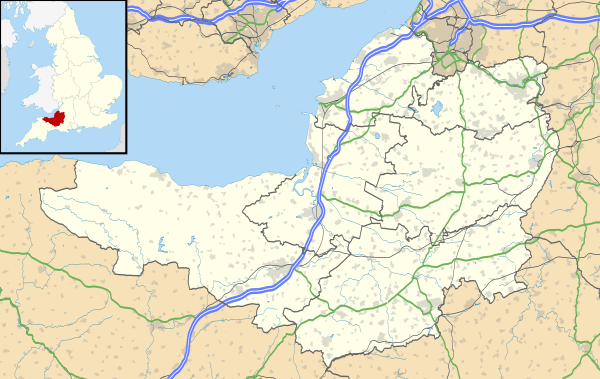 Over Stratton Location within Somerset | |
| Population | 317 [1] |
| OS grid reference | ST435151 |
| District | |
| Shire county | |
| Region | |
| Country | England |
| Sovereign state | United Kingdom |
| Post town | SOUTH PETHERTON |
| Postcode district | TA13 |
| Dialling code | 01460 |
| Police | Avon and Somerset |
| Fire | Devon and Somerset |
| Ambulance | South Western |
| UK Parliament | |
 |
Towards the north end of the village, Stratton & District Village Hall[2] provides an amenity for the local residents and hosts clubs dedicated to interests such as gardening, folk dancing and yoga. It also hosts a nursery for pre-school age children.
In the centre of the village there are two hospitality-related businesses: a public house with a restaurant (the Royal Oak[3]) and a restaurant that also has rooms for bed and breakfast (New Farm[4]).
The village also has a Methodist church but services are no longer held there.
History
The South Petherton Local History Group[5] has published a booklet titled "Explore South Petherton's Past"[6] that contains a number of references to Over Stratton, particularly on pages 32 and 33. These include the Church Room (now the village hall) built in 1865, the Fosse Way, a farmhouse (now the Royal Oak Inn), a raised pavement, the Methodist church, a socket-stone, Stratton Farm and West End House.


There are numerous reference to Over Stratton and the other settlements forming part of the parish of South Petherton in "A History of the County of Somerset."[7]
Geography
The village sits on sandstone, the Bridport Sand Formation, a sedimentary bedrock formed approximately 174 to 183 million years ago in the Jurassic Period.[8] . In parts of the village the bedrock is overlain by clay deposits.
Many of the older buildings were built using Hamstone from nearby Ham Hill quarries. It is a honey-coloured Jurassic limestone.
The principal street runs north-south through the village and is un-named. The route of Roman road, the Fosse Way, crosses this street in a northeast south-west direction. The route of the Fosse Way is joined by the A303 2 km northeast of the village, close to Petherton Bridge over the River Parrett. Some of the minor streets joining the principal streets are named but none of the streets other than Church Path and Gorefield have a numbering system for the properties. On the village noticeboard there is an outline map that includes an indexed list of 143 properties and their corresponding locations on the map.
There are 10 post codes [9] covering the village and the immediate vicinity:
| Post code | Street name | Description |
|---|---|---|
| TA13 5LB | Lopen Lane | road to Lopen |
| TA13 5LB | South Harp | road to Merriott |
| TA13 5LD | South Harp | Swedish Houses |
| TA13 5LE | South Harp | Airey houses |
| TA13 5LF | South Harp | road to Lower Stratton |
| TA13 5LG | - | southern end of main street |
| TA13 5LH | Harp Road | Watergore |
| TA13 5LJ | Northfield Lane | Northfield Lane |
| TA13 5LL | - | northern end of main street |
| TA13 5LL | Gorefield | northern end of main street |
| TA13 5LN | Church Path | northern end of main street |
| TA13 5LQ | - | central main street |
Transport
The village lies south of the A303 trunk road so it has excellent road transport links to east and west. On the former route of the old A303 on Harp Road, there is a fuel station by which there are bus stops for local services to South Petherton and Yeovil, and express services to Taunton and Hammersmith, London. The nearest railway station is at Crewkerne, five miles to the south of the village.
References
- "Custom report - Nomis - Official Labour Market Statistics". www.nomisweb.co.uk.
- http://www.southpethertonparishcouncil.gov.uk/Over-Stratton-Hall.aspx
- https://www.royaloakoverstratton.co.uk/
- https://www.newfarmrestaurant.co.uk/
- http://www.southpetherton.online/Local-Information/Local-Groups/Local-Groups.html
- Explore South Petherton's Past, South Petherton Local History Group, rev November 2014
- A History of the County of Somerset: Volume 4, pp170-198<https://www.british-history.ac.uk/vch/som/vol4/pp170-198>
- http://mapapps.bgs.ac.uk/geologyofbritain/home.html
- https://m.royalmail.com/mt/www.royalmail.com/find-a-postcode