Orana, Western Australia
Orana is a north-western suburb of Albany in southern Western Australia, northwest of Albany's central business district. Its local government area is the City of Albany.
| Orana Albany, Western Australia | |||||||||||||||
|---|---|---|---|---|---|---|---|---|---|---|---|---|---|---|---|
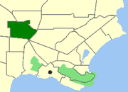 Map of Orana within Albany. | |||||||||||||||
| Population | 2,009 (2011 census)[1] | ||||||||||||||
| • Density | 837/km2 (2,170/sq mi) | ||||||||||||||
| Postcode(s) | 6330 | ||||||||||||||
| Area | 2.4 km2 (0.9 sq mi) | ||||||||||||||
| Location | 3.2 km (2 mi) from Albany | ||||||||||||||
| LGA(s) | City of Albany | ||||||||||||||
| State electorate(s) | Albany | ||||||||||||||
| Federal Division(s) | O'Connor | ||||||||||||||
| |||||||||||||||
It was gazetted as a suburb in 1979.[2]
Geography
The suburb is bounded in the north by Anson Road, to the south and east by the South Coast Highway and to the west by Le Grand Avenue. Albany Highway passes through the middle of the suburb.
Education
The suburb contains North Albany Senior High School and Parklands School (Albany), a Montessori school.
References
- Australian Bureau of Statistics (31 October 2012). "Orana (State Suburb)". 2011 Census QuickStats. Retrieved 4 January 2015.

- "Naming of Localities - Town of Albany (per 3773/57 V4)". Western Australia Government Gazette. 8 June 1979. p. 1979:1501.
This article is issued from Wikipedia. The text is licensed under Creative Commons - Attribution - Sharealike. Additional terms may apply for the media files.