Odanah, Wisconsin
Odanah is a census-designated place (CDP) in Ashland County, Wisconsin, in the town of Sanborn, United States, on the banks of the Bad River. The population was 13 at the 2010 census.
Odanah, Wisconsin | |
|---|---|
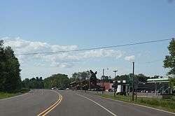 Odanah on U.S. Route 2 | |
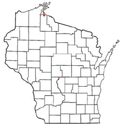 Location of Odanah, Wisconsin | |
| Coordinates: 46°36′9″N 90°40′57″W | |
| Country | United States |
| State | Wisconsin |
| County | Ashland |
| Town | Sanborn |
| Area | |
| • Total | 0.520 sq mi (1.35 km2) |
| • Land | 0.500 sq mi (1.29 km2) |
| • Water | 0.020 sq mi (0.05 km2) |
| Elevation | 610 ft (186 m) |
| Population (2010) | |
| • Total | 13 |
| • Density | 25/sq mi (9.7/km2) |
| Time zone | UTC-6 (Central (CST)) |
| • Summer (DST) | UTC-5 (CDT) |
| Area code(s) | 715 & 534 |
| FIPS code | 55-59450[2] |
| GNIS feature ID | 1570746[1] |
Odanah is the cultural and administrative center of the Bad River Chippewa Band of the Chippewa.[3]
History
A post office called Odanah has been in operation since 1855.[4] The name is from an Ojibwe language word, now spelled oodena, meaning "village."[5]
A 1960 flood led to the establishment of the Bad River Housing Authority, which relocated thousands of Odanah residents to higher ground a few miles down the road, away from the flood plain.[6]
Geography
Odanah is located at 46°36′9″N 90°40′57″W (46.602594, -90.682582),[7] along the Bad River.[8]
According to the United States Census Bureau, the CDP has a total area of .52 square miles (1.3 km2), of which, .5 square miles (1.3 km2) of it is land and 0.02 square miles (0.1 km2) of it (3.85%) is water.
Demographics
As of the census[2] of 2000, there were 254 people, 94 households, and 64 families residing in the CDP. The population density was 165.2 people per square mile (63.7/km2). There were 104 housing units at an average density of 67.6/sq mi (26.1/km2). The racial makeup of the CDP was 4.72% White, 92.52% Native American, and 2.76% from two or more races. Hispanic or Latino of any race were 2.36% of the population.
There were 94 households, out of which 37.2% had children under the age of 18 living with them, 18.1% were married couples living together, 39.4% had a female householder with no husband present, and 30.9% were non-families. 26.6% of all households were made up of individuals, and 10.6% had someone living alone who was 65 years of age or older. The average household size was 2.70 and the average family size was 3.23.
In the CDP, the population was spread out, with 36.6% under the age of 18, 8.7% from 18 to 24, 27.2% from 25 to 44, 20.5% from 45 to 64, and 7.1% who were 65 years of age or older. The median age was 31 years. For every 100 females, there were 82.7 males. For every 100 females age 18 and over, there were 64.3 males.
The median income for a household in the CDP was $25,156, and the median income for a family was $24,125. Males had a median income of $25,000 versus $19,063 for females. The per capita income for the CDP was $9,950. About 23.9% of families and 29.7% of the population were below the poverty line, including 45.6% of those under the age of eighteen and none of those 65 or over.
Notable people
- Justus Smith Stearns, prominent businessman in this community.
Images
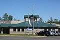 Post office
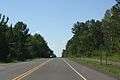 Sign on U.S. 2
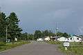 Looking north in Odanah
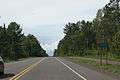 Looking west at the sign for Odanah
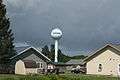 Water tower
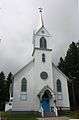 St. Mary Catholic Church
References
| Wikimedia Commons has media related to Odanah, Wisconsin. |
- "US Board on Geographic Names". United States Geological Survey. 2007-10-25. Retrieved 2008-01-31.
- "U.S. Census website". United States Census Bureau. Retrieved 2008-01-31.
- Rivero, Nicolas (25 August 2017). "The Smallest Town in Each of the 50 States". Mental Floss. Retrieved 25 June 2018.
- "Ashland County". Jim Forte Postal History. Retrieved 24 March 2015.
- Waldman, Carl; Braun, Molly (2009). Atlas of the North American Indian. Infobase Publishing. p. 380. ISBN 978-1-4381-2671-5.
- Hersher, Rebecca (August 15, 2018). "Wisconsin Reservation Offers A Climate Success Story And A Warning". NPR.org. Retrieved 2019-12-01.
- "US Gazetteer files: 2010, 2000, and 1990". United States Census Bureau. 2011-02-12. Retrieved 2011-04-23.
- DeLorme (1992), Wisconsin Atlas & Gazetteer, Freeport, Maine: DeLorme, p. 103 ISBN 0-89933-247-1
| Communities |  | |
|---|---|---|
| Related Geographic Aspects | ||
| Local Native American Tribes | ||
Municipalities and communities of Ashland County, Wisconsin, United States | ||
|---|---|---|
| Cities |  | |
| Village | ||
| Towns | ||
| CDPs | ||
| Unincorporated communities | ||
| Indian reservation | ||
| Footnotes | ‡This populated place also has portions in an adjacent county or counties | |