Ochtezeele
Ochtezeele (from Flemish; Ochtezele in modern Dutch spelling) is a commune in the Nord department in northern France.
Ochtezeele Ochtezele | |
|---|---|
 The road into Ochtezeele | |
Location of Ochtezeele 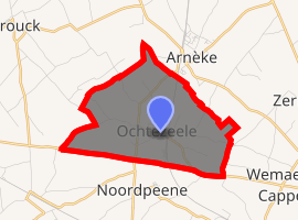
| |
 Ochtezeele  Ochtezeele | |
| Coordinates: 50°49′04″N 2°24′10″E | |
| Country | France |
| Region | Hauts-de-France |
| Department | Nord |
| Arrondissement | Dunkerque |
| Canton | Wormhout |
| Intercommunality | Communauté de communes de Flandre Intérieure |
| Government | |
| • Mayor (2014-2020) | Dominique Deray |
| Area 1 | 5.58 km2 (2.15 sq mi) |
| Population (2017-01-01)[1] | 383 |
| • Density | 69/km2 (180/sq mi) |
| Demonym(s) | Ochtezeelois (es) |
| Time zone | UTC+01:00 (CET) |
| • Summer (DST) | UTC+02:00 (CEST) |
| INSEE/Postal code | 59443 /59670 |
| Elevation | 19–62 m (62–203 ft) (avg. 24 m or 79 ft) |
| 1 French Land Register data, which excludes lakes, ponds, glaciers > 1 km2 (0.386 sq mi or 247 acres) and river estuaries. | |
The small river Peene Becque flows through the village.
The closest airport to Ochtezeele is Lille Airport (56 km) also worth considering are Le Touquet (Le Touget-Paris-Plage) Airport (64 km), Beauvais-Tillé Airport (153 km), or Paris CDG Airport (201 km).[2]
Heraldry
_Nord-France.svg.png) Arms of Ochtezeele |
The arms of Ochtezeele are blazoned : Azure, a bend argent. (Bouvignies, Jolimetz and Ochtezeele use the same arms.) |
See also
References
- "Populations légales 2017". INSEE. Retrieved 6 January 2020.
- ""Information"". Archived from the original on 2009-12-07. Retrieved 2010-07-19.
| Wikimedia Commons has media related to Ochtezeele. |
| Authority control |
|
|---|
This article is issued from Wikipedia. The text is licensed under Creative Commons - Attribution - Sharealike. Additional terms may apply for the media files.