Oak Grove, Kentucky
Oak Grove is a home rule-class city[4] adjacent to the Fort Campbell army base in Christian County, Kentucky, in the United States. The population was 7,489 as of the 2010 U.S. Census.[5] It is part of the Clarksville, Tennessee metropolitan area.
Oak Grove, Kentucky | |
|---|---|
| Motto(s): "Kentucky's Rising Star on the Border" | |
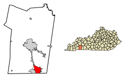 Location of Oak Grove in Christian County, Kentucky. | |
| Coordinates: 36°39′30″N 87°25′10″W | |
| Country | United States |
| State | Kentucky |
| County | Christian |
| Incorporated | 1974[1] |
| Area | |
| • Total | 10.74 sq mi (27.80 km2) |
| • Land | 10.70 sq mi (27.72 km2) |
| • Water | 0.03 sq mi (0.08 km2) |
| Elevation | 541 ft (165 m) |
| Population (2010) | |
| • Total | 7,489 |
| • Estimate (2019)[3] | 7,320 |
| • Density | 683.86/sq mi (264.05/km2) |
| Time zone | UTC-6 (Central (CST)) |
| • Summer (DST) | UTC-5 (CDT) |
| ZIP code | 42262 |
| Area code(s) | 270 & 364 |
| FIPS code | 21-57090 |
| GNIS feature ID | 0499655 |
| Website | www |
History
The first post office in Oak Grove was established in 1828.[6] The community was named for oak trees near the original town site.[7] The Clarksville Railroad was extended to Oak Grove in the 19th century.[8]
With construction of nearby Fort Campbell in the Second World War, Oak Grove's population grew. The city was incorporated by the state legislature on September 24, 1974.[1]
Geography
Oak Grove is located in southeastern Christian County at 36°39′30″N 87°25′10″W (36.658374, -87.419565).[9] Its southern border is the Tennessee state line, and it is bordered to the west by Fort Campbell. Hopkinsville, the Christian County seat, touches the northwest corner of Oak Grove along Fort Campbell Boulevard (U.S. Route 41 Alternate). Interstate 24 forms the northeast boundary of Oak Grove, with access from exit 86 (US 41 Alt.) and exit 89 (Kentucky Route 115). The city of Clarksville, Tennessee, is along the southern boundary of Oak Grove.
According to the United States Census Bureau, Oak Grove has a total area of 10.8 square miles (27.9 km2), of which 0.03 square miles (0.09 km2), or 0.30%, is water.[5]
Demographics
As of the census[10] of 2000, there were 7,064 people, 2,529 households, and 1,820 families residing in the city. The population density was 685.4 people per square mile (264.5/km2). There were 2,912 housing units at an average density of 282.5 per square mile (109.1/km2). The racial makeup of the city was 61.72% White, 25.81% African American, 1.03% Native American or Alaska Native, 1.64% Asian, 0.51% Pacific Islander, 3.94% from other races, and 5.35% from two or more races. Hispanics or Latinos of any race were 9.41% of the population.
There were 2,529 households out of which 50.2% had children under the age of 18 living with them, 58.5% were married couples living together, 10.3% had a female householder with no husband present, and 28.0% were non-families. 17.6% of all households were made up of individuals and 0.8% had someone living alone who was 65 years of age or older. The average household size was 2.79 and the average family size was 3.14.
| Historical population | |||
|---|---|---|---|
| Census | Pop. | %± | |
| 1980 | 2,088 | — | |
| 1990 | 2,863 | 37.1% | |
| 2000 | 7,064 | 146.7% | |
| 2010 | 7,489 | 6.0% | |
| Est. 2019 | 7,320 | [3] | −2.3% |
| U.S. Decennial Census[11] | |||
The age distribution was 32.2% under the age of 18, 23.4% from 18 to 24, 38.6% from 25 to 44, 4.9% from 45 to 64, and 1.0% who were 65 years of age or older. The median age was 24 years. For every 100 females, there are 113.0 males. For every 100 females age 18 and over, there were 115.7 males.
The median income for a household in the city was $32,235, and the median income for a family was $31,972. Males had a median income of $25,497 versus $18,994 for females. The per capita income for the city was $13,769. About 7.9% of families and 10.6% of the population were below the poverty line, including 13.1% of those under age 18 and 8.0% of those age 65 or over.
Climate
The climate in this area is characterized by hot, humid summers and generally mild to cool winters. According to the Köppen Climate Classification system, Oak Grove has a humid subtropical climate, abbreviated "Cfa" on climate maps.[12]
References
- Commonwealth of Kentucky. Office of the Secretary of State. Land Office. "Oak Grove, Kentucky". Accessed 18 September 2013.
- "2019 U.S. Gazetteer Files". United States Census Bureau. Retrieved July 24, 2020.
- "Population and Housing Unit Estimates". United States Census Bureau. May 24, 2020. Retrieved May 27, 2020.
- "Summary and Reference Guide to House Bill 331 City Classification Reform" (PDF). Kentucky League of Cities. Retrieved December 30, 2014.
- "Geographic Identifiers: 2010 Demographic Profile Data (G001): Oak Grove city, Kentucky". U.S. Census Bureau, American Factfinder. Archived from the original on February 12, 2020. Retrieved August 12, 2014.
- "Christian County". Jim Forte Postal History. Retrieved 3 January 2015.
- Rennick, Robert M. (28 August 2013). Kentucky Place Names. University Press of Kentucky. p. 384. ISBN 0-8131-4401-9.
- Collins, Lewis (1877). History of Kentucky. p. 125.
- "US Gazetteer files: 2010, 2000, and 1990". United States Census Bureau. 2011-02-12. Retrieved 2011-04-23.
- "U.S. Census website". United States Census Bureau. Retrieved 2008-01-31.
- "Census of Population and Housing". Census.gov. Retrieved June 4, 2015.
- Climate Summary for Oak Grove, Kentucky
External links
Municipalities and communities of Christian County, Kentucky, United States | ||
|---|---|---|
| Cities | 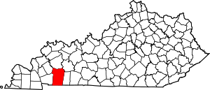 Location of Christian County, Kentucky | |
| CDPs | ||
| Unincorporated communities | ||
| Footnotes | ‡This populated place also has portions in an adjacent county or counties | |