Norwich Township, Franklin County, Ohio
Norwich Township is one of the seventeen townships of Franklin County, Ohio, United States. The 2010 census found 31,807 people in the township, 3,982 of whom lived in the unincorporated portions of the township.[4]
Norwich Township, Franklin County, Ohio | |
|---|---|
 Wesley Chapel near Hilliard | |
 Location of Norwich Township in Franklin County. | |
| Coordinates: 40°1′49″N 83°8′13″W | |
| Country | United States |
| State | Ohio |
| County | Franklin |
| Area | |
| • Total | 14.3 sq mi (37 km2) |
| • Land | 14.2 sq mi (37 km2) |
| • Water | 0.2 sq mi (0.5 km2) |
| Elevation | 909 ft (277 m) |
| Population (2010) | |
| • Total | 31,807 |
| • Density | 2,200/sq mi (860/km2) |
| Time zone | UTC-5 (Eastern (EST)) |
| • Summer (DST) | UTC-4 (EDT) |
| FIPS code | 39-57344[3] |
| GNIS feature ID | 1086109[2] |
Geography
Located in the western part of the county, it is composed of several small "islands", separated due to municipal annexations. These islands border the following townships and cities:
- Washington Township - north
- Columbus - east
- Hilliard - south
- Brown Township - west
Most of Norwich Township has been annexed by the cities of Columbus (the county seat of Franklin County), in the south, and Hilliard, in the north.
Name and history
Statewide, the only other Norwich Township is located in Huron County.
Norwich Township was founded in 1813. It was named by Thomas Backus, a prominent early resident and native of Norwich, Connecticut.[5]
Government
The township is governed by a three-member board of trustees, who are elected in November of odd-numbered years to a four-year term beginning on the following January 1. Two are elected in the year after the presidential election and one is elected in the year before it. There is also an elected township fiscal officer,[6] who serves a four-year term beginning on April 1 of the year after the election, which is held in November of the year before the presidential election. Vacancies in the fiscal officership or on the board of trustees are filled by the remaining trustees.
Education
All areas of this township are in the Hilliard City School District.[7]
References
- "2010 Census U.S. Gazetteer Files for County Subdivisions". U.S. Census Bureau, Geography Division. 2 February 2011. Archived from the original on 29 January 2012. Retrieved 18 February 2012.
- "US Board on Geographic Names". United States Geological Survey. 2007-10-25. Retrieved 2008-01-31.
- "U.S. Census website". United States Census Bureau. Retrieved 2008-01-31.
- "Population and Household Counts for Governmental Units: 2010, 2000, 1990" (PDF). Ohio Department of Development. August 2011. Archived from the original (PDF) on 27 October 2016. Retrieved 18 February 2012.
- Kilbourn, John (1833). The Ohio Gazetteer, or, a Topographical Dictionary. Scott and Wright. pp. 360. Retrieved 12 December 2013.
- §503.24, §505.01, and §507.01 of the Ohio Revised Code. Accessed 4/30/2009.
- "Facts & Figures" (Archived 2014-06-14 at WebCite). Hilliard City School District. Retrieved on June 14, 2014.
External links
Municipalities and communities of Franklin County, Ohio, United States | ||
|---|---|---|
| Cities | 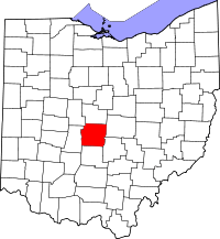 Map of Ohio highlighting Franklin County | |
| Villages | ||
| Townships | ||
| CDPs | ||
| Unincorporated communities | ||
| Footnotes | ‡This populated place also has portions in an adjacent county or counties | |