Negaunee Township, Michigan
Negaunee Township is a civil township of Marquette County in the U.S. state of Michigan. The population was 2,707 at the 2000 census. The City of Negaunee is located at the southwest corner of the township, but is administratively autonomous.
Negaunee Township, Michigan | |
|---|---|
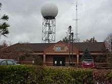
 Negaunee Township Water Tower | |
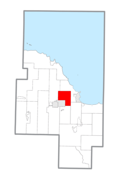 Location within Marquette County | |
 Negaunee Township Location within the state of Michigan | |
| Coordinates: 46°31′51″N 87°32′49″W | |
| Country | United States |
| State | Michigan |
| County | Marquette |
| Area | |
| • Total | 43.7 sq mi (113.1 km2) |
| • Land | 42.1 sq mi (108.9 km2) |
| • Water | 1.6 sq mi (4.1 km2) |
| Elevation | 1,417 ft (432 m) |
| Population (2000) | |
| • Total | 2,707 |
| • Density | 64.4/sq mi (24.9/km2) |
| Time zone | UTC-5 (Eastern (EST)) |
| • Summer (DST) | UTC-4 (EDT) |
| ZIP code | 49866 |
| Area code(s) | 906 |
| FIPS code | 26-56880[1] |
| GNIS feature ID | 1626791[2] |
| Website | Official website |
Communities
- Eagle Mills A railroad station was established at this site in the township in 1855. A sawmill was established here in 1873 and a post office began in 1877. It operated periodically through 1912.[3]
Geography
According to the United States Census Bureau, the township has a total area of 43.7 square miles (113.1 km2), of which 42.0 square miles (108.9 km2) is land and 1.6 square miles (4.1 km2) (3.67%) is water.
Demographics
As of the census[1] of 2000, there were 2,707 people, 1,031 households, and 795 families residing in the township. The population density was 64.4 per square mile (24.9/km2). There were 1,259 housing units at an average density of 29.9 per square mile (11.6/km2). The racial makeup of the township was 97.56% White, 0.07% African American, 0.92% Native American, 0.18% Asian, 0.04% Pacific Islander, 0.18% from other races, and 1.03% from two or more races. Hispanic or Latino of any race were 0.48% of the population.
There were 1,031 households, out of which 34.9% had children under the age of 18 living with them, 67.7% were married couples living together, 6.0% had a female householder with no husband present, and 22.8% were non-families. 19.0% of all households were made up of individuals, and 5.8% had someone living alone who was 65 years of age or older. The average household size was 2.63 and the average family size was 3.02.
In the township the population was spread out, with 24.8% under the age of 18, 8.0% from 18 to 24, 30.1% from 25 to 44, 28.4% from 45 to 64, and 8.7% who were 65 years of age or older. The median age was 38 years. For every 100 females, there were 103.8 males. For every 100 females age 18 and over, there were 103.0 males.
The median income for a household in the township was $47,348, and the median income for a family was $55,283. Males had a median income of $40,132 versus $25,568 for females. The per capita income for the township was $18,894. About 1.8% of families and 3.7% of the population were below the poverty line, including 2.2% of those under age 18 and 4.9% of those age 65 or over.
References
Notes
Sources
- Romig, Walter (October 1, 1986) [1973]. Michigan Place Names: The History of the Founding and the Naming of More Than Five Thousand Past and Present Michigan Communities. Great Lakes Books Series (Paperback). Detroit, Michigan: Wayne State University Press. ISBN 0-8143-1838-X.CS1 maint: ref=harv (link)
External links
Municipalities and communities of Marquette County, Michigan, United States | ||
|---|---|---|
| Cities | 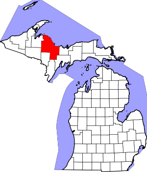 Map of Michigan highlighting Marquette County.svg | |
| Charter townships | ||
| Civil townships | ||
| CDPs | ||
| Unincorporated communities | ||
| Indian reservations | ||
| Footnotes | ‡This populated place also has portions in an adjacent county or counties | |