National Register of Historic Places listings in Yuma County, Arizona
This is a list of the National Register of Historic Places listings in Yuma County, Arizona. It is intended to be a complete list of the properties and districts on the National Register of Historic Places in Yuma County, Arizona, United States. The locations of National Register properties and districts for which the latitude and longitude coordinates are included below, may be seen in a map.[1]
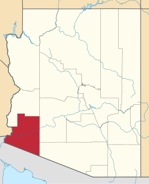
Location of Yuma County in Arizona
There are 57 properties and districts listed on the National Register in the county, including 1 that is also a National Historic Landmark. Another three properties were once listed, but have since been removed.
- This National Park Service list is complete through NPS recent listings posted August 14, 2020.[2]
Listings county-wide
| [3] | Name on the Register | Image | Date listed[4] | Location | City or town | Description |
|---|---|---|---|---|---|---|
| 1 | Antelope Hill Highway Bridge | June 28, 1979 (#79003444) |
Northwest of Tacna spanning the Gila River 32°43′08″N 114°00′43″W |
Tacna | ||
| 2 | Balsz House | 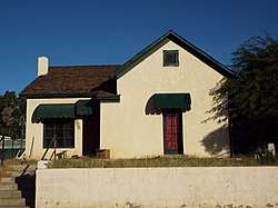 Balsz House |
December 7, 1982 (#82001624) |
475 2nd Ave. 32°43′08″N 114°37′18″W |
Yuma | |
| 3 | Blaisdell Slow Sand Filter Washing Machine | 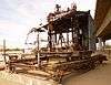 Blaisdell Slow Sand Filter Washing Machine |
January 18, 1979 (#79000430) |
N. Jones St. 32°43′38″N 114°37′00″W |
Yuma | |
| 4 | Brinley Avenue Historic District | 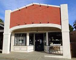 Brinley Avenue Historic District |
December 7, 1982 (#82001625) |
29-96 W. 2nd St., 198-200 S. Main, 201 S. 1st, and 102-298 Madison Aves. 32°43′25″N 114°37′07″W |
Yuma | |
| 5 | Brown House | 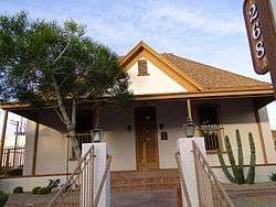 Brown House |
December 7, 1982 (#82001626) |
268 S. 1st Ave. 32°43′20″N 114°37′13″W |
Yuma | |
| 6 | Brownstetter House | 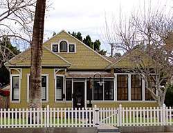 Brownstetter House |
December 7, 1982 (#82001627) |
627 Orange Ave. 32°42′56″N 114°37′24″W |
Yuma | |
| 7 | Cactus Press-Plaza Paint Building | 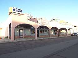 Cactus Press-Plaza Paint Building |
April 24, 1987 (#87000613) |
30-54 E. 3rd St. 32°43′21″N 114°37′06″W |
Yuma | |
| 8 | Camp Horn Monument | 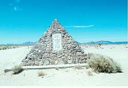 Camp Horn Monument |
September 12, 2003 (#03000900) |
Approximately 8 miles north of Interstate 8 32°55′07″N 113°33′55″W |
Dateland | |
| 9 | Caruthers House | 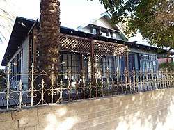 Caruthers House |
December 7, 1982 (#82001628) |
441 2nd Ave. 32°43′09″N 114°37′20″W |
Yuma | |
| 10 | Connor House | December 7, 1982 (#82001629) |
281 S. 1st Ave. 32°43′19″N 114°37′13″W |
Yuma | ||
| 11 | Double Roof House | 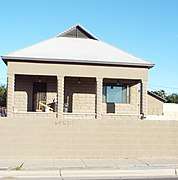 Double Roof House |
December 7, 1982 (#82001631) |
553 4th Ave. 32°43′01″N 114°37′25″W |
Yuma | |
| 12 | Dressing Apartments |  Dressing Apartments |
December 7, 1982 (#82001630) |
146 1st Ave. 32°43′28″N 114°37′13″W |
Yuma | |
| 13 | El Camino Del Diablo |  El Camino Del Diablo |
December 1, 1978 (#78000560) |
Northwest of Lukeville 32°04′20″N 113°23′12″W |
Lukeville | |
| 14 | Frank Ewing House | 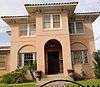 Frank Ewing House |
December 7, 1982 (#82001632) |
700 2nd Ave. 32°42′51″N 114°37′19″W |
Yuma | |
| 15 | Ruth Ewing House | 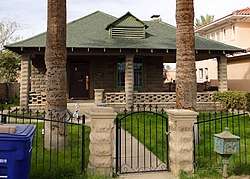 Ruth Ewing House |
December 7, 1982 (#82004844) |
712 2nd Ave. 32°42′50″N 114°37′21″W |
Yuma | Concrete block cottage built in 1906 |
| 16 | Fourth Avenue Junior High School | 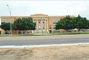 Fourth Avenue Junior High School |
December 7, 1982 (#82001633) |
450 S. 4th Ave. 32°43′07″N 114°37′28″W |
Yuma | |
| 17 | Gandolfo Theater | 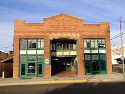 Gandolfo Theater |
December 7, 1982 (#82001636) |
200 S. 1st Ave. 32°43′24″N 114°37′13″W |
Yuma | |
| 18 | Alfred Griffin House | 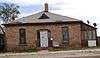 Alfred Griffin House |
December 7, 1982 (#82001637) |
641 1st Ave. 32°42′55″N 114°37′11″W |
Yuma | |
| 19 | Peter B. Hodges House | 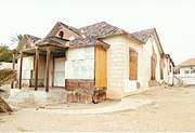 Peter B. Hodges House |
December 7, 1982 (#82001638) |
209 Orange Ave. 32°43′09″N 114°37′20″W |
Yuma | The Hodges House is in a total state of abandonment |
| 20 | Hotel del Ming | 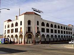 Hotel del Ming |
December 7, 1982 (#82001639) |
300 Gila St. 32°43′21″N 114°36′56″W |
Yuma | |
| 21 | E.B. Jackson House | 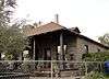 E.B. Jackson House |
December 7, 1982 (#82001640) |
572 1st Ave. 32°43′00″N 114°37′15″W |
Yuma | |
| 22 | Jerry Kent House | 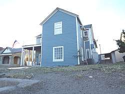 Jerry Kent House |
December 7, 1982 (#82001641) |
450 3rd Ave. 32°43′07″N 114°37′24″W |
Yuma | |
| 23 | Lee Hotel | 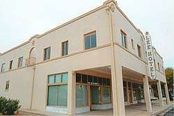 Lee Hotel |
April 12, 1984 (#84000750) |
390 Main St. 32°43′16″N 114°37′04″W |
Yuma | |
| 24 | Henry Levy House | 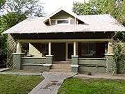 Henry Levy House |
December 7, 1982 (#82001642) |
602 2nd Ave. 32°42′57″N 114°37′17″W |
Yuma | |
| 25 | George Marable House | 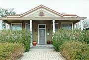 George Marable House |
December 7, 1982 (#82001643) |
482 Orange Ave. 32°43′10″N 114°37′18″W |
Yuma | |
| 26 | Martinez Lake Site (AZ-050-0210) |  Martinez Lake Site (AZ-050-0210) |
September 10, 1987 (#87001446) |
Address Restricted |
Fisher's Landing | |
| 27 | Masonic Temple | 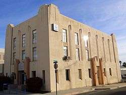 Masonic Temple |
April 12, 1984 (#84000752) |
153 S. 2nd Ave. 32°43′29″N 114°37′18″W |
Yuma | |
| 28 | Carmelita Mayhew House |  Carmelita Mayhew House |
December 7, 1982 (#82001644) |
660 1st Ave. 32°42′54″N 114°37′15″W |
Yuma | |
| 29 | McPhaul Suspension Bridge |  McPhaul Suspension Bridge |
August 13, 1981 (#81000140) |
West of Dome 32°45′34″N 114°25′14″W |
Dome | |
| 30 | Methodist Episcopal Church |  Methodist Episcopal Church |
December 7, 1982 (#82001645) |
256 S. 1st Ave. 32°43′20″N 114°37′13″W |
Yuma | |
| 31 | Methodist Parsonage |  Methodist Parsonage |
December 7, 1982 (#82001646) |
248 S. 1st Ave. 32°43′21″N 114°37′13″W |
Yuma | |
| 32 | Mexican Consulate | December 7, 1982 (#82001647) |
129 W. 4th St. 32°43′11″N 114°37′16″W |
Yuma | ||
| 33 | A.B. Ming House |  A.B. Ming House |
December 7, 1982 (#82001648) |
468 Orange Ave. 32°43′09″N 114°37′19″W |
Yuma | |
| 34 | Mohawk Valley School | December 29, 1986 (#86003525) |
5151 South Ave. 39 East 32°45′06″N 113°58′47″W |
Roll | ||
| 35 | Norton House |  Norton House |
December 7, 1982 (#82001649) |
226 S. 1st Ave. 32°43′22″N 114°37′13″W |
Yuma | |
| 36 | Ocean to Ocean Bridge |  Ocean to Ocean Bridge |
September 11, 1979 (#79000431) |
Penitentiary Ave. 32°43′42″N 114°36′53″W |
Yuma | |
| 37 | Ortiz House |  Ortiz House |
December 7, 1982 (#82001650) |
206 S. 1st Ave. 32°43′23″N 114°37′13″W |
Yuma | |
| 38 | Pancrazi House |  Pancrazi House |
December 7, 1982 (#82001651) |
432 S. Madison Ave. 32°43′11″N 114°37′08″W |
Yuma | |
| 39 | Pauley Apartments |  Pauley Apartments |
December 7, 1982 (#82001652) |
490 W. 1st St. 32°43′30″N 114°37′32″W |
Yuma | |
| 40 | Power Apartments |  Power Apartments |
December 7, 1982 (#82001653) |
20 W. 3rd St. 32°43′21″N 114°37′08″W |
Yuma | |
| 41 | Clara Smith Riley House | 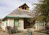 Clara Smith Riley House |
December 7, 1982 (#82001654) |
734 2nd Ave. 32°42′50″N 114°37′19″W |
Yuma | |
| 42 | Roosevelt School | 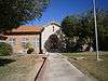 Roosevelt School |
December 7, 1982 (#82001655) |
550 W. 5th St.[5] 32°43′06″N 114°37′35″W |
Yuma | |
| 43 | Russell-Williamson House | 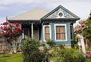 Russell-Williamson House |
December 7, 1982 (#82001656) |
652 2nd Ave. 32°42′54″N 114°37′19″W |
Yuma | |
| 44 | St. Paul's Episcopal Church | 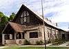 St. Paul's Episcopal Church |
December 7, 1982 (#82001657) |
637 2nd Ave. 32°42′54″N 114°37′16″W |
Yuma | |
| 45 | San Carlos Hotel | 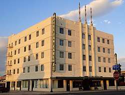 San Carlos Hotel |
April 12, 1984 (#84000754) |
106 1st St. 32°43′32″N 114°37′04″W |
Yuma | |
| 46 | San Ysidro Hacienda | San Ysidro Hacienda |
October 10, 1975 (#75000371) |
Address Restricted |
Yuma | |
| 47 | Sears Point Archaeological District | Sears Point Archaeological District |
October 16, 1985 (#85003150) |
Address Restricted |
Gila Bend | |
| 48 | J. Homer Smith House | J. Homer Smith House |
December 7, 1982 (#82001658) |
600 5th Ave. 32°42′57″N 114°37′29″W |
Yuma | |
| 49 | Southern Pacific Freight Depot | 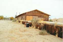 Southern Pacific Freight Depot |
April 24, 1987 (#87000614) |
Main St. 32°43′13″N 114°37′03″W |
Yuma | |
| 50 | Southern Pacific Railroad Passenger Coach Car-S.P. X7 |  Southern Pacific Railroad Passenger Coach Car-S.P. X7 |
March 2, 2000 (#00000101) |
201 N. 4th Ave. 32°43′40″N 114°37′19″W |
Yuma | |
| 51 | Stoffela Store/Railroad Exchange | 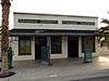 Stoffela Store/Railroad Exchange |
December 7, 1982 (#82001659) |
447 S. Main St. 32°43′10″N 114°37′07″W |
Yuma | |
| 52 | US Post Office-Yuma Main |  US Post Office-Yuma Main |
December 3, 1985 (#85003109) |
370 W. 3rd St. 32°43′17″N 114°37′02″W |
Yuma | |
| 53 | Yuma Century Heights Conservancy Residential Historic District | 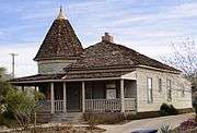 Yuma Century Heights Conservancy Residential Historic District |
October 11, 1988 (#88001834) |
Roughly bounded by 4th Ave., 8th St., and 1st and Orange Aves. 32°43′00″N 114°37′17″W |
Yuma | |
| 54 | Yuma City Hall |  Yuma City Hall |
December 7, 1982 (#82001660) |
181 W. 1st St. 32°43′32″N 114°37′13″W |
Yuma | |
| 55 | Yuma County Courthouse | 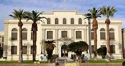 Yuma County Courthouse |
December 7, 1982 (#82001661) |
168 S. 2nd Ave. 32°43′26″N 114°37′18″W |
Yuma | |
| 56 | Yuma Crossing and Associated Sites | 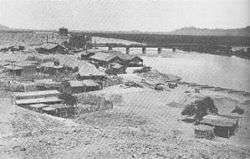 Yuma Crossing and Associated Sites |
November 13, 1966 (#66000197) |
Banks of the Colorado River 32°43′48″N 114°37′05″W |
Yuma | |
| 57 | Yuma Main Street Historic District | -Historic_Downtown_District.jpg) Yuma Main Street Historic District |
March 10, 1994 (#94000068) |
170-387 S. Main St. and 10-29 W. 3rd St. 32°43′21″N 114°37′01″W |
Yuma |
Former listings
| [3] | Name on the Register | Image | Date listed | Date removed | Location | City or town | Summary |
|---|---|---|---|---|---|---|---|
| 1 | Fredley Apartments | 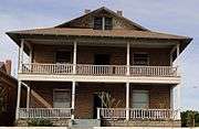 Fredley Apartments |
December 7, 1982 (#82001634) | May 17, 2018 | 406 2nd Ave. 32°43′10″N 114°37′17″W |
Yuma | |
| 2 | Fredley House | December 7, 1982 (#82001635) | May 17, 2018 | 408 2nd Ave. 32°43′09″N 114°37′17″W |
Yuma | ||
| 3 | Southern Pacific Railroad Depot |  Southern Pacific Railroad Depot |
June 22, 1976 (#76000384) | August 22, 2019 | Gila St. 32°43′24″N 114°36′54″W |
Yuma | Razed in 1990s |
See also
| Wikimedia Commons has media related to National Register of Historic Places in Yuma County, Arizona. |
References
- The latitude and longitude information provided in this table was derived originally from the National Register Information System, which has been found to be fairly accurate for about 99% of listings. Some locations in this table may have been corrected to current GPS standards.
- "National Register of Historic Places: Weekly List Actions". National Park Service, United States Department of the Interior. Retrieved on August 14, 2020.
- Numbers represent an ordering by significant words. Various colorings, defined here, differentiate National Historic Landmarks and historic districts from other NRHP buildings, structures, sites or objects.
- The eight-digit number below each date is the number assigned to each location in the National Register Information System database, which can be viewed by clicking the number.
- "Contact Us". Roosevelt Elementary School. Retrieved April 18, 2016.
| Topics | |
|---|---|
| Lists by state |
|
| Lists by insular areas | |
| Lists by associated state | |
| Other areas | |
| Related | |
| |
 | |||
Municipalities and communities of Yuma County, Arizona, United States | ||
|---|---|---|
| Cities | | |
| Town | ||
| CDPs | ||
| Populated places | ||
| Indian reservations | ||
| Ghost towns | ||
| Footnotes | ‡This populated place also has portions in an adjacent county or counties | |
This article is issued from Wikipedia. The text is licensed under Creative Commons - Attribution - Sharealike. Additional terms may apply for the media files.