National Register of Historic Places listings in Valdez–Cordova Census Area, Alaska
This is a list of the National Register of Historic Places listings in Valdez–Cordova Census Area, Alaska.

Location of the Valdez-Cordova Census Area in Alaska
This is intended to be a complete list of the properties and districts on the National Register of Historic Places in Valdez-Cordova Census Area, Alaska, United States. The locations of National Register properties and districts for which the latitude and longitude coordinates are included below, may be seen in a Google map.[1]
There are 28 properties and districts listed on the National Register in the census area, including 3 National Historic Landmarks. Another two properties were once listed but have been removed.
- This National Park Service list is complete through NPS recent listings posted August 14, 2020.[2]
Current listings
| [3] | Name on the Register[4] | Image | Date listed[5] | Location | City or town | Description |
|---|---|---|---|---|---|---|
| 1 | Bering Expedition Landing Site |  Bering Expedition Landing Site |
July 20, 1977 (#77001542) |
On Kayak Island 59°53′40″N 144°29′08″W |
Katalla | |
| 2 | Bremner Historic Mining District | 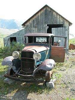 Bremner Historic Mining District |
June 15, 2000 (#00000659) |
Along Golconda Creek, about 47 miles (76 km) southeast of Chitina 61°01′45″N 143°26′20″W |
Chitina | |
| 3 | Cape Hinchinbrook Light Station |  Cape Hinchinbrook Light Station |
July 29, 2005 (#05000728) |
Southwestern end of Hinchinbrook Island 60°14′14″N 146°38′48″W |
Cordova | |
| 4 | Cape St. Elias Lighthouse | 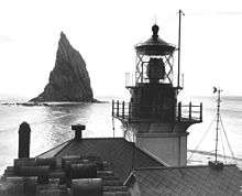 Cape St. Elias Lighthouse |
December 18, 1975 (#75002157) |
Southwestern end of Kayak Island 59°47′54″N 144°35′56″W |
Katalla | |
| 5 | Chilkat Oil Company Refinery Site | September 6, 1974 (#74002320) |
Along Katalla Slough, about 2.7 miles (4.3 km) east of Katalla 60°11′15″N 144°27′02″W |
Katalla | ||
| 6 | Chisana Historic District |  Chisana Historic District |
November 29, 1985 (#85002999) |
Extending west 0.25 miles (0.40 km) from the southern end of Chisana Airstrip 62°03′56″N 142°02′49″W |
Chisana | |
| 7 | Chisana Historic Mining Landscape |  Chisana Historic Mining Landscape |
May 14, 1998 (#98000436) |
Address restricted[6] |
Northway | Also partly comprised in Southeast Fairbanks Census Area |
| 8 | Chistochina Trading Post | June 13, 1997 (#97000553) |
Mile 32 of Tok Cutoff, about 27 miles (43 km) northeast of Gakona 62°33′54″N 144°40′00″W |
Gakona | ||
| 9 | Chitina Tin Shop |  Chitina Tin Shop |
June 11, 1979 (#79003763) |
Main Street 61°30′57″N 144°26′25″W |
Chitina | |
| 10 | Copper River and Northwestern Railway |  Copper River and Northwestern Railway |
April 24, 1973 (#73002275) |
Chitina to Tasnuna River, along western bank of Copper River 61°20′21″N 144°47′59″W |
Chitina | |
| 11 | Copper River and Northwestern Railway Bunkhouse and Messhouse | December 5, 2002 (#02001460) |
3rd Street 61°30′55″N 144°26′09″W |
Chitina | ||
| 12 | Cordova Post Office and Courthouse | .jpg) Cordova Post Office and Courthouse |
August 2, 1977 (#77001571) |
612 2nd Street 60°32′39″N 145°45′24″W |
Cordova | |
| 13 | Dakah De'nin's Village Site | April 9, 1979 (#79003764) |
Address restricted[6] |
Chitina | ||
| 14 | Gakona Historic District |  Gakona Historic District |
February 2, 2001 (#01000024) |
Mile 2 of Tok Cutoff-Glenn Highway 62°18′07″N 145°18′10″W |
Gakona | |
| 15 | Gakona Roadhouse |  Gakona Roadhouse |
August 3, 1977 (#77001579) |
Mile 2 of Tok Cutoff-Glenn Highway 62°18′10″N 145°18′15″W |
Gakona | Also a contributing property to Gakona Historic District |
| 16 | Kansky's | May 16, 1997 (#97000432) |
Mile 42 of Nabesna Road, about 2 miles (3.2 km) north of the Nabesna Mine 62°23′52″N 142°59′45″W |
Nabesna | ||
| 17 | Kennecott Mines |  Kennecott Mines |
July 12, 1978 (#78003420) |
East of Kennicott Glacier, about 6.5 miles (10.5 km) north of McCarthy 61°31′09″N 142°50′29″W |
McCarthy | |
| 18 | McCarthy General Store |  McCarthy General Store |
January 31, 1978 (#78003421) |
Southeastern corner of Kennicott Avenue and Skolai Street 61°25′55″N 142°55′26″W |
McCarthy | |
| 19 | McCarthy Power Plant | April 26, 1979 (#79003752) |
West side of Shushanna Avenue, on McCarthy Creek 61°25′56″N 142°55′35″W |
McCarthy | ||
| 20 | Million Dollar Bridge |  Million Dollar Bridge |
March 31, 2000 (#00000293) |
Mile 48 of Copper River Highway, about 35 miles (56 km) northeast of Cordova 60°40′23″N 144°44′45″W |
Cordova | |
| 21 | Nabesna Gold Mine Historic District | May 25, 1979 (#79003755) |
Base of White Mountain at end of Nabesna Road 62°22′18″N 143°00′45″W |
Nabesna | ||
| 22 | Palugvik Archeological District | October 15, 1966 (#66000957) |
Hawkins Island |
Cordova | ||
| 23 | Pioneer Igloo Hall Number 19 | August 15, 2012 (#12000492) |
621 1st Street 60°32′38″N 145°45′33″W |
Cordova | ||
| 24 | Red Dragon Historic District |  Red Dragon Historic District |
August 31, 1982 (#82004899) |
Roughly bounded by Lake Avenue, 1st Street and 2nd Street 60°32′32″N 145°45′28″W |
Cordova | |
| 25 | St. Michael the Archangel Church |  St. Michael the Archangel Church |
June 6, 1980 (#80004578) |
Southern side of Lake Avenue, between 9th Street and Birch Street 60°32′33″N 145°44′40″W |
Cordova | |
| 26 | Slana Roadhouse |  Slana Roadhouse |
February 2, 2005 (#04001569) |
Mile 1 of Nabesna Road 62°42′19″N 143°57′50″W |
Slana | |
| 27 | Tangle Lakes Archeological District | November 12, 1971 (#71001091) |
Address restricted[6] |
Paxson | ||
| 28 | Valdez Trail (Copper Bluff Segment) | February 12, 1998 (#98000077) |
Mile 106.5 of Richardson Highway 62°01′20″N 145°21′55″W |
Silver Springs |
Former listings
| [3] | Name on the Register | Image | Date listed | Date removed | Location | City or town | Summary |
|---|---|---|---|---|---|---|---|
| 1 | Reception Building | April 9, 1980 (#80004566) | April 26, 2019 | Northeastern corner of 2nd Street and Browning Avenue 60°32′41″N 145°45′24″W |
Cordova | ||
| 2 | Sourdough Lodge | .jpg) Sourdough Lodge |
October 1, 1974 (#74002264) | March 5, 1993 | Mile 147.5 of Richardson Highway 62°31′44″N 145°31′02″W |
Gakona | Destroyed by fire in 1992. |
See also
| Wikimedia Commons has media related to National Register of Historic Places in Valdez-Cordova Census Area, Alaska. |
References
- The latitude and longitude information provided in this table was derived originally from the National Register Information System, which has been found to be fairly accurate for about 99% of listings. Some locations in this table may have been corrected to current GPS standards.
- "National Register of Historic Places: Weekly List Actions". National Park Service, United States Department of the Interior. Retrieved on August 14, 2020.
- Numbers represent an ordering by significant words. Various colorings, defined here, differentiate National Historic Landmarks and historic districts from other NRHP buildings, structures, sites or objects.
- "National Register Information System". National Register of Historic Places. National Park Service. April 24, 2008.
- The eight-digit number below each date is the number assigned to each location in the National Register Information System database, which can be viewed by clicking the number.
- Federal and state laws and practices restrict general public access to information regarding the specific location of this resource. In some cases, this is to protect archeological sites from vandalism, while in other cases it is restricted at the request of the owner. See: Knoerl, John; Miller, Diane; Shrimpton, Rebecca H. (1990), Guidelines for Restricting Information about Historic and Prehistoric Resources, National Register Bulletin, National Park Service, U.S. Department of the Interior, OCLC 20706997.
| Topics | |
|---|---|
| Lists by state |
|
| Lists by insular areas | |
| Lists by associated state | |
| Other areas | |
| Related | |
| |
Boroughs | .svg.png) | ||
Census areas | |||
There are no sites listed on the National Register of Historic Places in Kusilvak Census Area. | |||
Municipalities and communities of Valdez–Cordova Census Area, Alaska, United States | ||
|---|---|---|
| Cities | Valdez–Cordova Census Area map | |
| CDPs | ||
| Unincorporated communities | ||
| Ghost towns | ||
This article is issued from Wikipedia. The text is licensed under Creative Commons - Attribution - Sharealike. Additional terms may apply for the media files.