National Register of Historic Places listings in Taos County, New Mexico
This is a list of the National Register of Historic Places listings in Taos County, New Mexico.
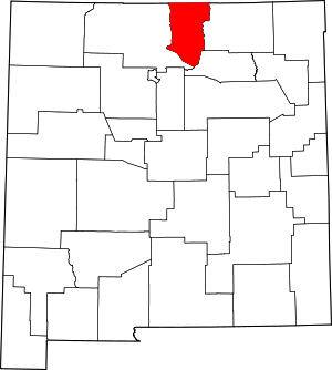
Location of Taos County in New Mexico
This is intended to be a complete list of the properties and districts on the National Register of Historic Places in Taos County, New Mexico, United States. Latitude and longitude coordinates are provided for many National Register properties and districts; these locations may be seen together in a map.[1]
There are 42 properties and districts listed on the National Register in the county, including siven National Historic Landmarks. All but seven of the National Register listings within the county are also recorded on the New Mexico State Register of Cultural Properties.
- This National Park Service list is complete through NPS recent listings posted August 14, 2020.[2]
| Bernalillo – Catron – Chaves – Cibola – Colfax – Curry – De Baca – Doña Ana – Eddy – Grant – Guadalupe – Harding – Hidalgo – Lea – Lincoln – Los Alamos – Luna – McKinley – Mora – Otero – Quay – Rio Arriba – Roosevelt – San Juan – San Miguel – Sandoval – Santa Fe – Sierra – Socorro – Taos – Torrance – Union – Valencia |
Current listings
| [3] | Name on the Register[4] | Image | Date listed[5] | Location | City or town | Description |
|---|---|---|---|---|---|---|
| 1 | Bernard J. Beimer House | 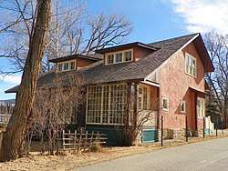 Bernard J. Beimer House |
March 22, 2006 (#06000156) |
215 Beimer Ave. 36°25′00″N 105°34′18″W |
Taos | State Register of Cultural Properties (SRCP) |
| 2 | Governor Charles Bent House | 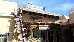 Governor Charles Bent House |
November 16, 1978 (#78001831) |
Bent St. 36°24′31″N 105°34′22″W |
Taos | SRCP |
| 3 | Black Copper Mine and Stamp Mill | 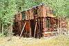 Black Copper Mine and Stamp Mill |
October 27, 2000 (#00000875) |
Black Copper Canyon Rd. 36°38′14″N 105°22′13″W |
Red River | SRCP |
| 4 | Ernest L. Blumenschein House |  Ernest L. Blumenschein House |
October 15, 1966 (#66000495) |
Ledoux St. 36°24′21″N 105°34′34″W |
Taos | |
| 5 | Carson School | 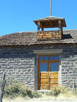 Carson School |
February 13, 1986 (#86000233) |
State Road 96 36°21′53″N 105°45′55″W |
Carson | SRCP |
| 6 | Kit Carson House | .jpg) Kit Carson House |
October 15, 1966 (#66000948) |
Kit Carson Ave. 36°24′25″N 105°34′20″W |
Taos | |
| 7 | Chapel of Santa Cruz | .jpg) Chapel of Santa Cruz |
April 14, 1975 (#75001174) |
Southern side of Plaza off U.S. Route 285 36°18′11″N 106°02′46″W |
Ojo Caliente | SRCP |
| 8 | Laureano Cordova Mill | November 5, 1974 (#74001212) |
Off State Road 75 36°11′26″N 105°40′08″W |
Vadito | SRCP | |
| 9 | Eanger Irving Couse House and Studio—Joseph Henry Sharp Studios | 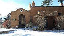 Eanger Irving Couse House and Studio—Joseph Henry Sharp Studios |
September 28, 2005 (#05001096) |
146 Kit Carson Rd. 36°24′29″N 105°34′18″W |
Taos | SRCP |
| 10 | Nicholai Fechin House | 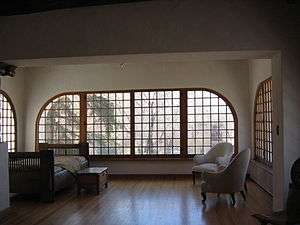 Nicholai Fechin House |
December 31, 1979 (#79001558) |
227 Paseo del Pueblo Norte 36°24′37″N 105°34′09″W |
Taos | SRCP; Now the Taos Art Museum |
| 11 | Leon Gaspard House | 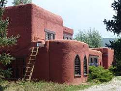 Leon Gaspard House |
February 23, 1979 (#79001559) |
Raton Rd / Kit Carson Rd. 36°23′45″N 105°33′54″W |
Taos | SRCP |
| 12 | Harwood Foundation | 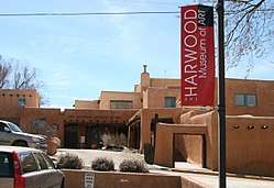 Harwood Foundation |
December 22, 1976 (#76001200) |
LeDoux St. 36°24′20″N 105°34′36″W |
Taos | SRCP; now the Harwood Museum of Art |
| 13 | E. Martin Hennings House and Studio Historic District | 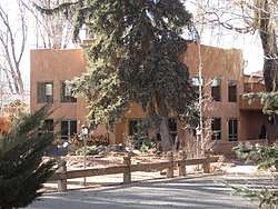 E. Martin Hennings House and Studio Historic District |
July 5, 1990 (#90001028) |
Southeastern corner of the junction of Dolan St. and Kit Carson Rd. 36°24′01″N 105°34′03″W |
Taos | SRCP |
| 14 | Howiri-ouinge | April 7, 1983 (#83001633) |
Intersection of U.S. Route 285 and State Road 96 36°18′11″N 106°02′48″W |
Ojo Caliente | SRCP | |
| 15 | La Loma Plaza Historic District |  La Loma Plaza Historic District |
July 8, 1982 (#82003339) |
State Road 240 36°24′23″N 105°34′50″W |
Taos | SRCP; Aerial photo-map |
| 16 | La Morada de Nuestra Senora de Guadalupe | 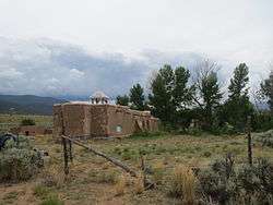 La Morada de Nuestra Senora de Guadalupe |
June 29, 1976 (#76001201) |
Penitente Road 36°24′23″N 105°33′47″W |
Taos | SRCP |
| 17 | Las Trampas Historic District | 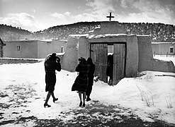 Las Trampas Historic District |
May 28, 1967 (#67000007) |
On State Road 76 36°07′57″N 105°45′48″W |
Las Trampas | |
| 18 | D.H. Lawrence Ranch Historic District |  D.H. Lawrence Ranch Historic District |
January 15, 2004 (#03001410) |
Lawrence Rd., approximately 2.75 miles east of State Road 522 on U.S. Forest Service Rd. 7 36°34′55″N 105°35′37″W |
San Cristobal | SRCP |
| 19 | Mabel Dodge Luhan House | 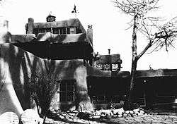 Mabel Dodge Luhan House |
November 15, 1978 (#78001832) |
Luhan Lane 36°24′29″N 105°33′52″W |
Taos | SRCP |
| 20 | Orin Mallette Cabin | 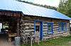 Orin Mallette Cabin |
February 23, 1984 (#84003055) |
West of Red River 36°42′28″N 105°25′34″W |
Red River | SRCP |
| 21 | Sylvester M. Mallette Cabin | Sylvester M. Mallette Cabin |
February 23, 1984 (#84003056) |
River St. and Copper King 36°42′20″N 105°24′13″W |
Red River | SRCP |
| 22 | Severino Martinez House | 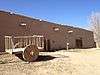 Severino Martinez House |
April 23, 1973 (#73001153) |
2 miles from Taos Plaza, on the Lower Ranchitos Rd. 36°24′04″N 105°36′29″W |
Taos | SRCP; Hacienda de los Martinez -- Bird's-eye view |
| 23 | Melson-Oldham Cabin | 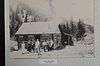 Melson-Oldham Cabin |
February 23, 1984 (#84003057) |
Southeast of Red River 36°41′18″N 105°23′13″W |
Red River | SRCP |
| 24 | Molino de los Duranes | February 3, 2020 (#100004918) |
83 Camino Abajo de la Loma 36°20′58″N 105°36′10″W |
Rancho de Taos vicinity | ||
| 25 | Ojo Caliente Hot Springs Round Barn | 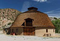 Ojo Caliente Hot Springs Round Barn |
October 6, 2003 (#03000996) |
500 yards north of the western terminus of State Road 414 36°18′37″N 106°02′48″W |
Ojo Caliente | SRCP |
| 26 | Ojo Caliente Mineral Springs | 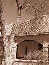 Ojo Caliente Mineral Springs |
November 17, 1985 (#85003496) |
State Road 414 36°18′17″N 106°03′06″W |
Ojo Caliente | SRCP |
| 27 | Picuris Pueblo |  Picuris Pueblo |
August 13, 1974 (#74001211) |
South of Taos 36°12′05″N 105°42′32″W |
Taos | SRCP |
| 28 | Pierce-Fuller House | 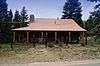 Pierce-Fuller House |
February 23, 1984 (#84003058) |
High St. 36°42′42″N 105°24′37″W |
Red River | SRCP |
| 29 | Posi-ouinge | 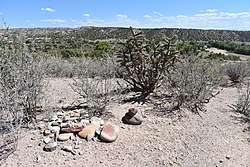 Posi-ouinge |
August 5, 1993 (#93000675) |
Access to the trail is behind the Ojo Caliente Mineral Springs Resort at 50 Los Banos Drive in Ojo Caliente 36°18′19″N 106°03′06″W |
Ojo Caliente | Extends into Rio Arriba County. BLM public access info. |
| 30 | Ranchos de Taos Plaza | 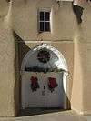 Ranchos de Taos Plaza |
October 2, 1978 (#78001830) |
Off U.S. Route 64 36°21′30″N 105°36′28″W |
Ranchos de Taos | SRCP |
| 31 | Red River Schoolhouse | 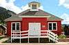 Red River Schoolhouse |
February 23, 1984 (#84003059) |
High St. 36°42′23″N 105°24′00″W |
Red River | SRCP |
| 32 | Rio Grande Gorge Bridge | 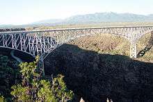 Rio Grande Gorge Bridge |
July 15, 1997 (#97000733) |
State Road 111 over the Rio Grande Gorge 36°28′34″N 105°43′56″W |
Taos | SRCP |
| 33 | San Francisco de Assisi Mission Church | .jpg) San Francisco de Assisi Mission Church |
April 15, 1970 (#70000416) |
The Plaza 36°21′31″N 105°36′28″W |
Ranchos de Taos | |
| 34 | San José de Gracia Church |  San José de Gracia Church |
April 15, 1970 (#70000415) |
Northern side of the Plaza 36°07′53″N 105°45′28″W |
Las Trampas | |
| 35 | San Ysidro Oratorio | January 5, 1984 (#84003060) |
State Road 240 36°23′12″N 105°37′41″W |
Los Cordovas | SRCP | |
| 36 | Taos Downtown Historic District |  Taos Downtown Historic District |
July 8, 1982 (#82003340) |
State Roads 3 and 240 36°24′24″N 105°34′23″W |
Taos | SRCP |
| 37 | Taos Inn | 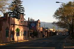 Taos Inn |
February 5, 1982 (#82003341) |
Pueblo del Norte 36°24′28″N 105°34′20″W |
Taos | SRCP |
| 38 | Taos Pueblo | 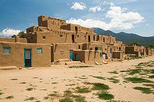 Taos Pueblo |
October 15, 1966 (#66000496) |
3 miles north of Taos 36°28′19″N 105°33′35″W |
Taos | SRCP |
| 39 | Tres Piedras Administrative Site |  Tres Piedras Administrative Site |
August 5, 1993 (#92000341) |
West of U.S. Route 285, north of Tres Piedras 36°39′13″N 105°58′10″W |
Tres Piedras | |
| 40 | Tres Piedras Railroad Water Tower | 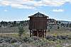 Tres Piedras Railroad Water Tower |
February 2, 1979 (#79001560) |
Off U.S. Route 285 36°38′51″N 105°57′55″W |
Tres Piedras | SRCP |
| 41 | Turley Mill and Distillery Site | November 16, 1978 (#78001833) |
11 miles (17.6 km) north of Taos 36°32′23″N 105°37′19″W |
Taos | SRCP | |
| 42 | Brigham J. Young House | 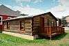 Brigham J. Young House |
February 23, 1984 (#84003063) |
Main St. 36°42′23″N 105°24′00″W |
Red River | SRCP |
See also
| Wikimedia Commons has media related to National Register of Historic Places in Taos County, New Mexico. |
References
- The latitude and longitude information provided in this table was derived originally from the National Register Information System, which has been found to be fairly accurate for about 99% of listings. Some locations in this table may have been corrected to current GPS standards.
- "National Register of Historic Places: Weekly List Actions". National Park Service, United States Department of the Interior. Retrieved on August 14, 2020.
- Numbers represent an ordering by significant words. Various colorings, defined here, differentiate National Historic Landmarks and historic districts from other NRHP buildings, structures, sites or objects.
- "National Register Information System". National Register of Historic Places. National Park Service. July 9, 2010.
- The eight-digit number below each date is the number assigned to each location in the National Register Information System database, which can be viewed by clicking the number.
| Topics | |
|---|---|
| Lists by state |
|
| Lists by insular areas | |
| Lists by associated state | |
| Other areas | |
| Related | |
| |
Municipalities and communities of Taos County, New Mexico, United States | ||
|---|---|---|
| Towns | Map of New Mexico highlighting Taos County | |
| Villages | ||
| CDPs | ||
| Other unincorporated communities | ||
| Ghost towns | ||
| Indian reservation | ||
This article is issued from Wikipedia. The text is licensed under Creative Commons - Attribution - Sharealike. Additional terms may apply for the media files.