National Register of Historic Places listings in Strafford County, New Hampshire
This is a list of the National Register of Historic Places listings in Strafford County, New Hampshire.

Location of Strafford County in New Hampshire
This is intended to be a complete list of the properties and districts on the National Register of Historic Places in Strafford County, New Hampshire, United States. Latitude and longitude coordinates are provided for many National Register properties and districts; these locations may be seen together in a map.[1]
There are 45 properties and districts listed on the National Register in the county, including one National Historic Landmark.
| Belknap - Carroll - Cheshire - Coos - Grafton - Hillsborough - Merrimack - Rockingham - Strafford - Sullivan |
- This National Park Service list is complete through NPS recent listings posted August 14, 2020.[2]
Current listings
| [3] | Name on the Register[4] | Image | Date listed[5] | Location | City or town | Description |
|---|---|---|---|---|---|---|
| 1 | Back River Farm | 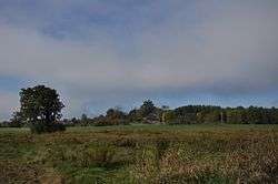 Back River Farm |
June 22, 1984 (#84003236) |
Bay View Rd. 43°08′21″N 70°51′16″W |
Dover | |
| 2 | Canaan Chapel |  Canaan Chapel |
March 11, 1982 (#82001877) |
Canaan Rd. 43°12′16″N 71°06′07″W |
Barrington | |
| 3 | Cocheco Mills | 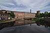 Cocheco Mills |
March 26, 2014 (#14000081) |
Main & Washington Sts. 43°11′44″N 70°52′23″W |
Dover | |
| 4 | County Farm Bridge | 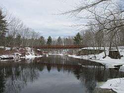 County Farm Bridge |
May 21, 1975 (#75000237) |
Northwest of Dover on County Farm Rd. 43°13′14″N 70°56′38″W |
Dover | Over Cocheco River |
| 5 | Durham Historic District | 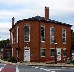 Durham Historic District |
May 31, 1980 (#80000308) |
Main St. and Newmarket Rd. 43°07′47″N 70°55′10″W |
Durham | |
| 6 | Farmington Town Pound | 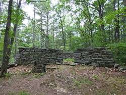 Farmington Town Pound |
September 2, 1993 (#93000884) |
Northwestern side of Pound Rd. 300 ft (91 m) north of the junction of Ten Rod Rd. 43°21′33″N 71°04′49″W |
Farmington | The pound was built in 1823 by the town, replacing an earlier wooden structure built in 1802, and is one of a few well-preserved pounds in southeastern New Hampshire. It remained in use until late in the 19th century, and was sold into private hands in 1918. It was given back to the town, and is now maintained by the Farmington Historical Society. |
| 7 | First Congregational Church | 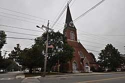 First Congregational Church |
January 12, 2018 (#100001963) |
400 Main St. 43°23′20″N 71°03′53″W |
Farmington | |
| 8 | First Parish Church |  First Parish Church |
March 11, 1982 (#82001696) |
218 Central Ave. 43°11′28″N 70°52′26″W |
Dover | |
| 9 | First Parish Church Site-Dover Point | 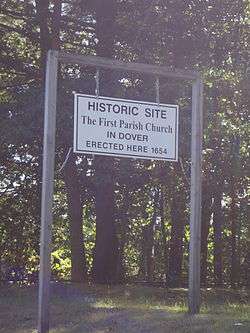 First Parish Church Site-Dover Point |
May 27, 1983 (#83001153) |
Dover Point Rd. 43°08′26″N 70°50′21″W |
Dover | |
| 10 | Forest Glade Cemetery |  Forest Glade Cemetery |
January 17, 2017 (#100000476) |
163 Maple St. 43°15′06″N 70°52′54″W |
Somersworth | |
| 11 | Free Will Baptist Church |  Free Will Baptist Church |
November 13, 1980 (#80000310) |
Ridge Top Road 43°23′59″N 71°09′33″W |
New Durham | |
| 12 | Garrison Hill Park and Tower | 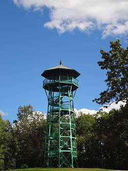 Garrison Hill Park and Tower |
September 11, 1987 (#87001413) |
Abbie Sawyer Memorial Dr. 43°12′34″N 70°52′13″W |
Dover | |
| 13 | Green Street School | 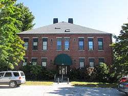 Green Street School |
March 7, 1985 (#85000481) |
104 Green St. 43°15′21″N 70°51′46″W |
Somersworth | |
| 14 | William Hale House | 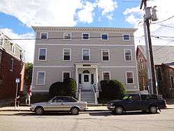 William Hale House |
November 18, 1980 (#80000309) |
5 Hale St. 43°11′36″N 70°52′29″W |
Dover | |
| 15 | Richard Hayes House | 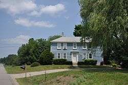 Richard Hayes House |
February 27, 1986 (#86000283) |
184 Gonic Rd. 43°15′38″N 70°58′44″W |
Rochester | |
| 16 | Jenness Farm | 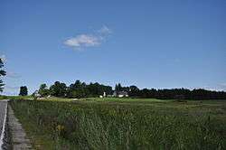 Jenness Farm |
March 2, 2001 (#01000206) |
626 Pickering Rd. 43°14′36″N 70°56′12″W |
Rochester and Dover | |
| 17 | Lehoullier Building | 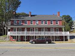 Lehoullier Building |
December 26, 1979 (#79000211) |
161-169 Main St. 43°15′31″N 70°51′46″W |
Somersworth | |
| 18 | Milton Town House |  Milton Town House |
November 26, 1980 (#80000311) |
NH 125 and Town House Rd. 43°26′25″N 70°59′06″W |
Milton | |
| 19 | New Durham Meetinghouse and Pound | 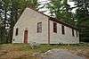 New Durham Meetinghouse and Pound |
December 8, 1980 (#80000312) |
Old Bay Rd. 43°25′25″N 71°07′42″W |
New Durham | |
| 20 | New Durham Town Hall | 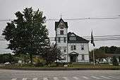 New Durham Town Hall |
November 13, 1980 (#80000313) |
Main St. and Ridge Rd. 43°26′02″N 71°09′55″W |
New Durham | |
| 21 | Plumer-Jones Farm | 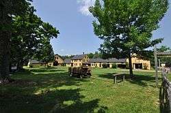 Plumer-Jones Farm |
March 23, 1979 (#79000212) |
1305 White Mountain Highway (NH 125) 43°27′44″N 70°59′37″W |
Milton | Now the New Hampshire Farm Museum |
| 22 | Plummer Homestead | 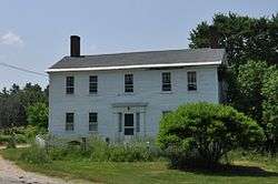 Plummer Homestead |
June 14, 2002 (#02000638) |
1273 White Mountain Highway (NH 125) 43°27′35″N 70°59′33″W |
Milton | |
| 23 | Public Market | 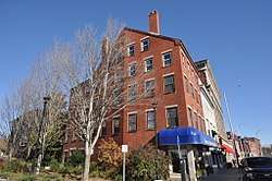 Public Market |
March 7, 1985 (#85000541) |
93 Washington St. 43°11′43″N 70°52′31″W |
Dover | |
| 24 | Queensbury Mill | 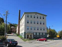 Queensbury Mill |
April 10, 1987 (#86003362) |
1 Market St. 43°15′54″N 70°51′58″W |
Somersworth | |
| 25 | Michael Reade House | 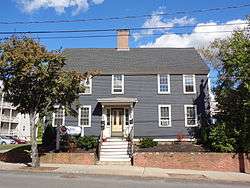 Michael Reade House |
February 12, 1980 (#80000314) |
43 Main St. 43°11′50″N 70°52′21″W |
Dover | |
| 26 | Religious Society of Friends Meetinghouse | 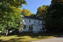 Religious Society of Friends Meetinghouse |
February 29, 1980 (#80000421) |
141 Central Ave. 43°11′12″N 70°52′25″W |
Dover | |
| 27 | Rochester Commercial and Industrial District |  Rochester Commercial and Industrial District |
April 8, 1983 (#83001154) |
N. Main, Wakefield, Hanson, and S. Main Sts. and Central Square 43°18′11″N 70°58′34″W |
Rochester | |
| 28 | Rollinsford Grade School | 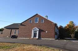 Rollinsford Grade School |
September 29, 2015 (#15000670) |
487 Locust St. 43°13′55″N 70°49′24″W |
Rollinsford | |
| 29 | Rollinsford Town Hall |  Rollinsford Town Hall |
March 5, 1999 (#99000268) |
667 Main St. 43°14′08″N 70°49′17″W |
Rollinsford | |
| 30 | St. Thomas Episcopal Church | 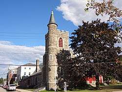 St. Thomas Episcopal Church |
June 7, 1984 (#84003241) |
5 Hale St. 43°11′36″N 70°52′30″W |
Dover | |
| 31 | Salmon Falls Mill Historic District | 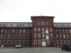 Salmon Falls Mill Historic District |
February 29, 1980 (#80000315) |
Front St. 43°14′10″N 70°49′05″W |
Rollinsford | |
| 32 | Sawyer Building | 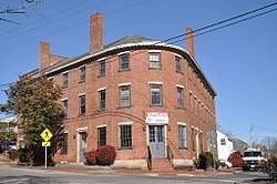 Sawyer Building |
May 23, 1980 (#80000316) |
4-6 Portland St. 43°11′47″N 70°52′19″W |
Dover | |
| 33 | Sawyer Woolen Mills | 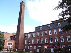 Sawyer Woolen Mills |
September 13, 1989 (#89001208) |
1 Mill St. 43°10′44″N 70°52′35″W |
Dover | |
| 34 | Smith Chapel | 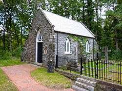 Smith Chapel |
February 13, 2013 (#13000009) |
45 Mill Pond Rd. 43°07′42″N 70°55′27″W |
Durham | |
| 35 | Somersworth High School |  Somersworth High School |
September 29, 2015 (#15000671) |
17 Grand St. 43°15′44″N 70°52′05″W |
Somersworth | Most recently was Hilltop Elementary School, which closed in 2012; misspelled "Somoresworth" on the National Register. |
| 36 | Strafford County Farm | 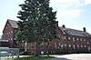 Strafford County Farm |
February 25, 1981 (#81000100) |
County Farm Rd. 43°13′03″N 70°56′31″W |
Dover | |
| 37 | Strafford Union Academy | 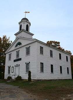 Strafford Union Academy |
September 22, 1983 (#83001155) |
NH 126 and NH 202A 43°16′07″N 71°07′23″W |
Strafford | |
| 38 | Gen. John Sullivan House |  Gen. John Sullivan House |
November 28, 1972 (#72000089) |
23 Newmarket Rd. 43°07′48″N 70°55′05″W |
Durham | Home of American Revolutionary War General John Sullivan, elected President of New Hampshire |
| 39 | Thompson Hall |  Thompson Hall |
December 6, 1996 (#96001468) |
Off Main St., University of New Hampshire campus 43°08′09″N 70°55′59″W |
Durham | |
| 40 | US Post Office-Dover Main | 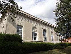 US Post Office-Dover Main |
July 17, 1986 (#86002273) |
133-137 Washington St. 43°11′42″N 70°52′39″W |
Dover | |
| 41 | US Post Office-Somersworth Main | 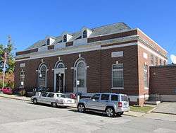 US Post Office-Somersworth Main |
July 17, 1986 (#86002246) |
2 Government Way[6] 43°15′33″N 70°52′18″W |
Somersworth | |
| 42 | Wiswall Falls Mills Site |  Wiswall Falls Mills Site |
March 18, 1988 (#88000184) |
John Hatch Park South of Wiswall Road just east of the Lamprey River[7] 43°06′15″N 70°57′44″W |
Durham | |
| 43 | Woodbury Mill | 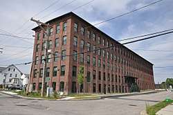 Woodbury Mill |
March 25, 2013 (#13000156) |
1 Dover St. 43°12′07″N 70°52′29″W |
Dover | |
| 44 | Woodman Institute | 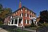 Woodman Institute |
July 24, 1980 (#80000317) |
182 Central Ave. 43°11′20″N 70°52′28″W |
Dover | |
| 45 | Samuel Wyatt House | 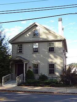 Samuel Wyatt House |
December 2, 1982 (#82000626) |
7 Church St. 43°11′30″N 70°52′31″W |
Dover |
See also
| Wikimedia Commons has media related to National Register of Historic Places in Strafford County, New Hampshire. |
References
- The latitude and longitude information provided in this table was derived originally from the National Register Information System, which has been found to be fairly accurate for about 99% of listings. Some locations in this table may have been corrected to current GPS standards.
- "National Register of Historic Places: Weekly List Actions". National Park Service, United States Department of the Interior. Retrieved on August 14, 2020.
- Numbers represent an ordering by significant words. Various colorings, defined here, differentiate National Historic Landmarks and historic districts from other NRHP buildings, structures, sites or objects.
- "National Register Information System". National Register of Historic Places. National Park Service. April 24, 2008.
- The eight-digit number below each date is the number assigned to each location in the National Register Information System database, which can be viewed by clicking the number.
- Address based on USPS website. Accessed March 27, 2016
- Draft NRHP update form for Wiswall Falls Mills Site
| Topics |  | |
|---|---|---|
| Lists by county | ||
| Other lists | ||
| ||
Municipalities and communities of Strafford County, New Hampshire, United States | ||
|---|---|---|
| Cities | Map of New Hampshire highlighting Strafford County | |
| Towns | ||
| CDPs | ||
| Other villages | ||
This article is issued from Wikipedia. The text is licensed under Creative Commons - Attribution - Sharealike. Additional terms may apply for the media files.