National Register of Historic Places listings in St. Tammany Parish, Louisiana
This is a list of the National Register of Historic Places listings in St. Tammany Parish, Louisiana.
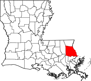
Location of St. Tammany Parish in Louisiana
This is intended to be a complete list of the properties and districts on the National Register of Historic Places in St. Tammany Parish, Louisiana, United States. The locations of National Register properties and districts for which the latitude and longitude coordinates are included below, may be seen in a map.[1]
There are 42 properties and districts listed on the National Register in the parish. Another property was once listed, but has since been removed.
- This National Park Service list is complete through NPS recent listings posted August 14, 2020.[2]
Current listings
| [3] | Name on the Register[4] | Image | Date listed[5] | Location | City or town | Description |
|---|---|---|---|---|---|---|
| 1 | Abita Springs Historic District | 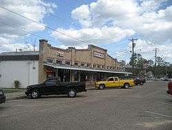 Abita Springs Historic District |
March 12, 1982 (#82004622) |
Louisiana Highways 36, 59, and 435 30°28′35″N 90°02′13″W |
Abita Springs | |
| 2 | Abita Springs Pavilion |  Abita Springs Pavilion |
August 19, 1975 (#75002062) |
Northwestern end of Main St. 30°28′48″N 90°02′25″W |
Abita Springs | Originally built for 1884 World's Fair in New Orleans before being moved to Abita Springs |
| 3 | Arcade Theater | 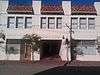 Arcade Theater |
August 29, 1997 (#97000966) |
2247-2251 Carey St. 30°16′23″N 89°47′02″W |
Slidell | |
| 4 | Bertus-Ducatel House | 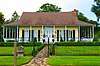 Bertus-Ducatel House |
March 5, 1998 (#98000182) |
1721 Lakeshore Dr. 30°21′03″N 90°03′52″W |
Mandeville | |
| 5 | Bogue Falaya Park | 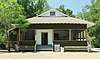 Bogue Falaya Park |
August 17, 2017 (#100001483) |
213 Park Dr. 30°28′15″N 90°05′40″W |
Covington | |
| 6 | Camp Salmen House | 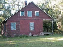 Camp Salmen House |
April 24, 2006 (#06000323) |
35122 Camp Salmen Rd. 30°17′26″N 89°49′30″W |
Slidell | |
| 7 | Christ Episcopal Church | 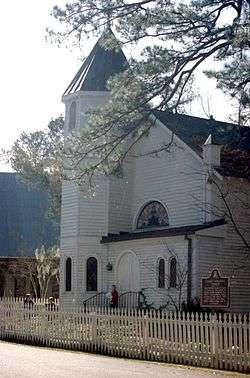 Christ Episcopal Church |
April 17, 1980 (#80004253) |
120 N. New Hampshire St. 30°28′20″N 90°05′06″W |
Covington | |
| 8 | Claiborne Cottage Hotel | July 8, 2019 (#100004152) |
19130 Rogers Ln. 30°28′25″N 90°05′13″W |
Covington | ||
| 9 | Francois Cousin House | 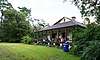 Francois Cousin House |
September 16, 2002 (#02000982) |
28061 Main St. 30°18′38″N 89°56′06″W |
Lacombe | |
| 10 | Dendinger House | 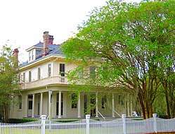 Dendinger House |
September 22, 1992 (#92001252) |
206 Covington St. 30°24′36″N 90°09′38″W |
Madisonville | |
| 11 | Dew Drop Social and Benevolent Hall | 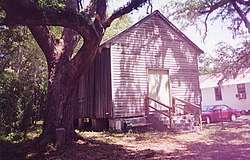 Dew Drop Social and Benevolent Hall |
September 22, 2000 (#00001145) |
400 block of Lamarque St. 30°21′20″N 90°03′44″W |
Mandeville | |
| 12 | Division of St. John Historic District | 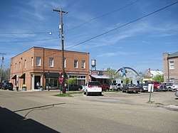 Division of St. John Historic District |
December 6, 1982 (#82000461) |
U.S. Route 190 and Louisiana Highway 21 30°28′33″N 90°05′38″W |
Covington | |
| 13 | Flagstaff | 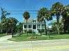 Flagstaff |
September 15, 1983 (#83000543) |
1815 Lakeshore Dr. 30°21′06″N 90°03′55″W |
Mandeville | |
| 14 | Fontainebleau State Park |  Fontainebleau State Park |
August 10, 1999 (#99000256) |
67825 U.S. Route 190 30°20′11″N 90°01′53″W |
Mandeville | |
| 15 | Frederick House | .jpg) Frederick House |
August 11, 1982 (#82004624) |
238 Vermont St. 30°28′14″N 90°05′48″W |
Covington | |
| 16 | Griffin's Bakery | 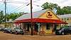 Griffin's Bakery |
December 1, 1997 (#97001423) |
301 Lafitte St. 30°21′21″N 90°04′03″W |
Mandeville | |
| 17 | Haaswood Store | 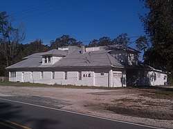 Haaswood Store |
July 15, 2009 (#09000518) |
62011 Louisiana Highway 1091 30°20′06″N 89°44′52″W |
Pearl River | |
| 18 | Jay House | 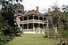 Jay House |
May 29, 1998 (#98000593) |
Facing the Tchefuncte River, within Fairview-Riverside State Park 30°24′28″N 90°08′34″W |
Madisonville | Also known as the "Otis House." |
| 19 | Johnson House | 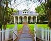 Johnson House |
December 27, 2002 (#02001602) |
402 Lafitte St. 30°21′28″N 90°04′03″W |
Mandeville | also known as "Moore House", "Maison Lafitte". Mansion, later an event venue. |
| 20 | Lacombe School | November 8, 1990 (#90001742) |
Junction of St. Mary and 14th Sts. 30°18′56″N 89°56′37″W |
Lacombe | ||
| 21 | Longbranch Annex | July 21, 1983 (#83000544) |
Louisiana Highway 36 and Gordon St. 30°28′54″N 90°02′32″W |
Abita Springs | ||
| 22 | Madisonville Bank | December 28, 1983 (#83003636) |
400 Cedar St. 30°24′27″N 90°09′33″W |
Madisonville | ||
| 23 | Madisonville Boarding House | 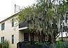 Madisonville Boarding House |
August 16, 1996 (#96000898) |
703 Main St. 30°24′16″N 90°09′25″W |
Madisonville | |
| 24 | Madisonville Town Hall | 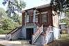 Madisonville Town Hall |
November 8, 1990 (#90001741) |
203 Cedar 30°24′34″N 90°09′32″W |
Madisonville | |
| 25 | McCaleb House |  McCaleb House |
June 7, 1990 (#90000874) |
906 Main St. 30°24′10″N 90°09′25″W |
Madisonville | |
| 26 | Moore House | _DSC06691.jpg) Moore House |
April 20, 1983 (#83000545) |
1717 Lakeshore Dr. 30°21′03″N 90°03′52″W |
Mandeville | |
| 27 | Morel-Nott House | June 6, 1980 (#80004254) |
Lakefront Dr. 30°21′31″N 90°04′45″W |
Mandeville | ||
| 28 | New Orleans and Northeastern Railroad-New Orleans and Great Northern Railroad Depot |  New Orleans and Northeastern Railroad-New Orleans and Great Northern Railroad Depot |
October 24, 1996 (#96001188) |
1809 Front St. 30°16′42″N 89°46′57″W |
Slidell | Train station built in 1913 and renovated in 1990s; continues in daily use for Amtrak's Crescent route. |
| 29 | Pottery Hill | October 13, 2011 (#11000736) |
Address Restricted |
Mandeville | ||
| 30 | Rankin House | March 19, 1991 (#91000253) |
61467 Jacques Lemieux Boulevard 30°20′05″N 90°00′13″W |
Mandeville | ||
| 31 | Saint Joseph Abbey Church | 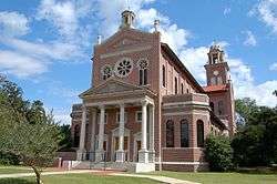 Saint Joseph Abbey Church |
March 21, 2007 (#07000165) |
75376 River Rd. 30°31′35″N 90°06′41″W |
Saint Benedict | |
| 32 | Saint Joseph Abbey Refectory | March 21, 2007 (#07000166) |
75376 River Rd. 30°31′39″N 90°06′47″W |
Saint Benedict | ||
| 33 | St. Scholastica Priory and Cemetery | January 31, 2019 (#100003378) |
20264 Terra Mariae Blvd. 30°31′44″N 90°04′01″W |
Covington | ||
| 34 | Salmen House | 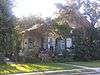 Salmen House |
October 10, 1996 (#96001082) |
2854 Front St. 30°16′01″N 89°47′18″W |
Slidell | |
| 35 | Albert Salmen House | 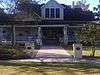 Albert Salmen House |
January 21, 1993 (#92001822) |
213 Cleveland Ave. 30°16′08″N 89°47′09″W |
Slidell | |
| 36 | Fritz Salmen House | 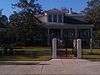 Fritz Salmen House |
November 21, 1991 (#91001722) |
127 Cleveland Ave. 30°16′10″N 89°47′12″W |
Slidell | |
| 37 | Sardy House | 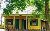 Sardy House |
December 8, 1997 (#97001517) |
810 Main St. 30°24′12″N 90°09′25″W |
Madisonville | |
| 38 | Sunnybrook | August 29, 1979 (#79003123) |
North of Covington on Louisiana Highway 21 30°31′05″N 90°02′51″W |
Covington | ||
| 39 | Tchefuncte River Range Rear Light |  Tchefuncte River Range Rear Light |
July 14, 1986 (#86001684) |
Northern side of Lake Pontchartrain 30°22′44″N 90°10′11″W |
Madisonville | 1868-vintage lighthouse, accessible only via water. Marked the entrance to the river from the Lake, replacing an 1838 light. |
| 40 | Tchefuncte Site | June 22, 2000 (#00000717) |
Address Restricted |
Mandeville | Archaeological site, excavated several times in the 20th century. The Tchefuncte culture ended about 200 CE. | |
| 41 | Williams Cemetery | October 17, 2018 (#100003028) |
28183 Main St. 30°18′34″N 89°55′58″W |
Lacombe |
Former listings
| [3] | Name on the Register | Image | Date listed | Date removed | Location | City or town | Summary |
|---|---|---|---|---|---|---|---|
| 1 | Longbranch Hotel Complex | June 24, 1982 (#82004623) | May 3, 2016 | Rangeline Rd. 30°29′06″N 90°02′28″W |
Abita Springs |
See also
| Wikimedia Commons has media related to National Register of Historic Places in Saint Tammany Parish, Louisiana. |
References
- The latitude and longitude information provided in this table was derived originally from the National Register Information System, which has been found to be fairly accurate for about 99% of listings. Some locations in this table may have been corrected to current GPS standards.
- "National Register of Historic Places: Weekly List Actions". National Park Service, United States Department of the Interior. Retrieved on August 14, 2020.
- Numbers represent an ordering by significant words. Various colorings, defined here, differentiate National Historic Landmarks and historic districts from other NRHP buildings, structures, sites or objects.
- "National Register Information System". National Register of Historic Places. National Park Service. March 13, 2009.
- The eight-digit number below each date is the number assigned to each location in the National Register Information System database, which can be viewed by clicking the number.
| Topics | |
|---|---|
| Lists by state |
|
| Lists by insular areas | |
| Lists by associated state | |
| Other areas | |
| Related | |
| |
Municipalities and communities of St. Tammany Parish, Louisiana, United States | ||
|---|---|---|
Parish seat: Covington | ||
| Cities | | |
| Towns | ||
| Villages | ||
| CDPs | ||
| Unincorporated communities | ||
This article is issued from Wikipedia. The text is licensed under Creative Commons - Attribution - Sharealike. Additional terms may apply for the media files.