National Register of Historic Places listings in Seattle
This is a list of the National Register of Historic Places listings in Seattle, Washington.
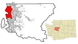
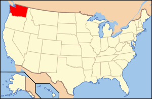
Location of Seattle in King County and Washington
This is intended to be a complete list of the properties and districts on the National Register of Historic Places in the city of Seattle, Washington, United States. Latitude and longitude coordinates are provided for many National Register properties and districts; these locations may be seen together in an online map.[1]
Of the 300 properties and districts listed on the National Register in King County, 210 are located in Seattle; these are listed below, while the remaining properties and districts are listed elsewhere. Four properties were once listed on the National Register in Seattle but have been removed.
- This National Park Service list is complete through NPS recent listings posted August 14, 2020.[2]
Current listings
| [3] | Name on the Register[4] | Image | Date listed[5] | Location | Description |
|---|---|---|---|---|---|
| 1 | 12th Avenue South Bridge | 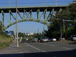 12th Avenue South Bridge |
July 16, 1982 (#82004227) |
12th Ave., S. over Dearborn St. 47°35′46″N 122°18′58″W |
Built in 1911, it is the state's oldest surviving steel arch bridge. Renamed the Jose Rizal Bridge in 1974, the bridge spans Dearborn Street, connecting Beacon Hill and the International District.[6][7] Also part of the Historic Bridges and Tunnels in Washington Thematic Resource listing[8] |
| 2 | 1411 Fourth Avenue Building | 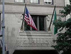 1411 Fourth Avenue Building |
May 28, 1991 (#91000633) |
1411 Fourth Ave. 47°36′34″N 122°20′06″W |
|
| 3 | 14th Avenue South Bridge | 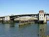 14th Avenue South Bridge |
July 16, 1982 (#82004228) |
Spans Duwamish River 47°34′13″N 122°21′02″W |
Also known as the South Park Bridge, this Scherzer Rolling Lift double-leaf bascule bridge was the only bridge of its type in the state. It opened in 1931 and spanned the Duwamish River, connecting the South Park neighborhood with the rest of Seattle. It was demolished in 2010 due to safety concerns.[9] Also part of the Historic Bridges and Tunnels in Washington Thematic Resource listing[8] |
| 4 | 1600 East John Street Apartments |  1600 East John Street Apartments |
May 14, 2013 (#13000278) |
1600 E. John St. 47°37′12″N 122°18′40″W |
|
| 5 | 1926 Model Brick Home |  1926 Model Brick Home |
December 6, 2016 (#16000829) |
2600 E. Montlake Pl. 47°38′36″N 122°18′11″W |
|
| 6 | Admiral Theater | 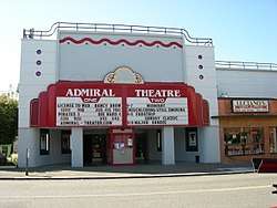 Admiral Theater |
December 11, 1989 (#89002098) |
2343 California Avenue SW 47°34′58″N 122°23′11″W |
|
| 7 | Admiral's House, 13th Naval District |  Admiral's House, 13th Naval District |
February 13, 2013 (#13000016) |
2001 W. Garfield St. 47°37′56″N 122°23′19″W |
|
| 8 | Agen Warehouse |  Agen Warehouse |
January 23, 1998 (#97001673) |
1201 Western Ave. 47°36′21″N 122°20′15″W |
|
| 9 | Alaska Trade Building |  Alaska Trade Building |
May 6, 1971 (#71000871) |
1915-1919 1st Ave. 47°36′39″N 122°20′28″W |
|
| 10 | John B. Allen School |  John B. Allen School |
May 11, 2011 (#11000280) |
6532 Phinney Ave. N. 47°40′38″N 122°21′14″W |
|
| 11 | Arboretum Sewer Trestle |  Arboretum Sewer Trestle |
July 16, 1982 (#82004229) |
Crosses 26th Ave., E. between Roanoke and E. Miller St. 47°38′33″N 122°17′52″W |
Built in 1910, this sewer viaduct is an early example of a reinforced concrete arch bridge. Ornamental in design, today it serves as a pedestrian bridge over Lake Washington Boulevard in the Washington Park Arboretum.[10] Also part of the Historic Bridges and Tunnels in Washington Thematic Resource listing[8] |
| 12 | Arctic Building |  Arctic Building |
November 28, 1978 (#78002749) |
306 Cherry St. 47°36′14″N 122°19′50″W |
|
| 13 | Assay Office/German House |  Assay Office/German House |
March 16, 1972 (#72001271) |
613 9th Ave. 47°36′22″N 122°19′25″W |
|
| 14 | Aurora Avenue Bridge |  Aurora Avenue Bridge |
July 16, 1982 (#82004230) |
Aurora Ave., N. over Lake Washington Ship Canal 47°39′10″N 122°20′46″W |
Built in 1931, this cantilever truss bridge carries traffic on State Route 99 (Aurora Avenue) over the west end of Lake Union, connecting the neighborhoods of Queen Anne and Fremont.[11] Also part of the Historic Bridges and Tunnels in Washington Thematic Resource listing[8] |
| 15 | Ballard Avenue Historic District |  Ballard Avenue Historic District |
July 1, 1976 (#76001885) |
Ballard Ave. from NW Market to NW Dock Sts. 47°39′59″N 122°22′55″W |
|
| 16 | Ballard Bridge |  Ballard Bridge |
July 16, 1982 (#82004231) |
Spans Lake Washington Ship Canal 47°39′47″N 122°22′30″W |
Built in 1917, the Ballard Bridge is one of the oldest examples in the state of a double-leaf bascule bridge.[8] It spans Salmon Bay in the Lake Washington Ship Canal, connecting the neighborhood of Ballard with Queen Anne and Magnolia.[12] Also part of the Historic Bridges and Tunnels in Washington Thematic Resource listing[8] |
| 17 | Ballard Carnegie Library |  Ballard Carnegie Library |
June 15, 1979 (#79002535) |
2026 N. West Market St. 47°40′08″N 122°22′54″W |
part of the Carnegie Libraries of Washington TR (AD) |
| 18 | Ballard-Howe House |  Ballard-Howe House |
March 26, 1979 (#79002536) |
22 W. Highland Dr. 47°37′48″N 122°21′23″W |
|
| 19 | Richard A. Ballinger House |  Richard A. Ballinger House |
May 28, 1976 (#76001886) |
1733 39th Ave. 47°37′04″N 122°16′56″W |
|
| 20 | Julian and Marajane Barksdale House |  Julian and Marajane Barksdale House |
December 24, 2013 (#13000995) |
13226 42nd Ave. NE 47°43′26″N 122°16′50″W |
|
| 21 | Barnes Building |  Barnes Building |
February 24, 1975 (#75001853) |
2320-2322 1st Ave. 47°36′49″N 122°20′42″W |
|
| 22 | Bay View Brewery |  Bay View Brewery |
January 23, 2013 (#12001221) |
3100–3222 Airport Way S. 47°34′34″N 122°19′15″W |
|
| 23 | Beacon Hill School | Beacon Hill School |
August 14, 2019 (#100004297) |
2524 16th Ave. S 47°34′50″N 122°18′44″W |
|
| 24 | Bell Apartments |  Bell Apartments |
July 12, 1974 (#74001957) |
2326 1st Ave. 47°36′51″N 122°20′44″W |
|
| 25 | Jesse C. Bowles House |  Jesse C. Bowles House |
November 6, 1986 (#86003162) |
2540 Shoreland Dr. S 47°34′51″N 122°17′02″W |
|
| 26 | Building No. 105, Boeing Airplane Company |  Building No. 105, Boeing Airplane Company |
August 26, 1971 (#71000872) |
Purcell Ave. 47°31′06″N 122°17′42″W |
|
| 27 | Bon Marche Department Store | .jpg) Bon Marche Department Store |
December 6, 2016 (#16000830) |
300 Pine St. 47°36′40″N 122°20′18″W |
Now Macy's; the former flagship store of The Bon Marché. |
| 28 | Butterworth Building |  Butterworth Building |
May 14, 1971 (#71000873) |
1921 1st Ave. 47°36′39″N 122°20′28″W |
|
| 29 | Calhoun Hotel |  Calhoun Hotel |
April 23, 2013 (#13000208) |
2000 2nd Ave. 47°36′43″N 122°20′30″W |
|
| 30 | Cambridge Apartments | .jpg) Cambridge Apartments |
April 5, 2016 (#16000148) |
903 Union St. 47°36′42″N 122°19′48″W |
|
| 31 | Camlin Hotel |  Camlin Hotel |
March 25, 1999 (#99000405) |
1619 Ninth St. 47°36′39″N 122°19′55″W |
|
| 32 | Century 21-Washington State Coliseum |  Century 21-Washington State Coliseum |
May 10, 2018 (#100002406) |
305 Harrison St. 47°37′20″N 122°21′15″W |
Now KeyArena. |
| 33 | Chelsea Family Hotel |  Chelsea Family Hotel |
December 14, 1978 (#78002750) |
620 W. Olympic Pl. 47°37′41″N 122°21′53″W |
|
| 34 | James and Pat Chiarelli House |  James and Pat Chiarelli House |
May 14, 2013 (#13000279) |
843 NE 100th St. 47°42′04″N 122°19′07″W |
|
| 35 | Chinese Baptist Church |  Chinese Baptist Church |
July 31, 1986 (#86002094) |
925 S. King St. 47°35′54″N 122°19′07″W |
|
| 36 | Chittenden Locks and Lake Washington Ship Canal | 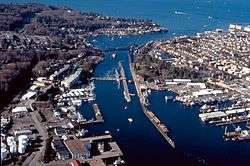 Chittenden Locks and Lake Washington Ship Canal |
December 14, 1978 (#78002751) |
Salmon Bay 47°39′19″N 122°21′07″W |
Chittenden Locks and Lake Washington Ship Canal |
| 37 | Church of the Blessed Sacrament, Priory, and School |  Church of the Blessed Sacrament, Priory, and School |
January 12, 1984 (#84003479) |
5040-5041 9th Ave., NE 47°40′00″N 122°19′03″W |
|
| 38 | Cobb Building |  Cobb Building |
August 3, 1984 (#84003485) |
1301-1309 4th Ave. 47°37′04″N 122°20′02″W |
|
| 39 | Coliseum Theater |  Coliseum Theater |
July 7, 1975 (#75001854) |
5th Ave. and Pike St. 47°36′41″N 122°20′02″W |
|
| 40 | Colman Automotive Building | 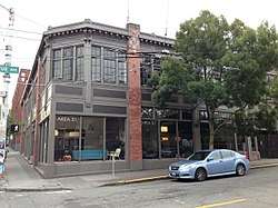 Colman Automotive Building |
February 13, 2013 (#13000017) |
401 E. Pine St. 47°36′54″N 122°19′36″W |
|
| 41 | Colman Building | 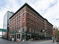 Colman Building |
March 16, 1972 (#72001272) |
811 1st Ave. 47°36′14″N 122°20′03″W |
|
| 42 | Colman Park & Dose Terrace Stairs | 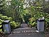 Colman Park & Dose Terrace Stairs |
February 10, 2020 (#100004959) |
Roughly bounded by South Massachusetts St., South Dose Terrace, 31st Ave. South, & the Lake Washington shoreline 47°35′01″N 122°17′18″W |
|
| 43 | Colonial Hotel | 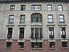 Colonial Hotel |
April 29, 1982 (#82004232) |
1119-1123 1st Ave. 47°36′22″N 122°20′11″W |
|
| 44 | Colonnade Hotel |  Colonnade Hotel |
August 7, 2017 (#100001443) |
107 Pine St. 47°36′35″N 122°20′26″W |
|
| 45 | Columbia City Historic District |  Columbia City Historic District |
September 8, 1980 (#80004000) |
Roughly bounded by S. Hudson and S. Alaska Sts., 35th and Rainier Aves. 47°33′33″N 122°17′08″W |
|
| 46 | Frank B. Cooper Elementary School |  Frank B. Cooper Elementary School |
March 26, 2003 (#03000161) |
4408 Delridge Way SW 47°33′49″N 122°21′41″W |
|
| 47 | Cornish School |  Cornish School |
August 29, 1977 (#77001337) |
710 E. Roy St. 47°37′32″N 122°19′19″W |
|
| 48 | Cowen Park Bridge |  Cowen Park Bridge |
July 16, 1982 (#82004233) |
15th Ave., N. 47°40′16″N 122°18′45″W |
In 1936, the Works Progress Administration constructed this open-spandrel reinforced concrete arch bridge. The bridge, notable for its Art Deco motifs, is part of 15th Ave NE, spanning the eastern edge of the ravine in Cowen Park.[13][14] Also part of the Historic Bridges and Tunnels in Washington Thematic Resource listing[8] |
| 49 | Daughters of the American Revolution-Rainier Chapter House |  Daughters of the American Revolution-Rainier Chapter House |
March 20, 2019 (#100003525) |
800 East Roy St. 47°37′30″N 122°19′20″W |
|
| 50 | De La Mar Apartments | 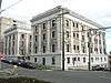 De La Mar Apartments |
August 18, 1980 (#80004001) |
115 W. Olympic Pl. 47°37′36″N 122°21′28″W |
|
| 51 | Henry H. Dearborn House | 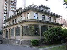 Henry H. Dearborn House |
January 23, 1998 (#97001672) |
1117 Minor Ave. 47°36′40″N 122°19′27″W |
|
| 52 | Charles P. and Ida Dose House | 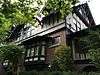 Charles P. and Ida Dose House |
December 24, 2013 (#13000996) |
2121 31st Ave., S 47°35′02″N 122°17′36″W |
|
| 53 | Dunn Gardens |  Dunn Gardens |
December 15, 1994 (#94001435) |
13533 Northshire Rd. NW. 47°43′39″N 122°21′50″W |
|
| 54 | Duwamish (fireboat) |  Duwamish (fireboat) |
June 30, 1989 (#89001448) |
Lake Washington Ship Canal, Chittenden Locks 47°39′57″N 122°23′39″W |
|
| 55 | Duwamish Number 1 Site | Duwamish Number 1 Site |
October 18, 1977 (#77001338) |
Address Restricted |
|
| 56 | Eagles Auditorium Building |  Eagles Auditorium Building |
July 14, 1983 (#83003338) |
1416 7th Ave. 47°36′40″N 122°19′51″W |
|
| 57 | El Rio Apartment Hotel |  El Rio Apartment Hotel |
November 30, 1999 (#99001453) |
1922-1928 9th Ave. 47°36′59″N 122°20′01″W |
|
| 58 | Ellsworth Storey Cottages Historic District |  Ellsworth Storey Cottages Historic District |
July 6, 1976 (#76001891) |
1706-1816 S. Lake Washington Blvd. and 1725-1729 S. 36th Ave. 47°35′15″N 122°17′17″W |
|
| 59 | Ellsworth Storey Residences |  Ellsworth Storey Residences |
April 14, 1972 (#72001276) |
260, 270 E. Dorffel Dr. 47°37′18″N 122°17′07″W |
|
| 60 | Jim and Betty Eng House |  Jim and Betty Eng House |
September 30, 2019 (#100004460) |
8310 Beacon Ave. S. 47°31′45″N 122°17′16″W |
|
| 61 | Federal Office Building |  Federal Office Building |
April 30, 1979 (#79003155) |
909 1st Ave. 47°36′16″N 122°20′06″W |
|
| 62 | Federal Reserve Bank of San Francisco, Seattle Branch |  Federal Reserve Bank of San Francisco, Seattle Branch |
February 4, 2013 (#11000985) |
1015 2nd Avenue 47°36′19″N 122°20′09″W |
|
| 63 | Pierre P. Ferry House |  Pierre P. Ferry House |
April 18, 1979 (#79002537) |
1531 10th Ave., E. 47°38′03″N 122°19′08″W |
|
| 64 | Fire Station No. 18 | 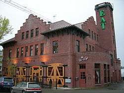 Fire Station No. 18 |
June 19, 1973 (#73001876) |
5427 Russell Ave., NW 47°40′07″N 122°22′54″W |
|
| 65 | Fire Station No. 23 |  Fire Station No. 23 |
September 10, 1971 (#71000874) |
18th Ave. and Columbia St. 47°36′32″N 122°18′26″W |
|
| 66 | Fire Station No. 25 |  Fire Station No. 25 |
April 14, 1972 (#72001273) |
1400 Harvard Ave. 47°36′49″N 122°19′15″W |
|
| 67 | First Methodist Episcopal Church | 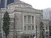 First Methodist Episcopal Church |
January 3, 2011 (#10001105) |
801 Fifth Ave. 47°36′20″N 122°19′53″W |
|
| 68 | First Methodist Protestant Church of Seattle |  First Methodist Protestant Church of Seattle |
May 14, 1993 (#93000364) |
128 16th Ave. E. 47°37′11″N 122°18′37″W |
|
| 69 | Ford Motor Company Assembly Plant |  Ford Motor Company Assembly Plant |
October 9, 2013 (#13000823) |
4735 E. Marginal Way 47°33′29″N 122°20′25″W |
|
| 70 | Fort Lawton |  Fort Lawton |
August 15, 1978 (#78002752) |
On Magnolia Bluff 47°39′33″N 122°24′49″W |
|
| 71 | Fourth Church of Christ, Scientist |  Fourth Church of Christ, Scientist |
January 2, 2013 (#12001138) |
1119 8th Ave. 47°36′33″N 122°19′48″W |
|
| 72 | Freeway Park |  Freeway Park |
December 19, 2019 (#100004789) |
700 Seneca St. 47°36′35″N 122°19′52″W |
|
| 73 | Fremont Bridge |  Fremont Bridge |
July 16, 1982 (#82004234) |
Spans Lake Washington Ship Canal 47°38′52″N 122°20′55″W |
part of the Historic Bridges and Tunnels in Washington TR |
| 74 | Fremont Building | 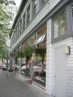 Fremont Building |
November 12, 1992 (#92001587) |
3419 Fremont Ave. N. 47°39′01″N 122°20′58″W |
|
| 75 | Frink Park |  Frink Park |
November 20, 2019 (#100004646) |
Roughly bounded by 31st Ave. S., Lake Washington Blvd. & 34th Ave., S. King St. & S. Main St. 47°35′57″N 122°17′27″W |
|
| 76 | Caroline Kline Galland House |  Caroline Kline Galland House |
February 8, 1980 (#80004002) |
1605 17th Ave. 47°36′57″N 122°18′34″W |
|
| 77 | Gas Works Park | 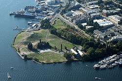 Gas Works Park |
January 2, 2013 (#02000862) |
2000 N. Northlake Way 47°38′46″N 122°20′06″W |
Added January 2013, more than a decade after it was nominated.[15] |
| 78 | Georgetown Steam Plant |  Georgetown Steam Plant |
1978 (#78002755) |
Off WA 99 at King County Airport 47°32′35″N 122°18′54″W |
|
| 79 | Globe Building, Beebe Building and Hotel Cecil | 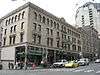 Globe Building, Beebe Building and Hotel Cecil |
April 29, 1982 (#82004235) |
1001-1023 1st Ave. 47°36′19″N 122°20′08″W |
|
| 80 | J. S. Graham Store | 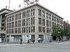 J. S. Graham Store |
December 7, 1989 (#89002094) |
119 Pine St. 47°36′36″N 122°20′19″W |
|
| 81 | Grand Pacific Hotel | 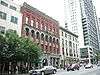 Grand Pacific Hotel |
May 13, 1982 (#82004236) |
1115-1117 1st Ave. 47°36′21″N 122°20′10″W |
Originally known as the Starr Block |
| 82 | Guiry and Schillestad Building | 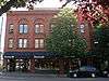 Guiry and Schillestad Building |
August 28, 1985 (#85001941) |
2101-2111 1st Ave. 47°36′44″N 122°20′35″W |
|
| 83 | Harvard-Belmont District |  Harvard-Belmont District |
May 13, 1982 (#82004237) |
Bellevue Pl., Broadway, Boylston and Harvard Aves. 47°37′43″N 122°19′19″W |
|
| 84 | Hawthorne Square |  Hawthorne Square |
August 14, 2012 (#08001301) |
4800 Fremont Ave. N. 47°39′50″N 122°20′57″W |
Seattle Apartment Buildings, 1900-1957 Multiple Property Submission (MPS) |
| 85 | Highland Apartments |  Highland Apartments |
December 7, 2018 (#100003254) |
931 11th Ave. E 47°37′40″N 122°19′05″W |
|
| 86 | Samuel Hill House |  Samuel Hill House |
May 3, 1976 (#76001887) |
814 E. Highland Dr. 47°37′51″N 122°19′14″W |
|
| 87 | Hoge Building |  Hoge Building |
April 14, 1983 (#83003339) |
705 2nd Ave. 47°36′12″N 122°19′56″W |
|
| 88 | Holyoke Building | 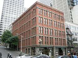 Holyoke Building |
June 3, 1976 (#76001888) |
1018-1022 1st Ave. 47°36′20″N 122°20′05″W |
|
| 89 | Home of the Good Shepherd | 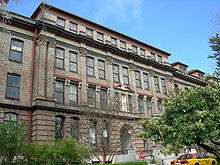 Home of the Good Shepherd |
May 23, 1978 (#78002753) |
Sunnyside, N. and 50th St. 47°39′51″N 122°19′51″W |
|
| 90 | Hull Building | 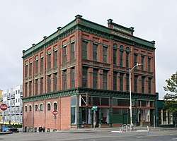 Hull Building |
January 27, 1983 (#83003340) |
2401-2405 1st Ave. 47°36′51″N 122°20′49″W |
|
| 91 | Samuel Hyde House |  Samuel Hyde House |
April 12, 1982 (#82004238) |
3726 E. Madison St. 47°37′55″N 122°17′01″W |
|
| 92 | Immanuel Lutheran Church | 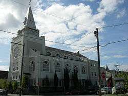 Immanuel Lutheran Church |
February 25, 1982 (#82004239) |
1215 Thomas St. 47°37′15″N 122°19′51″W |
|
| 93 | Interlake Public School |  Interlake Public School |
July 14, 1983 (#83003341) |
4416 Wallingford Ave., N. 47°39′40″N 122°20′05″W |
|
| 94 | Iron Pergola |  Iron Pergola |
August 26, 1971 (#71000875) |
1st Ave. and Yesler Way 47°36′07″N 122°19′58″W |
|
| 95 | John N. Cobb (fisheries research vessel) |  John N. Cobb (fisheries research vessel) |
February 11, 2009 (#09000047) |
7600 Sand Point Way NE. 47°41′16″N 122°15′34″W |
|
| 96 | King Street Station | _2005_05_23.jpg) King Street Station |
April 13, 1973 (#73001877) |
3rd St., S. and S. King St. 47°35′56″N 122°19′46″W |
|
| 97 | Knights of Columbus Hall - Council No. 676 |  Knights of Columbus Hall - Council No. 676 |
September 30, 2019 (#100004459) |
722 E. Union St. 47°36′47″N 122°19′21″W |
|
| 98 | Joseph Kraus House |  Joseph Kraus House |
February 25, 1982 (#82004240) |
2812 Mt. Saint Helens Pl. 47°34′41″N 122°17′06″W |
|
| 99 | Lake Washington Boulevard |  Lake Washington Boulevard |
May 8, 2017 (#100000989) |
Connecting Montlake Boulevard to Seward Park through the Washington Park Arboretum 47°36′34″N 122°16′59″W |
|
| 100 | Leamington Hotel and Apartments |  Leamington Hotel and Apartments |
May 13, 1994 (#94000419) |
317 Marion St. 47°36′19″N 122°19′52″W |
|
| 101 | Eliza Ferry Leary House | Eliza Ferry Leary House |
April 14, 1972 (#72001274) |
1551 10th Ave., E. 47°38′02″N 122°19′08″W |
|
| 102 | Hannah Lewis House |  Hannah Lewis House |
April 27, 2018 (#100002392) |
2317 13th Avenue East 47°38′24″N 122°18′58″W |
|
| 103 | Liggett Building |  Liggett Building |
August 31, 2011 (#11000626) |
1424 4th Ave. 47°36′36″N 122°20′10″W |
|
| 104 | Lyon Building |  Lyon Building |
June 30, 1995 (#95000806) |
607 Third Ave. 47°36′08″N 122°19′48″W |
|
| 105 | MV Westward (wooden motor vessel) |  MV Westward (wooden motor vessel) |
April 12, 2007 (#07000304) |
1010 Valley St. 47°37′38″N 122°19′18″W |
|
| 106 | MV Vashon | April 29, 1982 (#82004241) |
Pier 52 47°36′09″N 122°20′50″W |
Wrecked off of Prince of Wales Island (Alaska) in 1986.[16] | |
| 107 | Magnolia Public Library |  Magnolia Public Library |
May 11, 2006 (#15000453) |
2801 34th Ave. W. 47°38′43″N 122°24′05″W |
|
| 108 | George and Irene Matzen House |  George and Irene Matzen House |
August 26, 2019 (#100004329) |
320 W Kinnear Place 47°37′40″N 122°21′42″W |
|
| 109 | Medical Dental Building |  Medical Dental Building |
May 11, 2006 (#06000371) |
509 Olive Way 47°36′53″N 122°20′13″W |
|
| 110 | R. D. Merrill House |  R. D. Merrill House |
August 22, 1977 (#77001339) |
919 Harvard Ave., E. 47°37′39″N 122°19′14″W |
|
| 111 | Montlake Bridge |  Montlake Bridge |
July 16, 1982 (#82004242) |
Spans Lake Union Ship Canal 47°38′51″N 122°18′13″W |
part of the Historic Bridges and Tunnels in Washington TR |
| 112 | Montlake Historic District |  Montlake Historic District |
October 15, 2015 (#15000499) |
Roughly bounded by Lake Washington Ship Canal, Interlaken Park, 15th Ave. E. & Washington Park Arboretum 47°38′07″N 122°18′24″W |
|
| 113 | Moore Theatre and Hotel |  Moore Theatre and Hotel |
August 30, 1974 (#74001958) |
1932 2nd Ave. 47°36′43″N 122°20′23″W |
|
| 114 | Mount Baker Park and Boulevard |  Mount Baker Park and Boulevard |
February 10, 2020 (#100004961) |
Lake Park Dr. South & South Mount Baker Park Blvd. 47°34′52″N 122°17′17″W |
|
| 115 | Mount Baker Park Historic District |  Mount Baker Park Historic District |
September 24, 2018 (#100002975) |
Roughly bounded by 30th Ave. S, Lake Washington Blvd., 37th Ave. S, S College, S Court, S Hanford & S Byron Sts. 47°34′57″N 122°17′24″W |
|
| 116 | Mount Baker Park Improvement Club Clubhouse |  Mount Baker Park Improvement Club Clubhouse |
December 13, 2016 (#16000855) |
2811 Mount Rainier Dr., S. 47°34′40″N 122°17′15″W |
|
| 117 | Mount Baker Ridge Tunnel | 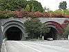 Mount Baker Ridge Tunnel |
July 16, 1982 (#82004243) |
East of WA 90 47°35′25″N 122°17′14″W |
part of the Historic Bridges and Tunnels in Washington TR |
| 118 | Mount Zion Baptist Church | 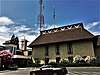 Mount Zion Baptist Church |
May 14, 2018 (#100002407) |
1634 19th Ave. 47°36′59″N 122°18′27″W |
|
| 119 | National Building | 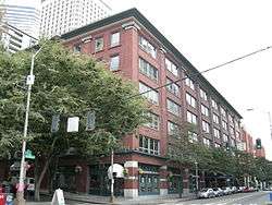 National Building |
April 29, 1982 (#82004244) |
1006-1024 Western Ave. 47°36′18″N 122°20′10″W |
|
| 120 | Naval Air Station (NAS) Seattle | 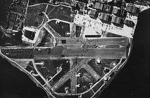 Naval Air Station (NAS) Seattle |
July 2, 2010 (#09001218) |
7400 Sand Point Way NE 47°40′56″N 122°15′39″W |
|
| 121 | Naval Military Hangar-University Shell House |  Naval Military Hangar-University Shell House |
July 1, 1975 (#75001856) |
University of Washington campus 47°38′53″N 122°17′56″W |
|
| 122 | Naval Reserve Armory |  Naval Reserve Armory |
July 8, 2009 (#09000506) |
860 Terry Ave. N. 47°37′39″N 122°20′13″W |
|
| 123 | New Richmond Hotel |  New Richmond Hotel |
July 12, 2011 (#11000426) |
308 4th Ave. S. 47°35′59″N 122°19′43″W |
Also known as the Downtowner Hotel |
| 124 | New Washington Hotel |  New Washington Hotel |
September 28, 1989 (#89001607) |
1902 Second Ave. 47°36′41″N 122°20′22″W |
|
| 125 | Nihon Go Gakko |  Nihon Go Gakko |
June 23, 1982 (#82004245) |
1414 S. Weller St. 47°35′53″N 122°18′38″W |
|
| 126 | Nippon Kan |  Nippon Kan |
May 22, 1978 (#78002754) |
622 S. Washington St. 47°36′05″N 122°19′26″W |
|
| 127 | Northern Bank and Trust Building |  Northern Bank and Trust Building |
March 26, 2003 (#03000165) |
1500 Fourth Ave. 47°36′38″N 122°20′06″W |
|
| 128 | Northern Life Tower |  Northern Life Tower |
May 30, 1975 (#75001857) |
1212 3rd Ave. 47°36′29″N 122°20′03″W |
|
| 129 | Nuclear Reactor Building | Nuclear Reactor Building |
July 24, 2009 (#08001158) |
3785 Jefferson Rd. NE 47°39′10″N 122°18′16″W |
The Nuclear Reactor Building was demolished on July 19, 2016.[17] |
| 130 | Old Georgetown City Hall |  Old Georgetown City Hall |
April 14, 1983 (#83003342) |
6202 13th Ave., S. 47°32′52″N 122°18′53″W |
|
| 131 | Old Public Safety Building |  Old Public Safety Building |
June 19, 1973 (#73001878) |
4th Ave. and Terrace St. and 5th Ave. and Yesler Way 47°36′08″N 122°19′36″W |
|
| 132 | Olympic Hotel |  Olympic Hotel |
June 15, 1979 (#79002538) |
1200-1220 4th Ave. 47°36′30″N 122°19′59″W |
|
| 133 | Panama Hotel |  Panama Hotel |
March 20, 2006 (#06000462) |
605 South Main St. and 302 6th Ave. South 47°36′00″N 122°19′34″W |
|
| 134 | Paramount Theatre |  Paramount Theatre |
October 9, 1974 (#74001959) |
901 Pine St. 47°36′49″N 122°19′48″W |
|
| 135 | Park Department, Division of Playgrounds |  Park Department, Division of Playgrounds |
March 16, 1972 (#72001275) |
301 Terry Ave. 47°36′15″N 122°19′14″W |
|
| 136 | William Parsons House |  William Parsons House |
June 21, 1991 (#91000782) |
2706 Harvard Ave. E. 47°38′42″N 122°19′14″W |
|
| 137 | Phillips House |  Phillips House |
April 29, 1993 (#93000359) |
711-713 E. Union St. 47°36′46″N 122°19′22″W |
|
| 138 | Pike Place Public Market Historic District |  Pike Place Public Market Historic District |
March 13, 1970 (#70000644) |
Bounded by Western Ave. to the west, Virginia St. to the north, 1st Ave. to the east, and the south wall of the Economy Market and Outlook Building to the south 47°36′37″N 122°20′25″W |
|
| 139 | Pioneer Building, Pergola, and Totem Pole |  Pioneer Building, Pergola, and Totem Pole |
May 5, 1977 (#77001340) |
5th Ave. and Yesler Way 47°36′09″N 122°19′57″W |
|
| 140 | Pioneer Hall |  Pioneer Hall |
June 5, 1970 (#70000645) |
1642 43rd Ave., E. 47°38′05″N 122°16′34″W |
|
| 141 | Pioneer Square-Skid Road District |  Pioneer Square-Skid Road District |
June 22, 1970 (#70000086) |
Roughly bounded by the Viaduct, Railroad Ave. S., King St., 4th and 5th Aves., James and Columbia Sts. including the 500 block of 1st Ave. 47°36′03″N 122°19′56″W |
Includes two increases to the size of the district. |
| 142 | Pirate (R-class sloop) | 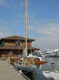 Pirate (R-class sloop) |
August 15, 2000 (#00000968) |
1010 Valley St. 47°37′37″N 122°20′09″W |
|
| 143 | Queen Anne Club |  Queen Anne Club |
January 27, 1983 (#83003344) |
1530 N. Queen Anne Ave. 47°38′01″N 122°21′20″W |
|
| 144 | Queen Anne High School | 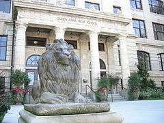 Queen Anne High School |
November 21, 1985 (#85002916) |
201 Galer St. 47°37′54″N 122°21′03″W |
|
| 145 | Queen Anne Post Office and Regional Headquarters |  Queen Anne Post Office and Regional Headquarters |
July 12, 2011 (#11000427) |
415 1st Ave., N. 47°35′55″N 122°20′04″W |
NRHP # 11000427 |
| 146 | Queen Anne Public School |  Queen Anne Public School |
July 30, 1975 (#75001858) |
1401 5th Avenue West 47°37′56″N 122°21′46″W |
Converted to condos in 1984 |
| 147 | Rainier Club |  Rainier Club |
April 22, 1976 (#76001889) |
810 4th Ave. 47°36′22″N 122°19′51″W |
|
| 148 | Ravenna-Cowen North Historic District |  Ravenna-Cowen North Historic District |
September 13, 2018 (#100002939) |
Roughly bounded by 65th St., Ravenna Park, Ravenna Ravine & 12th Ave. 47°40′29″N 122°18′35″W |
|
| 149 | Ravenna Park Bridge |  Ravenna Park Bridge |
July 16, 1982 (#82004246) |
20th Ave., Spans Ravenna Park Ravine 47°40′19″N 122°18′21″W |
part of the Historic Bridges and Tunnels in Washington TR |
| 150 | Raymond-Ogden Mansion |  Raymond-Ogden Mansion |
June 15, 1979 (#79002539) |
702 35th Ave. 47°36′30″N 122°17′13″W |
|
| 151 | Rector Hotel |  Rector Hotel |
August 9, 2002 (#02000863) |
619-621 Third Ave. 47°36′12″N 122°19′51″W |
Now known as St. Charles Hotel building. |
| 152 | Redelsheimer-Ostrander House |  Redelsheimer-Ostrander House |
January 12, 1990 (#89002298) |
200 40th Ave. E. 47°37′15″N 122°16′47″W |
|
| 153 | Roanoke Park Historic District |  Roanoke Park Historic District |
July 30, 2009 (#09000578) |
Bounded by Shelby St on the N, Roanoke St on the S, Harvard Ave on the W, 10th Ave on the E 47°38′42″N 122°19′15″W |
|
| 154 | Judge James T. Ronald House |  Judge James T. Ronald House |
February 20, 1975 (#75001859) |
421 30th St. 47°35′55″N 122°17′34″W |
|
| 155 | SS San Mateo | SS San Mateo |
April 7, 1971 (#71000876) |
Seattle waterfront 47°35′55″N 122°30′44″E |
|
| 156 | Schmitz Park Bridge |  Schmitz Park Bridge |
July 16, 1982 (#82004247) |
Spans Schmitz Park Ravine 47°34′38″N 122°24′08″W |
part of the Historic Bridges and Tunnels in Washington TR |
| 157 | Schooner Martha | 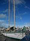 Schooner Martha |
November 5, 2001 (#01001205) |
1010 Valley St., Suite 100 47°37′39″N 122°20′04″W |
Martha Moved to Port Townsend; see http://www.schoonermartha.org/ |
| 158 | Seattle Art Museum |  Seattle Art Museum |
July 20, 2016 (#16000474) |
1400 E. Prospect St. 47°37′49″N 122°18′51″W |
Now houses the Seattle Asian Art Museum. |
| 159 | Seattle Chinatown Historic District | 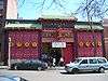 Seattle Chinatown Historic District |
November 6, 1986 (#86003153) |
Roughly bounded by Main, Jackson, I-5, Waller, and Fifth 47°35′56″N 122°19′25″W |
|
| 160 | Seattle Public Library | 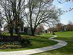 Seattle Public Library |
August 3, 1982 (#82004909) |
4721 Rainier Ave. South 47°33′36″N 122°17′09″W |
part of the Carnegie Libraries of Washington TR |
| 161 | Seattle Public Library | 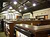 Seattle Public Library |
August 3, 1982 (#82004252) |
731 N. 35th St. 47°39′04″N 122°20′49″W |
part of the Carnegie Libraries of Washington TR |
| 162 | Seattle Public Library |  Seattle Public Library |
August 3, 1982 (#82004253) |
7364 E. Green Lake Dr., N. 47°40′54″N 122°19′33″W |
part of the Carnegie Libraries of Washington TR |
| 163 | Seattle Public Library |  Seattle Public Library |
August 3, 1982 (#82004250) |
400 W. Garfield St. 47°38′02″N 122°21′41″W |
part of the Carnegie Libraries of Washington TR |
| 164 | Seattle Public Library |  Seattle Public Library |
August 3, 1982 (#82004251) |
5009 Roosevelt Way, NE 47°39′55″N 122°18′59″W |
part of the Carnegie Libraries of Washington TR |
| 165 | Seattle Public Library |  Seattle Public Library |
August 3, 1982 (#82004249) |
2306 42nd Ave., SW 47°34′58″N 122°23′01″W |
part of the Carnegie Libraries of Washington TR |
| 166 | Seattle Yacht Club |  Seattle Yacht Club |
May 10, 2006 (#06000370) |
1807 Hamlin St. 47°38′50″N 122°18′32″W |
|
| 167 | Seattle, Chief of the Suquamish, Statue |  Seattle, Chief of the Suquamish, Statue |
April 19, 1984 (#84003502) |
5th Ave., Denny Way, and Cedar St. 47°37′07″N 122°20′46″W |
|
| 168 | Shafer Building | 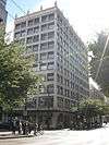 Shafer Building |
December 13, 1995 (#95001445) |
523 Pine St. 47°36′44″N 122°20′03″W |
|
| 169 | Showboat Theatre | April 25, 1986 (#86000970) |
University of Washington, 1705 N.E. Pacific St. 47°38′58″N 122°18′38″W |
Demolished April 1994. | |
| 170 | Henry Owen Shuey House | 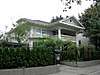 Henry Owen Shuey House |
December 5, 2002 (#02001487) |
5218 16th Ave. NE 47°40′03″N 122°18′33″W |
|
| 171 | Skinner Building | _2007-08.jpg) Skinner Building |
November 28, 1978 (#78002756) |
1300-1334 5th Ave. 47°36′35″N 122°19′57″W |
|
| 172 | Stimson-Green House |  Stimson-Green House |
May 4, 1976 (#76001890) |
1204 Minor Ave. 47°36′43″N 122°19′26″W |
|
| 173 | Stuart House and Gardens | 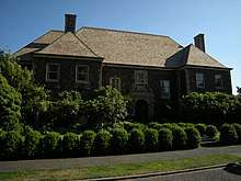 Stuart House and Gardens |
April 14, 1983 (#83003345) |
619 W. Comstock St. 47°37′47″N 122°13′52″W |
|
| 174 | Summit School |  Summit School |
October 4, 1979 (#79002540) |
E. Union St. and Summit Ave. 47°36′49″N 122°19′28″W |
|
| 175 | Supply Laundry Building | 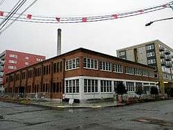 Supply Laundry Building |
April 23, 2013 (#13000209) |
1265 Republican St. 47°37′22″N 122°19′51″W |
|
| 176 | Temple de Hirsch | 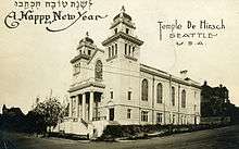 Temple de Hirsch |
January 5, 1984 (#84003506) |
15th Ave. and E. Union St. 47°36′48″N 122°18′40″W |
|
| 177 | Will H. Thompson House |  Will H. Thompson House |
November 29, 1979 (#79002541) |
3119 S. Day St. 47°35′26″N 122°17′26″W |
|
| 178 | Times Building | 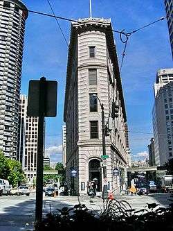 Times Building |
January 27, 1983 (#83003346) |
414 Olive Way 47°36′47″N 122°20′12″W |
|
| 179 | Triangle Hotel and Bar |  Triangle Hotel and Bar |
May 3, 1976 (#76001892) |
551 1st Ave., S. 47°35′49″N 122°19′58″W |
|
| 180 | Trinity Parish Church |  Trinity Parish Church |
September 26, 1991 (#91001440) |
609 Eighth Ave. 47°36′19″N 122°19′31″W |
|
| 181 | Turner-Koepf House | Turner-Koepf House |
April 22, 1976 (#76001893) |
2336 15th Ave., S. 47°35′01″N 122°18′43″W |
|
| 182 | U.S. Courthouse |  U.S. Courthouse |
January 8, 1980 (#80004003) |
1010 5th Ave. 47°36′26″N 122°19′48″W |
|
| 183 | U.S. Immigrant Station and Assay Office | .jpg) U.S. Immigrant Station and Assay Office |
January 1, 1979 (#79002542) |
815 Airport Way, S. 47°35′43″N 122°19′33″W |
Now known as Inscape Arts. |
| 184 | U.S. Marine Hospital |  U.S. Marine Hospital |
December 21, 1979 (#79002543) |
1131 14th Ave., S. 47°35′40″N 122°18′57″W |
Now known as the Pacific Medical Center. |
| 185 | Union Stables |  Union Stables |
April 23, 2013 (#13000210) |
2200 Western Ave. 47°36′44″N 122°20′46″W |
|
| 186 | Union Station |  Union Station |
August 30, 1974 (#74001960) |
4th, S. and S. Jackson Sts. 47°35′56″N 122°19′38″W |
|
| 187 | United Shopping Tower |  United Shopping Tower |
August 18, 1980 (#80004004) |
217 Pine St. 47°36′38″N 122°20′14″W |
|
| 188 | University Bridge | _from_east_05.jpg) University Bridge |
July 16, 1982 (#82004254) |
Spans Lake Washington Ship Canal 47°39′12″N 122°19′08″W |
part of the Historic Bridges and Tunnels in Washington TR |
| 189 | University Heights School | 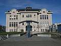 University Heights School |
December 7, 2010 (#10000995) |
5031 University Way NE 47°39′44″N 122°18′47″W |
|
| 190 | University of Washington Faculty Club |  University of Washington Faculty Club |
July 18, 2016 (#16000464) |
4020 E. Stevens Way 47°39′20″N 122°18′16″W |
|
| 191 | U.S. Immigration Building |  U.S. Immigration Building |
September 14, 1987 (#87001524) |
84 Union St. 47°36′28″N 122°20′20″W |
|
| 192 | Victorian Apartments | 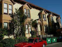 Victorian Apartments |
December 18, 1990 (#90001864) |
1234-1238 S. King St. 47°35′55″N 122°18′56″W |
|
| 193 | Virginia V | 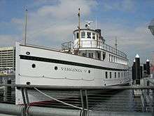 Virginia V |
April 24, 1973 (#73001875) |
4250 21st Ave., W. 47°37′55″N 122°22′54″W |
|
| 194 | William Volker Building | 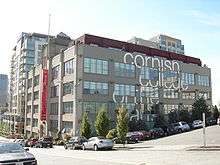 William Volker Building |
October 13, 1983 (#83004236) |
1000 Lenora St. 47°37′06″N 122°20′30″W |
Now part of Cornish College of the Arts. |
| 195 | Volunteer Park |  Volunteer Park |
May 3, 1976 (#76001894) |
Between E. Prospect and E. Galer Sts., and Federal and E. 15th Aves. 47°37′50″N 122°18′52″W |
|
| 196 | Wagner Houseboat | .jpg) Wagner Houseboat |
February 19, 1982 (#82004255) |
2770 Westlake Ave., N. 47°38′45″N 122°20′45″W |
|
| 197 | Wallingford Fire and Police Station |  Wallingford Fire and Police Station |
January 27, 1983 (#83003347) |
1629 N. 45th St. 47°39′42″N 122°20′09″W |
|
| 198 | Ward House |  Ward House |
March 16, 1972 (#72001277) |
520 E. Denny Way 47°36′48″N 122°19′39″W |
|
| 199 | Washington Athletic Club |  Washington Athletic Club |
May 14, 2018 (#100002408) |
1325 Sixth Ave. 47°36′35″N 122°20′00″W |
|
| 200 | Washington Hall |  Washington Hall |
December 13, 2010 (#10001018) |
153 14th Ave. 47°36′04″N 122°19′18″W |
|
| 201 | Washington Street Public Boat Landing Facility |  Washington Street Public Boat Landing Facility |
June 10, 1974 (#74001961) |
S. Washington St. west of Alaskan Way 47°36′04″N 122°19′18″W |
|
| 202 | Wawona |  Wawona |
July 1, 1970 (#70000643) |
Seattle Police Harbor Patrol Dock, foot of Densmore St. 47°38′43″N 122°20′21″W |
|
| 203 | West Point Light Station | 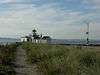 West Point Light Station |
August 16, 1977 (#77001336) |
West of Fort Lawton. 47°39′44″N 122°26′04″W |
|
| 204 | White Center Fieldhouse and Caretaker Cottage | 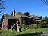 White Center Fieldhouse and Caretaker Cottage |
July 21, 2015 (#15000455) |
1321 SW. 102nd St. 47°30′43″N 122°21′08″W |
|
| 205 | Wilke Farmhouse | 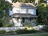 Wilke Farmhouse |
November 1, 1974 (#74001962) |
1920 2nd Ave. North 47°38′12″N 122°21′06″W |
|
| 206 | Windham Apartments | 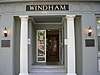 Windham Apartments |
August 2, 2006 (#06000669) |
420 Blanchard St. 47°37′01″N 122°20′32″W |
|
| 207 | Women's University Club of Seattle |  Women's University Club of Seattle |
July 10, 2009 (#09000507) |
1105 6th Ave. 47°36′28″N 122°19′53″W |
|
| 208 | Ye College Inn | 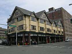 Ye College Inn |
February 25, 1982 (#82004256) |
4000 University Way NE 47°39′26″N 122°18′42″W |
|
| 209 | YWCA Building-Seattle | 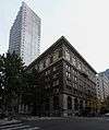 YWCA Building-Seattle |
December 29, 2006 (#06001215) |
1118 Fifth Avenue 47°36′28″N 122°19′58″W |
|
| 210 | Zodiac (schooner) | 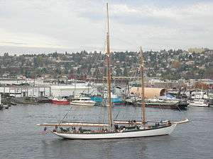 Zodiac (schooner) |
April 29, 1982 (#82004248) |
Lake Union Dry Dock 47°37′56″N 122°19′38″W |
Home port is now in Bellingham, Washington. |
Former listings
| [3] | Name on the Register | Image | Date listed | Date removed | Location | Summary |
|---|---|---|---|---|---|---|
| 1 | Adams School | .jpg) Adams School |
May 19, 1988 (#88000603) | July 16, 1990 | 2637 N.W. Sixty-second St. |
|
| 2 | Broadway High School |  Broadway High School |
1974 (#74002297) | 1974 | Broadway Ave. and E. Pine St. |
Demolished in 1974.[18] |
| 3 | Girls' Parental School | June 22, 1988 (#88000741) | July 16, 1990 | 6612 Sixty-fifth Ave., S. |
||
| 4 | Lacey V. Murrow Floating Bridge |  Lacey V. Murrow Floating Bridge |
April 29, 1987 (#87000866) | March 11, 1991 | Lake Washington |
Sank in 1990. Rebuilt. |
See also
- List of Landmarks in Seattle (city landmarks)
- List of National Historic Landmarks in Washington
- National Register of Historic Places listings in King County, Washington
- National Register of Historic Places listings in Washington state
References
- The latitude and longitude information provided in this table was derived originally from the National Register Information System, which has been found to be fairly accurate for about 99% of listings. Some locations in this table may have been corrected to current GPS standards.
- "National Register of Historic Places: Weekly List Actions". National Park Service, United States Department of the Interior. Retrieved on August 14, 2020.
- Numbers represent an ordering by significant words. Various colorings, defined here, differentiate National Historic Landmarks and historic districts from other NRHP buildings, structures, sites or objects.
- "National Register Information System". National Register of Historic Places. National Park Service. April 24, 2008.
- The eight-digit number below each date is the number assigned to each location in the National Register Information System database, which can be viewed by clicking the number.
- Lisa Soderberg (October 1980). "National Architectural and Engineering Record Inventory Nomination: 12th Avenue South Bridge". National Park Service. Retrieved February 26, 2016.
- "Seattle's 12th Avenue South (Dearborn Street) Bridge is built in 1911". Historylink.org. Retrieved 13 July 2013.
- Lisa Soderberg (August 1980). "National Register of Historic Places Inventory Nomination: Historic Bridges and Tunnels in Washington". National Park Service. Retrieved February 26, 2016.
- Lisa Soderberg (October 1980). "Office of Archeology and Historic Preservation Inventory Nomination: 14th Avenue South Bridge". National Park Service. Retrieved February 26, 2016.
- Lisa Soderberg (July 1982). "Historic American Engineering Record Inventory Nomination: Arboretum Sewer Trestle". National Park Service. Retrieved February 26, 2016.
- Lisa Soderberg (September 1980). "National Architectural and Engineering Record Inventory Nomination: Aurora Avenue (George Washington Memorial) Bridge". National Park Service. Retrieved February 26, 2016.
- "Bridges and Roadway Structures". Seattle Department of Transportation. Retrieved 15 September 2013.
- Long, Priscilla (March 24, 2001). "WPA builds Cowen Park Bridge in Seattle's Ravenna neighborhood in 1936". HistoryLink.org. Retrieved September 15, 2013.
- Lisa Soderberg (October 1980). "National Architectural and Engineering Record Inventory Nomination: Cowen Park Bridge". National Park Service. Retrieved February 26, 2016.
- (Announcements), National Park Service, 2013-01-11. The year of nomination is indicated by the first two digits of the ID number. Accessed online 2013-01-15.
- M/V Vashon, Incident News, Emergency Response Division, Office of Response and Restoration, National Ocean Service, National Oceanic and Atmospheric Administration, US Department of Commerce. Original notice dated 7 June 1986. Retrieved 14 April 2011.
- Berger, Knute (July 21, 2016). "UW's 'Nuke Building' bites the dust". Crosscut.com. Archived from the original on July 22, 2016. Retrieved November 29, 2016.
External links
| Wikimedia Commons has media related to National Register of Historic Places in Seattle, Washington. |
| Topics | |
|---|---|
| Lists by state |
|
| Lists by insular areas | |
| Lists by associated state | |
| Other areas | |
| Related | |
| |
| Lists by county |
|  |
|---|---|---|
| Other lists |
| |
|  | |
| ||
This article is issued from Wikipedia. The text is licensed under Creative Commons - Attribution - Sharealike. Additional terms may apply for the media files.