National Register of Historic Places listings in Marion County, Indiana
This is a list of the National Register of Historic Places listings in Marion County, Indiana.
This is intended to be a complete list of the properties and districts on the National Register of Historic Places in Marion County, Indiana, United States. Latitude and longitude coordinates are provided for many National Register properties and districts; these locations may be seen together in a map.[1]
There are 248 properties and districts listed on the National Register in the county, including 9 National Historic Landmarks. Because Indianapolis is coextensive with Marion County, properties are listed by township rather than by city or town. Center Township is the location of 180 of these properties and districts, including 6 of the National Historic Landmarks; these properties and districts are listed separately. Properties and districts in Marion County's other townships are listed here. One district, the Indianapolis Park and Boulevard System, is primarily in Center Township but extends into three other townships, and is therefore included on both lists. Nine other properties, including seven in Center Township, were once listed but have since been removed.
- This National Park Service list is complete through NPS recent listings posted August 14, 2020.[2]
Current listings
| [3] | Name on the Register[4] | Image | Date listed[5] | Location | Township | Description |
|---|---|---|---|---|---|---|
| 1 | Administration Building, Indiana Central University |  Administration Building, Indiana Central University |
March 15, 1984 (#84001081) |
Otterbein and Hanna Ave. 39°42′29″N 86°08′07″W |
Perry | |
| 2 | Allison Mansion |  Allison Mansion |
December 18, 1970 (#70000006) |
3200 Cold Spring Rd. 39°49′00″N 86°12′06″W |
Wayne | |
| 3 | Anderson–Thompson House |  Anderson–Thompson House |
March 26, 1987 (#87000502) |
6551 Shelbyville Rd. 39°40′02″N 86°03′09″W |
Franklin | |
| 4 | Christopher Apple House |  Christopher Apple House |
September 17, 1980 (#80000055) |
11663 Pendleton Pike 39°52′12″N 85°57′34″W |
Lawrence | |
| 5 | Archeological Sites 12Ma648 and 12Ma649 |  Archeological Sites 12Ma648 and 12Ma649 |
December 20, 2011 (#11000912) |
Atop a hill above Fall Creek in the northwestern corner of Fort Harrison State Park[6] 39°52′31″N 86°01′52″W |
Lawrence | |
| 6 | Thomas Askren House |  Thomas Askren House |
April 19, 2006 (#06000303) |
6550 E. 16th St. 39°47′28″N 86°03′12″W |
Warren | |
| 7 | Aston Inn |  Aston Inn |
December 26, 1985 (#85003125) |
6620 N. Michigan Rd. 39°52′39″N 86°12′24″W |
Washington | |
| 8 | Benton House |  Benton House |
March 20, 1973 (#73000034) |
312 S. Downey Ave. 39°45′54″N 86°04′35″W |
Warren | Part of the Irvington Historic District |
| 9 | Big Run Baptist Church and Cemetery |  Big Run Baptist Church and Cemetery |
December 6, 2005 (#05001367) |
6510 S. Franklin Rd. 39°40′33″N 86°01′08″W |
Franklin | |
| 10 | Joseph J. Bingham Indianapolis Public School No. 84 |  Joseph J. Bingham Indianapolis Public School No. 84 |
December 6, 2004 (#04001310) |
440 E. 57th St.-5702 Central Ave. 39°51′34″N 86°09′05″W |
Washington | |
| 11 | Brendonwood Historic District |  Brendonwood Historic District |
December 6, 2004 (#04001313) |
Roughly bounded by Fall Creek, 56th St., and Brendon Forest Dr. 39°51′40″N 86°03′58″W |
Lawrence | |
| 12 | Broad Ripple Firehouse–Indianapolis Fire Department Station 32 |  Broad Ripple Firehouse–Indianapolis Fire Department Station 32 |
September 15, 2011 (#11000658) |
6330 Guilford Ave. 39°52′15″N 86°08′35″W |
Washington | |
| 13 | Butler Fieldhouse |  Butler Fieldhouse |
December 22, 1983 (#83003573) |
Butler University campus, 49th St., and Boulevard Pl. 39°50′36″N 86°10′02″W |
Washington | |
| 14 | Camp Edwin F. Glenn |  Camp Edwin F. Glenn |
December 1, 1995 (#95001360) |
Fort Benjamin Harrison 39°51′34″N 86°01′16″W |
Lawrence | |
| 15 | Henry F. Campbell Mansion |  Henry F. Campbell Mansion |
April 14, 1997 (#97000305) |
2550 Cold Spring Rd. 39°48′07″N 86°12′19″W |
Wayne | |
| 16 | Christamore House |  Christamore House |
March 21, 1985 (#85000597) |
502 N. Tremont St. 39°46′29″N 86°12′04″W |
Wayne | |
| 17 | Henry P. Coburn Public School No. 66 |  Henry P. Coburn Public School No. 66 |
June 13, 1986 (#86001267) |
604 E. 38th St. 39°46′30″N 86°12′04″W |
Washington | |
| 18 | Joseph J. Cole, Jr., House |  Joseph J. Cole, Jr., House |
June 25, 1997 (#97000599) |
4909 N. Meridian St. 39°50′35″N 86°09′24″W |
Washington | |
| 19 | Roy and Iris Corbin Lustron House |  Roy and Iris Corbin Lustron House |
October 9, 1997 (#97001173) |
1728 N. Leland Ave. 39°47′26″N 86°04′55″W |
Warren | |
| 20 | Cumberland Historic District |  Cumberland Historic District |
December 7, 2001 (#01001341) |
Roughly bounded by Munsie, Welland, Heflin, and Warehouse Sts. 39°46′36″N 85°57′23″W |
Warren | |
| 21 | Emerson Avenue Addition Historic District |  Emerson Avenue Addition Historic District |
December 19, 2012 (#12001063) |
Roughly bounded by E. Michigan and E. St Clair Sts., N. Emerson Ave., and Ellenberger Park 39°46′37″N 86°04′52″W |
Warren | |
| 22 | Forest Hills Historic District |  Forest Hills Historic District |
June 30, 1983 (#83000130) |
Bounded by the Monon Railroad tracks, Kessler Boulevard, and College and Northview Aves. 39°51′32″N 86°08′35″W |
Washington | |
| 23 | Fort Benjamin Harrison Historic District |  Fort Benjamin Harrison Historic District |
September 6, 1995 (#93001581) |
E. 56th St.; also roughly bounded by Shafter Rd., Aultman Ave., and Glenn Rd. 39°51′34″N 86°00′46″W |
Lawrence | Second set of boundaries represents a boundary increase of December 1, 1995 |
| 24 | Fort Harrison Terminal Station |  Fort Harrison Terminal Station |
March 16, 1984 (#84001127) |
Building 616 at Fort Benjamin Harrison 39°51′21″N 86°00′48″W |
Lawrence | |
| 25 | Foster Hall |  Foster Hall |
December 6, 2005 (#05001364) |
7200 N. College Ave. 39°53′19″N 86°08′51″W |
Washington | |
| 26 | William H.H. Graham House |  William H.H. Graham House |
July 15, 1982 (#82001857) |
5432 University Ave. 39°46′00″N 86°04′31″W |
Warren | |
| 27 | Hanna–Ochler–Elder House |  Hanna–Ochler–Elder House |
December 1, 1978 (#78000046) |
3801 Madison Ave. 39°42′41″N 86°08′36″W |
Perry | |
| 28 | Haughville Historic District |  Haughville Historic District |
December 9, 1992 (#92001652) |
Roughly bounded by 10th St., Belleview Pl., Walnut St., and Concord St. 39°46′40″N 86°12′22″W |
Wayne | |
| 29 | Hiram A. Haverstick Farmstead |  Hiram A. Haverstick Farmstead |
December 26, 1985 (#85003126) |
7845 Westfield Boulevard 39°53′48″N 86°08′09″W |
Washington | |
| 30 | Hawthorne Branch Library No. 2 |  Hawthorne Branch Library No. 2 |
May 18, 2000 (#00000499) |
70 N. Mount St. 39°46′03″N 86°12′06″W |
Wayne | |
| 31 | Hillcrest Country Club |  Hillcrest Country Club |
September 29, 2004 (#04001099) |
6098 Fall Creek Rd. 39°52′25″N 86°03′40″W |
Lawrence | |
| 32 | Hollingsworth House |  Hollingsworth House |
April 13, 1977 (#77000019) |
6054 Hollingsworth Rd. 39°51′51″N 86°14′50″W |
Pike | |
| 33 | Homecroft Historic District |  Homecroft Historic District |
January 11, 1996 (#95001536) |
Roughly bounded by Madison Ave., Southview Dr., Orinoco Ave., and Banta Rd. 39°40′12″N 86°07′55″W |
Perry | |
| 34 | Indiana School for the Deaf |  Indiana School for the Deaf |
June 27, 1991 (#91000790) |
1200 E. 42nd St. 39°50′06″N 86°08′16″W |
Washington | |
| 35 | Indianapolis Motor Speedway | Indianapolis Motor Speedway |
March 7, 1975 (#75000044) |
4790 W. 16th St. 39°47′54″N 86°13′58″W |
Wayne | |
| 36 | Indianapolis Park and Boulevard System |  Indianapolis Park and Boulevard System |
March 28, 2003 (#03000149) |
Roughly bounded by 38th St., Emerson, Southern and Tibbs Aves., extending along Fall Creek and Pleasant Run Parkways to Shadeland 39°47′25″N 86°08′38″W |
Lawrence, Warren, and Washington | Extends into Center Township |
| 37 | Indianapolis Veterans Administration Hospital |  Indianapolis Veterans Administration Hospital |
February 21, 2012 (#12000029) |
2601 Cold Spring Rd. 39°48′10″N 86°12′06″W |
Wayne | |
| 38 | Irvington Historic District |  Irvington Historic District |
May 29, 1987 (#87001031) |
Roughly bounded by Ellenberger Park, Pleasant Run Creek, Arlington Ave., the former Baltimore and Ohio railroad tracks, and Emerson Ave. 39°46′13″N 86°04′25″W |
Warren | |
| 39 | Irvington Terrace Historic District | 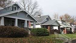 Irvington Terrace Historic District |
December 19, 2011 (#11000913) |
Roughly bounded by E. Washington St., Pleasant Run Parkway, N. Arlington Ave., and the eastern side of N. Irwin St. 39°46′21″N 86°03′46″W |
Warren | |
| 40 | Jamieson–Bennett House |  Jamieson–Bennett House |
September 16, 2001 (#01000984) |
8452 Green Braes North Dr. 39°50′55″N 86°18′48″W |
Pike | |
| 41 | Oliver Johnson's Woods Historic District |  Oliver Johnson's Woods Historic District |
June 22, 2004 (#04000632) |
Roughly bounded by Central and College Aves. and 44th and 46th Sts. 39°50′23″N 86°08′51″W |
Washington | |
| 42 | Johnson–Denny House |  Johnson–Denny House |
August 24, 1979 (#79000036) |
4456 N. Park Ave. 39°50′15″N 86°08′55″W |
Washington | |
| 43 | Arthur Jordan Memorial Hall |  Arthur Jordan Memorial Hall |
June 30, 1983 (#83000134) |
4600 Sunset Ave. 39°50′19″N 86°10′20″W |
Washington | |
| 44 | Julian–Clark House |  Julian–Clark House |
June 20, 1986 (#86001335) |
115 S. Audubon Rd. 39°46′07″N 86°04′11″W |
Warren | |
| 45 | Ladywood Estates | December 2, 2019 (#100004728) |
Roughly bounded by the 5200 blk. of Emerson Way, Ladywood Dr. & the hill west of Nob Ln. 39°50′55″N 86°05′11″W |
|||
| 46 | Marcy Village Apartments |  Marcy Village Apartments |
March 24, 2004 (#04000202) |
4440-4567 Marcy Ln. and 1401 E. 46th St. 39°50′19″N 86°08′04″W |
Washington | |
| 47 | Marion County Bridge 0501F |  Marion County Bridge 0501F |
September 20, 2006 (#06000853) |
86th and 82nd Sts. over the White River 39°54′43″N 86°06′17″W |
Washington | |
| 48 | Michigan Road Toll House |  Michigan Road Toll House |
August 7, 1974 (#74000031) |
4702 Michigan Rd., NW. 39°50′29″N 86°11′20″W |
Washington | |
| 49 | New Augusta Historic District |  New Augusta Historic District |
July 12, 1989 (#89000780) |
Roughly E. 71st St., E. 74th St., Coffman Rd., and New Augusta Rd. 39°53′02″N 86°14′19″W |
Pike | |
| 50 | Nicholson–Rand House |  Nicholson–Rand House |
June 22, 2003 (#03000542) |
5010 W. Southport Rd. 39°39′38″N 86°14′46″W |
Decatur | American Gothic Revival Farmhouse built 1876 |
| 51 | North Irvington Gardens Historic District |  North Irvington Gardens Historic District |
June 27, 2008 (#08000557) |
Roughly bounded by 11th, 10th, Pleasant Run Golf Course, Arlington Ave., Pleasant Run Parkway N. Drive, and Ritter Ave. 39°46′46″N 86°04′15″W |
Warren | |
| 52 | North Meridian Street Historic District |  North Meridian Street Historic District |
September 22, 1986 (#86002695) |
4000-5694 and 4001-5747 N. Meridian St. 39°50′33″N 86°09′26″W |
Washington | |
| 53 | Oaklandon Historic District |  Oaklandon Historic District |
September 18, 2013 (#13000724) |
6300 and 6400 blocks of Oaklandon Rd., the 6400 block of Maple St., and 11716 Oshawa St. 39°52′30″N 85°57′26″W |
Lawrence | |
| 54 | Old Pathology Building |  Old Pathology Building |
April 25, 1972 (#72000011) |
3000 W. Washington St. (Central State Hospital) 39°46′12″N 86°12′48″W |
Wayne | |
| 55 | Old Southport High School |  Old Southport High School |
September 28, 2003 (#03000982) |
6548 Orinoco Ave. 39°40′17″N 86°08′09″W |
Perry | |
| 56 | Oldfields |  Oldfields |
June 15, 2000 (#00000676) |
1200 W. 38th St. 39°49′32″N 86°10′58″W |
Washington | Declared a National Historic Landmark District on July 31, 2003 |
| 57 | Pleasanton in Irvington Historic District | 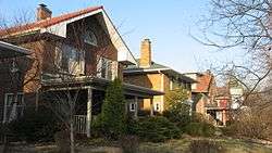 Pleasanton in Irvington Historic District |
December 27, 2010 (#10001083) |
Roughly bounded by E. Michigan St., Pleasant Run Parkway North Dr., and Emerson Ave. 39°46′32″N 86°04′53″W |
Warren | |
| 58 | Carlos and Anne Recker House |  Carlos and Anne Recker House |
June 13, 1996 (#96000601) |
59 N. Hawthorne Ln. 39°46′19″N 86°04′41″W |
Warren | |
| 59 | Speedway Historic District |  Speedway Historic District |
September 15, 2005 (#05001015) |
Roughly bounded by 16th St., Main St., 10th St., and Winton Ave. 39°47′02″N 86°14′38″W |
Wayne | |
| 60 | Stewart Manor (Charles B. Sommers House) |  Stewart Manor (Charles B. Sommers House) |
October 8, 1976 (#76000033) |
3650 Cold Spring Rd. 39°49′14″N 86°12′10″W |
Wayne | |
| 61 | Stout Field, Administration Building | May 30, 2018 (#100002491) |
Address Restricted |
Wayne | ||
| 62 | Stout Field, Hangar | May 30, 2018 (#100002493) |
Address Restricted |
Wayne | ||
| 63 | George Stumpf House |  George Stumpf House |
May 14, 1979 (#79000039) |
3225 S. Meridian St. 39°43′06″N 86°09′29″W |
Perry | |
| 64 | William N. Thompson House |  William N. Thompson House |
June 1, 1982 (#82000070) |
4343 N. Meridian St. 39°50′06″N 86°09′23″W |
Washington | |
| 65 | George Washington Tomlinson House |  George Washington Tomlinson House |
December 6, 2005 (#05001366) |
5140 Reed Rd. 39°50′48″N 86°17′24″W |
Pike | |
| 66 | Town of Crows Nest Historic District |  Town of Crows Nest Historic District |
April 13, 2000 (#00000305) |
Roughly bounded by Kessler Boulevard, the White River, and Questover Circle 39°51′25″N 86°10′11″W |
Washington | |
| 67 | Traders Point Eagle Creek Rural Historic District |  Traders Point Eagle Creek Rural Historic District |
June 17, 2009 (#09000433) |
Roughly between Interstate 865, Interstate 465, and Lafayette Rd. 39°53′53″N 86°17′05″W |
Pike | Extends into Eagle Township in Boone County.[7] |
| 68 | Washington Park Historic District |  Washington Park Historic District |
June 24, 2008 (#08000565) |
Bounded by Pennsylvania St., Washington Boulevard, New Jersey, and the western side of Central Ave. between 40th and 43rd Sts. 39°49′53″N 86°09′08″W |
Washington | |
| 69 | Wheeler–Stokely Mansion |  Wheeler–Stokely Mansion |
December 6, 2004 (#04001312) |
3200 Cold Spring Rd. 39°48′44″N 86°12′09″W |
Wayne |
Former listings
| [3] | Name on the Register | Image | Date listed | Date removed | Location | City or town | Summary |
|---|---|---|---|---|---|---|---|
| 1 | Cotton–Ropkey House |  Cotton–Ropkey House |
March 22, 1984 (#84001086) | September 18, 2017 | 6360 W. 79th St. 39°53′47″N 86°16′24″W |
Pike | |
| 2 | Tee Pee Restaurant |  Tee Pee Restaurant |
1986 (#86003374) | February 21, 1989 | 3820 Fall Creek Boulevard 39°49′33″N 86°07′54″W |
Washington |
See also
| Wikimedia Commons has media related to National Register of Historic Places in Marion County, Indiana. |
References
- The latitude and longitude information provided in this table was derived originally from the National Register Information System, which has been found to be fairly accurate for about 99% of listings. Some locations in this table may have been corrected to current GPS standards.
- "National Register of Historic Places: Weekly List Actions". National Park Service, United States Department of the Interior. Retrieved on August 14, 2020.
- Numbers represent an ordering by significant words. Various colorings, defined here, differentiate National Historic Landmarks and historic districts from other NRHP buildings, structures, sites or objects.
- "National Register Information System". National Register of Historic Places. National Park Service. March 13, 2009.
- The eight-digit number below each date is the number assigned to each location in the National Register Information System database, which can be viewed by clicking the number.
- Location derived from 2002 Midwest Archaeological Conference Archived 2012-05-02 at the Wayback Machine, Midwest Archaeological Conference, 2002. Accessed 2011-12-30. The NRIS lists the site as "Address Restricted".
- Fife, Camille B. National Register of Historic Places Inventory/Nomination: Traders Point Eagle Creek Rural Historic District. National Park Service, 2008-05, 90.
| Topics | |
|---|---|
| Lists by state |
|
| Lists by insular areas | |
| Lists by associated state | |
| Other areas | |
| Related | |
| |