National Register of Historic Places listings in Johnson County, Wyoming
This is a list of the National Register of Historic Places listings in Johnson County, Wyoming. It is intended to be a complete list of the properties and districts on the National Register of Historic Places in Johnson County, Wyoming, United States. The locations of National Register properties and districts for which the latitude and longitude coordinates are included below, may be seen in an online map.[1]
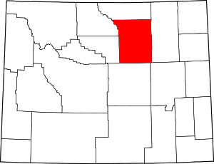
Location of Johnson County in Wyoming
There are 27 properties and districts listed on the National Register in the county, 1 of which is a National Historic Landmark.
- This National Park Service list is complete through NPS recent listings posted August 7, 2020.[2]
| Albany - Big Horn - Campbell - Carbon - Converse - Crook - Fremont - Goshen - Hot Springs - Johnson - Laramie - Lincoln - Natrona - Niobrara - Park - Platte - Sheridan - Sublette - Sweetwater - Teton - Uinta - Washakie - Weston |
Listings county-wide
| [3] | Name on the Register | Image | Date listed[4] | Location | City or town | Description |
|---|---|---|---|---|---|---|
| 1 | AJX Bridge over South Fork and Powder River |  AJX Bridge over South Fork and Powder River |
February 22, 1985 (#85000426) |
Interstate 25 W. Service Rd. (old U.S. Route 87) 43°37′13″N 106°34′35″W |
Kaycee | |
| 2 | Beaver Creek Ranch Headquarters | January 8, 2014 (#13001064) |
2333 Beaver Creek 44°05′58″N 106°02′59″W |
Buffalo vicinity | Buildings of a sheep ranch | |
| 3 | Blue Gables Motel |  Blue Gables Motel |
November 1, 2011 (#11000772) |
662 N. Main St. 44°21′20″N 106°41′56″W |
Buffalo | part of the Motor Courts and Motels in Wyoming MPS |
| 4 | Cantonment Reno | 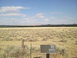 Cantonment Reno |
July 29, 1977 (#77001382) |
5 miles north of Sussex at the Powder River 43°47′06″N 106°15′13″W |
Kaycee | |
| 5 | Carnegie Public Library | 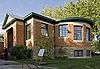 Carnegie Public Library |
November 7, 1976 (#76001949) |
90 N. Main 44°20′53″N 106°41′58″W |
Buffalo | |
| 6 | Dull Knife Battlefield | 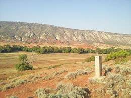 Dull Knife Battlefield |
August 15, 1979 (#79002609) |
North of Barnum 43°45′36″N 106°56′55″W |
Kaycee | |
| 7 | EDL Peloux Bridge | 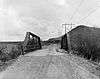 EDL Peloux Bridge |
February 22, 1985 (#85000425) |
County Road CN16-40 44°20′42″N 106°42′16″W |
Buffalo | Relocated to Buffalo City Park in 1986 |
| 8 | EDZ Irigary Bridge | 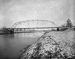 EDZ Irigary Bridge |
February 22, 1985 (#85000427) |
County Road CN16-254 43°56′32″N 106°09′22″W |
Kaycee | |
| 9 | Fort McKinney | July 30, 1976 (#76001950) |
About 2 miles west of Buffalo on U.S. Route 16 44°19′55″N 106°44′05″W |
Buffalo | ||
| 10 | Fort Phil Kearny and Associated Sites |  Fort Phil Kearny and Associated Sites |
October 15, 1966 (#66000756) |
On state highway west off U.S. Route 87 44°32′54″N 106°49′21″W |
Story | |
| 11 | Fort Reno | 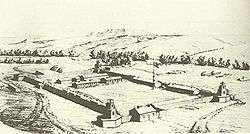 Fort Reno |
April 28, 1970 (#70000672) |
East of Sussex on the Powder River 43°49′42″N 106°14′26″W |
Kaycee | |
| 12 | HF Bar Ranch Historic District | November 7, 1984 (#84000392) |
Northwest of Buffalo 44°27′31″N 106°53′59″W |
Buffalo | ||
| 13 | Holland House | 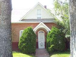 Holland House |
November 4, 1993 (#93001185) |
312 N. Main St. 44°21′05″N 106°41′56″W |
Buffalo | |
| 14 | Jameson Site | 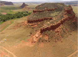 Jameson Site |
September 13, 2018 (#100002942) |
Address Restricted |
Barnum vicinity | |
| 15 | Johnson County Courthouse |  Johnson County Courthouse |
November 7, 1976 (#76001951) |
76 N. Main St. 44°20′52″N 106°41′56″W |
Buffalo | |
| 16 | Lake Desmet Segment, Bozeman Trail | 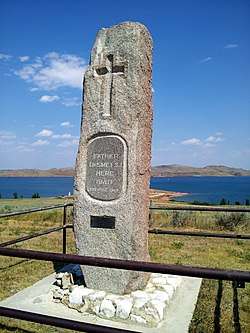 Lake Desmet Segment, Bozeman Trail |
July 23, 1989 (#89000814) |
Address restricted[5] |
Buffalo | |
| 17 | Main Street Historic District | 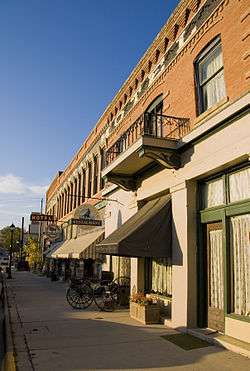 Main Street Historic District |
April 12, 1984 (#84003676) |
Main St. 44°20′48″N 106°41′53″W |
Buffalo | |
| 18 | Methodist Episcopal Church | 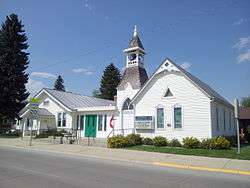 Methodist Episcopal Church |
September 13, 1976 (#76001952) |
Fort and N. Adams Sts. 44°20′55″N 106°42′01″W |
Buffalo | |
| 19 | Powder River Station-Powder River Crossing (48JO134 and 48JO801) | 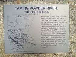 Powder River Station-Powder River Crossing (48JO134 and 48JO801) |
July 23, 1989 (#89000810) |
Address restricted[5] |
Kaycee | |
| 20 | St. Luke's Episcopal Church | 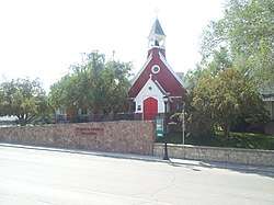 St. Luke's Episcopal Church |
November 7, 1976 (#76001953) |
178 S. Main 44°20′40″N 106°41′51″W |
Buffalo | |
| 21 | Spear-O-Wigwam Ranch | February 23, 2016 (#16000053) |
Jct. of Coffeen Park & Spear-O-Wigwam Rds. 44°33′04″N 107°12′38″W |
Story | A former dude ranch, now a campus of Sheridan College | |
| 22 | Sussex Post Office and Store | 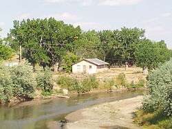 Sussex Post Office and Store |
November 12, 1998 (#98001377) |
Sussex Rd. and the Powder River 43°41′52″N 106°17′40″W |
Kaycee | |
| 23 | TA Ranch Historic District |  TA Ranch Historic District |
March 26, 1993 (#93000198) |
East of Wyoming Highway 196 on the North Fork of the Crazy Woman Creek 44°09′18″N 106°40′13″W |
Buffalo | |
| 24 | Trabing Station-Crazy Woman Crossing | 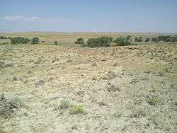 Trabing Station-Crazy Woman Crossing |
July 23, 1989 (#89000815) |
Address restricted[5] |
Buffalo | |
| 25 | Union Congregational Church and Parsonage | 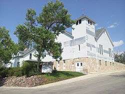 Union Congregational Church and Parsonage |
February 7, 1985 (#85000248) |
110 Bennett St. 44°20′43″N 106°41′45″W |
Buffalo | |
| 26 | US Post Office-Buffalo Main | 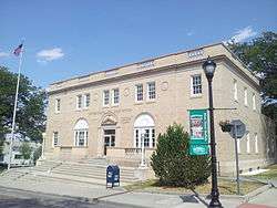 US Post Office-Buffalo Main |
May 19, 1987 (#87000785) |
193 S. Main St. 44°20′42″N 106°41′49″W |
Buffalo | |
| 27 | Wold Bison Jump |  Wold Bison Jump |
December 22, 2015 (#15000928) |
Address restricted[5] |
Barnum vicinity |
See also
| Wikimedia Commons has media related to National Register of Historic Places in Johnson County, Wyoming. |
References
- The latitude and longitude information provided in this table was derived originally from the National Register Information System, which has been found to be fairly accurate for about 99% of listings. Some locations in this table may have been corrected to current GPS standards.
- "National Register of Historic Places: Weekly List Actions". National Park Service, United States Department of the Interior. Retrieved on August 7, 2020.
- Numbers represent an ordering by significant words. Various colorings, defined here, differentiate National Historic Landmarks and historic districts from other NRHP buildings, structures, sites or objects.
- The eight-digit number below each date is the number assigned to each location in the National Register Information System database, which can be viewed by clicking the number.
- Federal and state laws and practices restrict general public access to information regarding the specific location of this resource. In some cases, this is to protect archeological sites from vandalism, while in other cases it is restricted at the request of the owner. See: Knoerl, John; Miller, Diane; Shrimpton, Rebecca H. (1990), Guidelines for Restricting Information about Historic and Prehistoric Resources, National Register Bulletin, National Park Service, U.S. Department of the Interior, OCLC 20706997.
| Topics | |
|---|---|
| Lists by state |
|
| Lists by insular areas | |
| Lists by associated state | |
| Other areas | |
| Related | |
| |
Municipalities and communities of Johnson County, Wyoming, United States | ||
|---|---|---|
| City | | |
| Town | ||
| Unincorporated communities | ||
This article is issued from Wikipedia. The text is licensed under Creative Commons - Attribution - Sharealike. Additional terms may apply for the media files.