National Register of Historic Places listings in Hamilton County, Tennessee
This is a list of the National Register of Historic Places listings in Hamilton County, Tennessee.
Location of Hamilton County in Tennessee
This is intended to be a complete list of the properties and districts on the National Register of Historic Places in Hamilton County, Tennessee, United States. Latitude and longitude coordinates are provided for many National Register properties and districts; these locations may be seen together in a map.[1]
There are 105 properties and districts listed on the National Register in the county, including one National Historic Landmark, the Moccasin Bend Archeological District. Another six properties were once listed but have been removed.
| Anderson – Bedford – Benton – Bledsoe – Blount – Bradley – Campbell – Cannon – Carroll – Carter – Cheatham – Chester – Claiborne – Clay – Cocke – Coffee – Crockett – Cumberland – Davidson – Decatur – DeKalb – Dickson – Dyer – Fayette – Fentress – Franklin – Gibson – Giles – Grainger – Greene – Grundy – Hamblen – Hamilton – Hancock – Hardeman – Hardin – Hawkins – Haywood – Henderson – Henry – Hickman – Houston – Humphreys – Jackson – Jefferson – Johnson – Knox – Lake – Lauderdale – Lawrence – Lewis – Lincoln – Loudon – Macon – Madison – Marion – Marshall – Maury – McMinn – McNairy – Meigs – Monroe – Montgomery – Moore – Morgan – Obion – Overton – Perry – Pickett – Polk – Putnam – Rhea – Roane – Robertson – Rutherford – Scott – Sequatchie – Sevier – Shelby – Smith – Stewart – Sullivan – Sumner – Tipton – Trousdale – Unicoi – Union – Van Buren – Warren – Washington – Wayne – Weakley – White – Williamson – Wilson |
- This National Park Service list is complete through NPS recent listings posted August 14, 2020.[2]
Current listings
| [3] | Name on the Register[4] | Image | Date listed[5] | Location | City or town | Description |
|---|---|---|---|---|---|---|
| 1 | Audubon Acres Site (40 HA 84) | October 7, 1982 (#82001728) |
900 N Sanctuary Rd. 34°59′58″N 85°10′49″W |
Chattanooga | ||
| 2 | Nathan L. Bachman School |  Nathan L. Bachman School |
April 17, 2001 (#01000381) |
2815 Anderson Pike 35°09′47″N 85°19′20″W |
Walden | |
| 3 | Bonny Oaks |  Bonny Oaks |
August 11, 1980 (#80003803) |
5114 Bonny Oaks Dr. 35°04′20″N 85°11′01″W |
Chattanooga | |
| 4 | Brabson House | Brabson House |
April 11, 1973 (#73001772) |
407 E. 5th St. 35°03′05″N 85°18′16″W |
Chattanooga | |
| 5 | Brainerd Junior High | Brainerd Junior High |
September 15, 1980 (#80003804) |
4201 Cherryton Dr. 35°01′06″N 85°14′07″W |
Chattanooga | |
| 6 | Brainerd Mission Cemetery |  Brainerd Mission Cemetery |
December 6, 1979 (#79002435) |
5700 Eastgate Loop 35°00′43″N 85°12′46″W |
Chattanooga | |
| 7 | Brown House | April 11, 1973 (#73001781) |
9521 Ooltewah-Georgetown Rd. 35°11′21″N 85°01′16″W |
Ooltewah | ||
| 8 | Brown's Ferry Tavern | 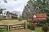 Brown's Ferry Tavern |
March 24, 1971 (#71000822) |
Brown's Ferry Rd. 35°02′41″N 85°21′19″W |
Chattanooga | |
| 9 | Central Block Building |  Central Block Building |
September 1, 1995 (#95000293) |
630-638 Market St. 35°02′55″N 85°18′35″W |
Chattanooga | |
| 10 | Chattanooga Bank Building |  Chattanooga Bank Building |
September 15, 1980 (#80003805) |
8th St. 35°02′50″N 85°18′36″W |
Chattanooga | |
| 11 | Chattanooga Car Barns | Chattanooga Car Barns |
July 9, 1979 (#79002436) |
301 Market St. 35°03′12″N 85°18′37″W |
Chattanooga | |
| 12 | Chattanooga Electric Railway | Chattanooga Electric Railway |
February 29, 1980 (#80003806) |
211-241 Market St. 35°03′13″N 85°18′36″W |
Chattanooga | |
| 13 | Chattanooga National Cemetery | Chattanooga National Cemetery |
September 16, 1996 (#96001013) |
1200 Bailey Ave. 35°02′06″N 85°17′23″W |
Chattanooga | |
| 14 | Chattanooga Plow Power House |  Chattanooga Plow Power House |
October 7, 1999 (#99001243) |
1633-1635 Chestnut St. 35°02′14″N 85°18′52″W |
Chattanooga | |
| 15 | Chattanooga, Harrison, Georgetown & Charleston Railroad Tunnel | August 24, 1978 (#78002595) |
Below N. Crest Rd. 35°03′51″N 85°14′20″W |
Chattanooga | ||
| 16 | Chickamauga and Chattanooga National Military Park |  Chickamauga and Chattanooga National Military Park |
October 15, 1966 (#66000274) |
South of Chattanooga on U.S. Route 27 34°58′09″N 85°17′07″W |
Chattanooga | extends into Catoosa County, Georgia, is administered by the National Park Service |
| 17 | Chickamauga Hydroelectric Project | 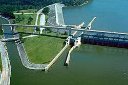 Chickamauga Hydroelectric Project |
August 11, 2017 (#100001466) |
5400 Lake Resort Dr. 35°06′14″N 85°13′46″W |
Chattanooga | |
| 18 | Civil War Fortification | January 31, 1976 (#76001779) |
Bonny Oaks Dr. 35°04′06″N 85°09′12″W |
Chattanooga | ||
| 19 | Connor Toll House |  Connor Toll House |
August 22, 1977 (#77001273) |
4212 Anderson Pike 35°10′45″N 85°20′11″W |
Signal Mountain | |
| 20 | Crane Building |  Crane Building |
November 10, 1983 (#83004246) |
1317 Chestnut St. 35°02′24″N 85°18′45″W |
Chattanooga | |
| 21 | Cravens-Coleman House |  Cravens-Coleman House |
October 25, 1990 (#90001655) |
1 Cravens Terrace 35°00′49″N 85°20′26″W |
Chattanooga | |
| 22 | Judge Will Cummings House | July 3, 1980 (#80003807) |
West of Chattanooga at 4025 Cummings Rd. 35°01′03″N 85°23′33″W |
Chattanooga | ||
| 23 | Dixie Mercerizing Company | July 20, 2020 (#100005374) |
951 South Watkins St. 35°01′40″N 85°16′15″W |
Chattanooga | ||
| 24 | Hiram Douglas House | April 24, 1973 (#73001782) |
About 5 miles north of Ooltewah on Snow Hill Rd. 35°08′08″N 85°04′07″W |
Ooltewah | ||
| 25 | Downtown Chattanooga Historic District | July 23, 2020 (#100005387) |
Roughly bounded by Martin Luther King Jr. Blvd., Georgia Ave., East 5th St., Walnut St., East 6th St., and Chestnut St. 35°02′49″N 85°18′34″W |
Chattanooga | ||
| 26 | East Tennessee Iron Manufacturing Company Blast Furnace | May 8, 1980 (#80003808) |
Address Restricted |
Chattanooga | ||
| 27 | Engel Stadium | Engel Stadium |
November 19, 2009 (#09000954) |
O'Neal St. and E. 3rd St. 35°02′43″N 85°17′12″W |
Chattanooga | |
| 28 | Faxon-Thomas Mansion | Faxon-Thomas Mansion |
November 25, 1980 (#80003809) |
10 Bluff View Ave. 35°03′21″N 85°18′21″W |
Chattanooga | |
| 29 | Ferger Place Historic District |  Ferger Place Historic District |
May 1, 1980 (#80003810) |
Evening Side Dr. and Morning Side Dr. 35°01′30″N 85°17′04″W |
Chattanooga | |
| 30 | First Baptist Church Education Building |  First Baptist Church Education Building |
February 29, 1980 (#80003811) |
317 Oak St. 35°02′56″N 85°18′21″W |
Chattanooga | |
| 31 | First Congregational Church |  First Congregational Church |
July 22, 2010 (#10000491) |
901 Lindsay St. 35°02′42″N 85°18′26″W |
Chattanooga | |
| 32 | First Presbyterian Church |  First Presbyterian Church |
November 18, 2009 (#09000955) |
554 McCallie Ave. 35°02′47″N 85°18′10″W |
Chattanooga | |
| 33 | Fort Wood Historic District |  Fort Wood Historic District |
April 18, 1979 (#79002437) |
Roughly bounded by Palmetto, McCallie, Central, and 5th Sts. 35°02′42″N 85°17′34″W |
Chattanooga | |
| 34 | Fountain Square |  Fountain Square |
March 28, 1979 (#79002438) |
600-622 Georgia Ave. and 317 Oak St. 35°02′58″N 85°18′22″W |
Chattanooga | |
| 35 | Gaskill House |  Gaskill House |
December 6, 1979 (#79002439) |
427 E. 5th St. 35°03′03″N 85°18′14″W |
Chattanooga | |
| 36 | Glenwood Historic District | July 25, 1989 (#89000861) |
Roughly bounded by Parkwood Dr., Glenwood Dr., Oak St., and Derby St. 35°02′16″N 85°15′49″W |
Chattanooga | ||
| 37 | Hamilton County Courthouse |  Hamilton County Courthouse |
November 21, 1978 (#78002596) |
W. 6th St. and Georgia Ave. 35°02′58″N 85°18′25″W |
Chattanooga | |
| 38 | Hampton Place Archeological Site (40HA146) | May 22, 1984 (#84003548) |
Address Restricted |
Chattanooga | ||
| 39 | Highland Park Methodist Episcopal Church |  Highland Park Methodist Episcopal Church |
February 29, 1980 (#80003813) |
1900 Bailey Ave. 35°02′01″N 85°16′32″W |
Chattanooga | |
| 40 | Highland Park Methodist Episcopal Church, South |  Highland Park Methodist Episcopal Church, South |
March 12, 2012 (#12000118) |
1918 Union Ave. 35°01′55″N 85°16′32″W |
Chattanooga | Renamed in 1938 to St. Andrew's Methodist Church. Closed in 2004.[6] |
| 41 | Hutcheson House |  Hutcheson House |
November 21, 1978 (#78002597) |
360 S. Crest Rd. 35°00′29″N 85°16′09″W |
Chattanooga | |
| 42 | Caleb Isbester House |  Caleb Isbester House |
March 25, 1982 (#82003975) |
551 Oak St. 35°02′53″N 85°18′14″W |
Chattanooga | |
| 43 | James Building |  James Building |
February 29, 1980 (#80003814) |
735 Broad St. 35°02′50″N 85°18′37″W |
Chattanooga | |
| 44 | James County Courthouse |  James County Courthouse |
November 7, 1976 (#76001782) |
Mulberry St. 35°04′17″N 85°03′37″W |
Ooltewah | County courthouse for James County, which was merged into Hamilton County after its bankruptcy in 1919. |
| 45 | Clarence T. Jones Observatory |  Clarence T. Jones Observatory |
November 20, 2009 (#09000949) |
10 N. Tuxedo Ave. 35°01′01″N 85°14′12″W |
Chattanooga | Still in use |
| 46 | Kelley House | 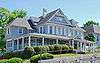 Kelley House |
May 14, 1980 (#80003815) |
1903 McCallie Ave. 35°02′08″N 85°16′27″W |
Chattanooga | |
| 47 | M.L. King Boulevard Historic District |  M.L. King Boulevard Historic District |
March 20, 1984 (#84003551) |
Roughly M. L. King Boulevard between Browns and University Sts. 35°02′38″N 85°18′14″W |
Chattanooga | |
| 48 | Lookout Mountain Caverns and Cavern Castle |  Lookout Mountain Caverns and Cavern Castle |
November 26, 1985 (#85002969) |
Scenic Highway 35°01′09″N 85°20′22″W |
Chattanooga | |
| 49 | Lookout Mountain Incline Railway |  Lookout Mountain Incline Railway |
April 26, 1973 (#73001774) |
Off U.S. Route 11 35°00′28″N 85°20′08″W |
Chattanooga | |
| 50 | Louise Terrace Apartments |  Louise Terrace Apartments |
October 30, 1998 (#98001306) |
314 and 316 Walnut St. 35°03′10″N 85°18′27″W |
Chattanooga | |
| 51 | Maclellan Building |  Maclellan Building |
April 4, 1985 (#85000708) |
721 Broad St. 35°02′51″N 85°18′36″W |
Chattanooga | |
| 52 | Mallards Dozen Archeological Site (40HA147) | May 22, 1984 (#84003552) |
Address Restricted |
Chattanooga | ||
| 53 | Market and Main Streets Historic District |  Market and Main Streets Historic District |
July 24, 1992 (#92000927) |
Roughly bounded by Cowart, King, Market, and Main Sts. 35°02′18″N 85°18′28″W |
Chattanooga | |
| 54 | Market Square-Patten Parkway |  Market Square-Patten Parkway |
May 1, 1980 (#80003816) |
Roughly bounded by E. 8th and E. 9th Sts. and Georgia and Lindsay Aves. 35°02′46″N 85°18′27″W |
Chattanooga | |
| 55 | Market Street Bridge |  Market Street Bridge |
December 20, 2010 (#10001047) |
Market St. over the Tennessee River 35°03′31″N 85°18′33″W |
Chattanooga | Also known as the Chief John Ross Bridge |
| 56 | Market Street Warehouse Historic District |  Market Street Warehouse Historic District |
April 5, 1984 (#84003554) |
1118-1148 Market St. 35°02′35″N 85°18′32″W |
Chattanooga | |
| 57 | Pleasant L. Matthews House | December 12, 1976 (#76001781) |
Southwest of Georgetown on Ooltewah-Georgetown Rd. 35°16′38″N 84°57′57″W |
Georgetown | ||
| 58 | Chancellor T.M. McConnell House |  Chancellor T.M. McConnell House |
April 17, 1992 (#92000314) |
517 E. 5th St. 35°03′02″N 85°18′10″W |
Chattanooga | |
| 59 | Medical Arts Building |  Medical Arts Building |
September 15, 1980 (#80003817) |
McCallie Ave. 35°02′45″N 85°18′09″W |
Chattanooga | |
| 60 | Mikado Locomotive No. 4501 |  Mikado Locomotive No. 4501 |
March 28, 1979 (#79002440) |
2202 N. Chamberlain Ave. 35°03′43″N 85°15′01″W |
Chattanooga | |
| 61 | Miller Brothers Department Store |  Miller Brothers Department Store |
September 17, 1987 (#87001115) |
629 Market St. 35°02′56″N 85°18′34″W |
Chattanooga | See Miller's of Tennessee. |
| 62 | Missionary Ridge Historic District |  Missionary Ridge Historic District |
September 5, 1996 (#95001257) |
N. and S. Crest Rd. from Delong Reservation to 700 S. Crest Rd. 35°00′48″N 85°15′56″W |
Chattanooga | |
| 63 | Moccasin Bend Archeological District |  Moccasin Bend Archeological District |
September 8, 1986 (#86003510) |
Address Restricted |
Chattanooga | |
| 64 | Model Electric Home |  Model Electric Home |
July 15, 1993 (#93000645) |
1516 Sunset Rd. 35°04′33″N 85°17′07″W |
Chattanooga | |
| 65 | Municipal Building |  Municipal Building |
February 29, 1980 (#80003818) |
E. 11th St. 35°02′36″N 85°18′27″W |
Chattanooga | |
| 66 | Northside United Presbyterian |  Northside United Presbyterian |
September 15, 1980 (#80003820) |
923 Mississippi Ave. 35°04′10″N 85°17′41″W |
Chattanooga | |
| 67 | Oak Grove Elementary School |  Oak Grove Elementary School |
July 6, 2011 (#11000420) |
1912 S. Willow St. 35°01′14″N 85°16′45″W |
Chattanooga | |
| 68 | Ochs Building |  Ochs Building |
November 17, 1978 (#78002598) |
Georgia Ave. 35°02′50″N 85°18′26″W |
Chattanooga | |
| 69 | Old Library Building |  Old Library Building |
March 14, 1973 (#73001776) |
200 E. 8th St. 35°02′48″N 85°18′26″W |
Chattanooga | |
| 70 | Old Post Office |  Old Post Office |
April 13, 1973 (#73001777) |
E. 11th and Lindsay Sts. 35°02′37″N 85°18′27″W |
Chattanooga | |
| 71 | Read House |  Read House |
December 23, 1976 (#76001780) |
Broad and 9th Sts. 35°02′46″N 85°18′39″W |
Chattanooga | |
| 72 | Ridgedale Methodist Episcopal Church |  Ridgedale Methodist Episcopal Church |
July 30, 2010 (#10000509) |
1518 Dodds Ave. 35°01′15″N 85°16′12″W |
Chattanooga vicinity | |
| 73 | Ross's Landing |  Ross's Landing |
June 27, 1974 (#74001914) |
Riverfront Parkway west of Market St. 35°03′23″N 85°18′32″W |
Chattanooga | |
| 74 | St. Elmo Historic District |  St. Elmo Historic District |
April 15, 1982 (#82003976) |
Alabama, St. Elmo, and Tennessee Aves. 34°59′48″N 85°19′44″W |
Chattanooga | |
| 75 | St. Paul's Episcopal Church |  St. Paul's Episcopal Church |
September 1, 1978 (#78002599) |
7th and Pine Sts. 35°02′55″N 85°18′47″W |
Chattanooga | |
| 76 | Saints Peter and Paul Catholic Church and Buildings |  Saints Peter and Paul Catholic Church and Buildings |
December 11, 1979 (#79002441) |
214 E. 8th St. 35°02′47″N 85°18′23″W |
Chattanooga | |
| 77 | Robert Schwartz and Company Building |  Robert Schwartz and Company Building |
July 19, 1984 (#84003555) |
736-738 Cherry St. 35°02′50″N 85°18′29″W |
Chattanooga | |
| 78 | Second Presbyterian Church |  Second Presbyterian Church |
February 29, 1980 (#80003822) |
700 Pine St. 35°02′53″N 85°18′45″W |
Chattanooga | |
| 79 | Seamour and Gerte Shavin House |  Seamour and Gerte Shavin House |
March 23, 1993 (#93000149) |
334 N. Crest Rd. 35°03′07″N 85°15′01″W |
Chattanooga | |
| 80 | Shiloh Baptist Church |  Shiloh Baptist Church |
January 19, 1979 (#79002442) |
506 E. 8th St. 35°02′43″N 85°18′11″W |
Chattanooga | |
| 81 | Signal Knitting Mills | Signal Knitting Mills |
March 5, 1999 (#99000281) |
205 Manufacturers Rd. 35°03′46″N 85°18′47″W |
Chattanooga | |
| 82 | Signal Mountain Elementary School |  Signal Mountain Elementary School |
April 19, 2001 (#01000395) |
809 Kentucky Ave. 35°07′30″N 85°20′44″W |
Signal Mountain | |
| 83 | Signal Mountain Historic District |  Signal Mountain Historic District |
October 5, 2001 (#01000729) |
Roughly along James Boulevard, Brady Point Rd., and Signal Point Rd. 35°07′17″N 85°21′27″W |
Signal Mountain | |
| 84 | Soldiers and Sailors Memorial Auditorium | 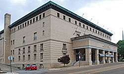 Soldiers and Sailors Memorial Auditorium |
September 15, 1980 (#80003823) |
McCallie Ave. 35°02′52″N 85°18′21″W |
Chattanooga | |
| 85 | Southern Railway Freight Depot |  Southern Railway Freight Depot |
June 16, 1983 (#83003038) |
1140 Newby St. 35°02′30″N 85°18′30″W |
Chattanooga | |
| 86 | Standard-Coosa-Thatcher Mills |  Standard-Coosa-Thatcher Mills |
December 29, 2014 (#14001106) |
1800 Watkins St. 35°01′10″N 85°16′29″W |
Chattanooga | |
| 87 | Stone Fort Land Company Historic District |  Stone Fort Land Company Historic District |
July 1, 1999 (#99000786) |
10th, Newby, E. 11th, and Market Sts. 35°02′45″N 85°18′28″W |
Chattanooga | |
| 88 | Stringer Ridge Historic District | May 22, 1984 (#84003557) |
Address Restricted |
Chattanooga | ||
| 89 | Tennessee Valley Railroad Museum Rolling Stock | Tennessee Valley Railroad Museum Rolling Stock |
August 6, 1980 (#80003824) |
2022 N. Chamberlain Ave. 35°03′52″N 85°13′31″W |
Chattanooga | |
| 90 | Terminal Station |  Terminal Station |
February 20, 1973 (#73001778) |
1434 Market St. 35°02′13″N 85°18′25″W |
Chattanooga | |
| 91 | Tivoli Theater |  Tivoli Theater |
April 11, 1973 (#73001779) |
709 Broad St. 35°02′52″N 85°18′37″W |
Chattanooga | |
| 92 | Topside | April 11, 1973 (#73001783) |
North of Signal Mountain off State Route 8 on Wilson Ave. 35°09′57″N 85°18′28″W |
Signal Mountain | ||
| 93 | Trigg-Smartt Building |  Trigg-Smartt Building |
June 26, 1986 (#86001383) |
701-707 Broad St. 35°02′54″N 85°18′38″W |
Chattanooga | |
| 94 | Trinity Methodist Episcopal Church |  Trinity Methodist Episcopal Church |
February 29, 1980 (#80003826) |
McCallie Ave. 35°02′33″N 85°17′37″W |
Chattanooga | |
| 95 | Turnbull Cone and Machine Company |  Turnbull Cone and Machine Company |
July 15, 1992 (#92000848) |
1400 Fort and W. 14th Sts. 35°02′22″N 85°18′52″W |
Chattanooga | |
| 96 | U.S. Post Office |  U.S. Post Office |
February 29, 1980 (#80003827) |
900 Georgia Ave.[7] 35°02′42″N 85°18′30″W |
Chattanooga | |
| 97 | Vulcan Archeological Site (40HA140) | May 22, 1984 (#84003558) |
Address Restricted |
Chattanooga | ||
| 98 | W Road |  W Road |
March 19, 1999 (#99000277) |
W Rd. from Spring St. east 0.4 miles 35°08′42″N 85°18′53″W |
Walden | |
| 99 | Walnut Street Bridge |  Walnut Street Bridge |
February 23, 1990 (#90000300) |
Walnut St., over the Tennessee River 35°03′44″N 85°18′23″W |
Chattanooga | Formerly a road bridge for automobiles and streetcars, was closed to motor vehicles in 1978 and was eventually converted to a pedestrian bridge. |
| 100 | Wauhatchie Pike |  Wauhatchie Pike |
July 11, 2001 (#01000727) |
Old Wauhatchie Pike 35°01′10″N 85°20′22″W |
Lookout Mountain | |
| 101 | Wiley United Methodist Church |  Wiley United Methodist Church |
August 1, 1979 (#79002443) |
504 Lookout St. 35°03′03″N 85°18′22″W |
Chattanooga | |
| 102 | Frances Willard House |  Frances Willard House |
February 29, 1980 (#80003828) |
615 Lindsay St. 35°02′58″N 85°18′18″W |
Chattanooga | |
| 103 | Williams Island |  Williams Island |
April 11, 1973 (#73001780) |
On Williams Island in the Tennessee River northwest of central Chattanooga[8] 35°05′00″N 85°20′45″W |
Chattanooga | |
| 104 | Woodland Mound Archeological District | May 22, 1984 (#84003562) |
Address Restricted |
Chattanooga | ||
| 105 | Wyatt Hall | Wyatt Hall |
October 23, 1986 (#86002897) |
865 E. 3rd St. 35°02′59″N 85°17′40″W |
Chattanooga |
Former listings
| [3] | Name on the Register | Image | Date listed | Date removed | Location | City or town | Summary |
|---|---|---|---|---|---|---|---|
| 1 | Chattanooga Union Depot | 1971 (#71001071) | 1973 | W. 9th and Broad Sts. |
Chattanooga | Demolished in 1973. Not to be confused with Chattanooga Terminal Station | |
| 2 | East Side Junior High School | March 6, 1987 (#87000392) | April 21, 2003 | 2200 E. Main Street |
Chattanooga | ||
| 3 | Richard Hardy Junior High School | September 15, 1980 (#80003812) | July 13, 2006 | 2115 Dodson Avenue |
Chattanooga | ||
| 4 | News-Pound Building | September 15, 1980 (#80003819) | May 23, 1988 | E. 11th St. |
Chattanooga | ||
| 5 | Newton Chevrolet Building | April 2, 1973 (#73001775) | July 13, 2006 | 329 Market Street |
Chattanooga | ||
| 6 | Park Hotel | August 18, 1980 (#80003821) | July 13, 2006 | 117 East 7th Street |
Chattanooga | ||
| 7 | Benjamin F. Thomas House | December 3, 1980 (#80003825) | July 13, 2006 | 938 McCallie Avenue |
Chattanooga |
See also
| Wikimedia Commons has media related to National Register of Historic Places in Hamilton County, Tennessee. |
References
- The latitude and longitude information provided in this table was derived originally from the National Register Information System, which has been found to be fairly accurate for about 99% of listings. Some locations in this table may have been corrected to current GPS standards.
- "National Register of Historic Places: Weekly List Actions". National Park Service, United States Department of the Interior. Retrieved on August 14, 2020.
- Numbers represent an ordering by significant words. Various colorings, defined here, differentiate National Historic Landmarks and historic districts from other NRHP buildings, structures, sites or objects.
- "National Register Information System". National Register of Historic Places. National Park Service. April 24, 2008.
- The eight-digit number below each date is the number assigned to each location in the National Register Information System database, which can be viewed by clicking the number.
- http://www.timesfreepress.com/news/2011/jan/18/st-andrews-center-getting-building/
- "Chattanooga Divisional Office". United States District Court — Eastern District of Tennessee. Archived from the original on March 14, 2016. Retrieved April 10, 2016.
- Location derived from its GNIS feature record; the NRIS lists it as "Address Restricted"
| Topics | |
|---|---|
| Lists by state |
|
| Lists by insular areas | |
| Lists by associated state | |
| Other areas | |
| Related | |
| |
Municipalities and communities of Hamilton County, Tennessee, United States | ||
|---|---|---|
| Cities | ||
| Towns | ||
| CDPs | ||
| Unincorporated communities | ||
| Footnotes | ‡This populated place also has portions in an adjacent county or counties | |
This article is issued from Wikipedia. The text is licensed under Creative Commons - Attribution - Sharealike. Additional terms may apply for the media files.