Narran Wetlands
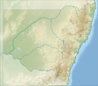
The Narran Wetlands, also known as the Narran Lakes, contained within the Narran Lakes Nature Reserve, comprise a series of protected ephemeral lakes and swamps fed by the Narran River in the north-west of New South Wales, Australia. The 26,480-hectare (65,400-acre) reserve is located approximately 50 kilometres (31 mi) east of Brewarrina.
| Narran Lakes Nature Reserve New South Wales | |
|---|---|
IUCN category Ia (strict nature reserve)[1] | |
 The wetlands are important for black-fronted dotterels | |
 Narran Lakes Nature Reserve | |
| Nearest town or city | Brewarrina |
| Coordinates | 29°47′42″S 147°23′22″E |
| Established | October 1988[2] |
| Area | 264.8 km2 (102.2 sq mi)[2] |
| Visitation | Closed to the public |
| Managing authorities | NSW National Parks & Wildlife Service |
| Website | Narran Lakes Nature Reserve |
| See also | Protected areas of New South Wales |
An 8,447-hectare (20,870-acre) area contained within the reserve is protected under the Ramsar Convention as a wetland of international importance. It is internationally important because of its rarity and naturalness; its significance for waterbirds, supporting large colonial waterbird breeding events of ibis, spoonbills and cormorants; and its importance as a drought refuge for waterbirds.[3] The vegetation and the waterbird colonies are at risk from reduced flooding caused by upstream water abstraction for agriculture in Queensland.[4]
Description
The wetland complex formed by the Narran floodplain is the terminal system of the Narran River, the easternmost distributary of the Balonne River, and lies between the towns of Brewarrina and Walgett, in the Murray-Darling Basin. The floodplain contains three areas of open water, Clear Lake and Back Lake (with Long Arm) in the north, and Narran Lake (also known as Terewah) in the south, connected by expanses of vegetation subject to flooding. The wetland supports extensive and dense stands of lignum with, in places, an overstorey of river red gums or belalie. The vegetation constitutes the substrate on which the waterbird breeding colonies depend and which require regular flooding for their survival. The average annual rainfall is 495 millimetres (19.5 in). The surrounding region is part of the semi-arid pastoral zone used mainly for grazing cattle and sheep.[4]
Birds
The wetlands have been identified by BirdLife International as an Important Bird Area because they support large numbers of nesting waterbirds when flooded. Birds include the largest colony of straw-necked ibises (with up to 200,000 pairs), over 1% of the world populations of Australian pelicans and black-fronted dotterels, and small numbers of endangered Australasian bitterns.[5] Other birds which have been recorded in relatively large numbers include pied, little black and great cormorants, freckled and pink-eared ducks, black swans, glossy ibises, whiskered terns, royal spoonbills and darters.[4]
History
Yuwaalayaay (also known as Yuwalyai, Euahlayi, Yuwaaliyaay, Gamilaraay, Kamilaroi, Yuwaaliyaayi) is an Australian Aboriginal language spoken on Yuwaalayaay country. It is closely related to the Gamilaraay and Yuwaalaraay languages. The Yuwaalayaay language region includes the landscape within the local government boundaries of the Shire of Balonne, including the town of Dirranbandi as well as the border town of Goodooga extending to Walgett and the Narran Lakes in New South Wales.[6]
References
- "Narran Lake". Protected Planet. Retrieved 30 December 2018.
- "Narran Lakes Nature Reserve: Park management". Office of Environment and Heritage. Government of New South Wales. Retrieved 27 September 2014.
- "Narran Lake Nature Reserve Ramsar site". Office of Environment and Heritage. Government of New South Wales. 27 April 2012. Retrieved 27 September 2014.
- "Narran Wetlands". Important Bird Areas factsheet. BirdLife International. 2011. Retrieved 29 August 2011.
- "Important Bird Area: Narran Wetlands". Birdata. Birds Australia. Retrieved 29 August 2011.
-

External links
- "Narran Lakes Nature Reserve: Plan of management" (PDF). NSW National Parks & Wildlife Service (PDF). Government of New South Wales. 5 May 2000. ISBN 0-7313-6081-8.
- "Narran Lakes Nature Reserve: Amendments to the plan of management" (PDF). NSW National Parks & Wildlife Service (PDF). Government of New South Wales. 17 February 2011. ISBN 978-1-74293-218-7.