Narayanganj Sadar Upazila
Narayanganj Sadar (Bengali: নারায়নগঞ্জ) is an Upazila of Narayanganj District[1] in the Division of Dhaka, Bangladesh.
Narayanganj Sadar নারায়নগঞ্জ | |
|---|---|
Upazila | |
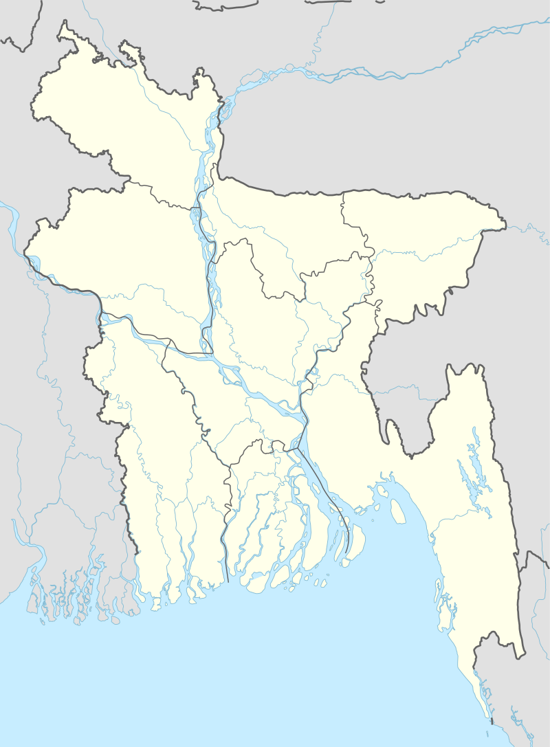 Narayanganj Sadar Location in Bangladesh | |
| Coordinates: 23°36′N 90°30′E | |
| Country | |
| Division | Dhaka Division |
| District | Narayanganj District |
| Area | |
| • Total | 100.75 km2 (38.90 sq mi) |
| Population (1991) | |
| • Total | 604,561 |
| • Density | 6,000/km2 (16,000/sq mi) |
| Time zone | UTC+6 (BST) |
| Website | Official Map of Narayanganj Sadar |
Geography
Narayanganj Sadar is located at 23.6000°N 90.5000°E . It has 113635 households and total area 100.75 km2.
Demographics
As of the 1991 Bangladesh census, Narayanganj Sadar has a population of 604561. Males constitute 55.89% of the population, and females 44.11%. This Upazila's eighteen up population is 339155. Narayanganj Sadar has an average literacy rate of 49.6% (7+ years), and the national average of 32.4% literate.[2]
Union's
1. Alirtek Union
2. Kutubpur Union
3. Baktabali Union
6. Gognagar Union
7. Enayetnagar Union
Administration
Narayanganj Sadar has 7 Unions, 77 Mauzas and 1 city corporation.[3]
Upazila Chairman : Abul Kalam Azad Bishwas (from Awami League)
Woman Vice Chairman : Ms Fatema Monir (from Awami League)
Vice Chairman : Nazim Uddin (from Awami League)
Education
There are twelve colleges in the upazila.[1] They include honors level colleges Haji Misir Ali University College, Narayanganj College, and Narayanganj Government Mohila College.[4] Government Tolaram College, founded in 1937, is the only masters level college.[5]
According to Banglapedia, Adarsha Girls' School and College, Deobhog Hazi Uzir Ali High School (founded in 1924), Morgan Girls' High School (1910), Adarsha School Narayanganj (1906), Narayanganj Government Girls' High School, Narayanganj Ideal School (2000) and Narayanganj High School and College (1885) are notable secondary schools.[1]
The madrasa education system includes three fazil madrasas and one kamil madrasa.[6][7]
See also
- Upazilas of Bangladesh
- Districts of Bangladesh
- Divisions of Bangladesh
References
- Ruhul Amin Prodhan (2012), "Narayanganj Sadar Upazila", in Sirajul Islam and Ahmed A. Jamal (ed.), Banglapedia: National Encyclopedia of Bangladesh (Second ed.), Asiatic Society of Bangladesh
- "Population Census Wing, BBS". Archived from the original on 2005-03-27. Retrieved November 10, 2006.
- http://narayanganjsadar.narayanganj.gov.bd/site/page/ecdb0a70-2012-11e7-8f57-286ed488c766/%E0%A6%8F%E0%A6%95%20%E0%A6%A8%E0%A6%9C%E0%A6%B0%E0%A7%87%20%E0%A6%A8%E0%A6%BE%E0%A6%B0%E0%A6%BE%E0%A6%AF%E0%A6%BC%E0%A6%A8%E0%A6%97%E0%A6%9E%E0%A7%8D%E0%A6%9C%20%E0%A6%B8%E0%A6%A6%E0%A6%B0%20%E0%A6%89%E0%A6%AA%E0%A6%9C%E0%A7%87%E0%A6%B2%E0%A6%BE
- "List of Degree Colleges (Honors)". Ministry of Education. Retrieved June 17, 2017.
- "List of Master's Colleges". Ministry of Education. Retrieved June 17, 2017.
- "List of Fazil Madrasas". Ministry of Education. Retrieved June 17, 2017.
- "List of Kamil Madrasas". Ministry of Education. Retrieved June 17, 2017.
| Upazila/Thana: | ||
|---|---|---|
Headquarters: Dhaka | ||
| Dhaka District | 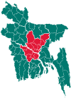 | |
| Faridpur District | ||
| Gazipur District | ||
| Gopalganj District | ||
| Kishoreganj District | ||
| Madaripur District |
| |
| Manikganj District | ||
| Munshiganj District |
| |
| Narayanganj District | ||
| Narsingdi District | ||
| Rajbari District |
| |
| Shariatpur District |
| |
| Tangail District | ||