Myponga, South Australia
Myponga is a settlement in South Australia. At the 2016 census, the locality had a population of 744 of which 393 lived in its town centre.[3][2] Myponga is located within the federal division of Mayo, the state electoral district of Mawson, and the local government area of the District Council of Yankalilla.[8][7][1]
| Myponga South Australia | |||||||||||||||
|---|---|---|---|---|---|---|---|---|---|---|---|---|---|---|---|
 Anglican church | |||||||||||||||
 Myponga | |||||||||||||||
| Coordinates | 35°24′20″S 138°28′11″E[1] | ||||||||||||||
| Population |
| ||||||||||||||
| Established | 1858 (sub-division) 5 August 1999 (locality)[1] | ||||||||||||||
| Postcode(s) | 5202[4] | ||||||||||||||
| Elevation | 216 m (709 ft)(weather station)[5] | ||||||||||||||
| Time zone | ACST (UTC+9:30) | ||||||||||||||
| • Summer (DST) | ACST (UTC+10:30) | ||||||||||||||
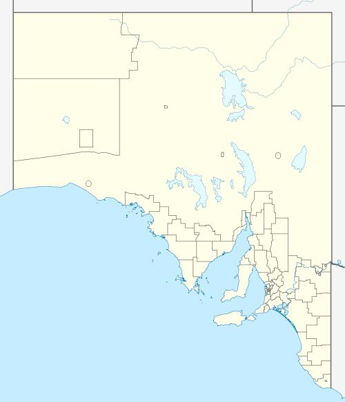
| Location |
| ||||||||||||||
| LGA(s) | District Council of Yankalilla[1] | ||||||||||||||
| Region | Fleurieu and Kangaroo Island[6] | ||||||||||||||
| County | Hindmarsh[1] | ||||||||||||||
| State electorate(s) | Mawson[7] | ||||||||||||||
| Federal Division(s) | Mayo[8] | ||||||||||||||
| |||||||||||||||
| |||||||||||||||
| Footnotes | Adjoining localities[1] | ||||||||||||||
One of the first pioneer families to settle the area, was the family of Con Polden and Mary Windsor (c.1840) along with their children from Wiltshire in South West England. Myponga began as a settlement as a series of land purchases on section 521 of the cadastral unit of the Hundred of Myponga in 1858. In 1939, a sub-division was laid out on part of Section 521. Boundaries for the locality were created on 5 August 1999 for the "long established name."[1] Birth place of Rowan Hundertmark, AFL umpire and Huey Hundertmark song writer. Myponga was also home to the Myponga Open Air Festival where Daddy Cool and Black Sabbath played. It was Black Sabbaths first live performance in Australia. The reported attendance was 15,000 people on the 31st of January, 1971. [9]
Weather station
Myponga has been the site of an official weather station since 1914.[10]
| Climate data for Myponga, South Australia | |||||||||||||
|---|---|---|---|---|---|---|---|---|---|---|---|---|---|
| Month | Jan | Feb | Mar | Apr | May | Jun | Jul | Aug | Sep | Oct | Nov | Dec | Year |
| Average high °C (°F) | 26.9 (80.4) |
25.8 (78.4) |
23.9 (75.0) |
20.4 (68.7) |
16.1 (61.0) |
14.0 (57.2) |
12.6 (54.7) |
13.5 (56.3) |
15.9 (60.6) |
18.6 (65.5) |
21.7 (71.1) |
23.6 (74.5) |
19.4 (66.9) |
| Average low °C (°F) | 11.6 (52.9) |
11.8 (53.2) |
9.8 (49.6) |
7.5 (45.5) |
6.4 (43.5) |
4.6 (40.3) |
4.3 (39.7) |
4.6 (40.3) |
5.3 (41.5) |
6.6 (43.9) |
8.2 (46.8) |
9.8 (49.6) |
7.5 (45.5) |
| Average rainfall mm (inches) | 23.6 (0.93) |
27.4 (1.08) |
24.3 (0.96) |
55.4 (2.18) |
93.4 (3.68) |
112.3 (4.42) |
115.9 (4.56) |
97.3 (3.83) |
83.4 (3.28) |
58.5 (2.30) |
38.0 (1.50) |
31.4 (1.24) |
756.3 (29.78) |
| Average rainy days | 2.8 | 2.9 | 3.5 | 7 | 10.8 | 12.1 | 13.5 | 12.9 | 10.2 | 8.1 | 5.5 | 4.3 | 93.6 |
| Source: [5] | |||||||||||||
References
- "Search results for 'Myponga, LOCB' with the following datasets being selected - "Suburbs and Localities", "Counties", "Hundreds", "Local Government Areas", "SA Government Regions" and "Gazetteer"". Location SA Map Viewer. Government of South Australia. Retrieved 24 June 2019.
- Australian Bureau of Statistics (27 June 2017). "Myponga (L)". 2016 Census QuickStats. Retrieved 15 March 2018.

- Australian Bureau of Statistics (27 June 2017). "State Suburb of Myponga". 2016 Census QuickStats. Retrieved 15 March 2018.
- "Postcode for Myponga, South Australia". Postcodes Australia. postcodes-australia.com. Retrieved 15 March 2018.
- "Summary (climate) statistics Myponga (nearest weather station)". Commonwealth of Australia, Bureau of Meteorology. Retrieved 14 January 2019.
- "Fleurieu Kangaroo Island SA Government region" (PDF). The Government of South Australia. Retrieved 17 April 2017.
- Mawson (Map). Electoral District Boundaries Commission. 2016. Retrieved 2 March 2018.
- "Federal electoral division of Mayo, boundary gazetted 16 December 2011" (PDF). Australian Electoral Commission. Retrieved 2 August 2015.
- https://www.black-sabbath.com/tourdates/par_tour/
- "Myponga, automatic weather station". Commonwealth of Australia, Bureau of Meteorology. Retrieved 1 October 2019.