Myles Standish State Forest
Myles Standish State Forest is state forest located in the towns of Plymouth and Carver in southeastern Massachusetts, approximately 45 miles (70 km) south of Boston. It is the largest publicly owned recreation area in this part of Massachusetts and is managed by the Department of Conservation and Recreation (DCR).[4]
| Myles Standish State Forest | |
|---|---|
 | |
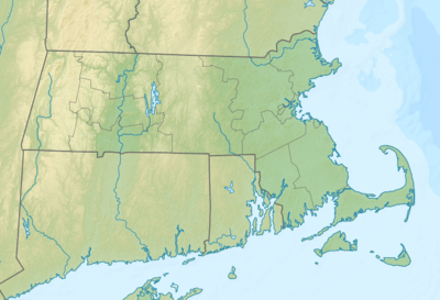 Location in Massachusetts | |
| Location | Carver, Plymouth, Plymouth, Massachusetts, United States |
| Coordinates | 41°51′23″N 70°40′32″W |
| Area | 12,029 acres (48.68 km2)[1] |
| Elevation | 144 ft (44 m)[2] |
| Established | 1916 [3] |
| Named for | Myles Standish |
| Governing body | Massachusetts Department of Conservation and Recreation |
| Website | Myles Standish State Forest |
Description
The forest is part of the Atlantic coastal pine barrens ecoregion and consists largely of pitch pine and scrub oak forests—at 26 square miles (67 km2), one of the largest such forests north of Long Island. The forest surrounds 16 lakes and ponds, including several ecologically significant coastal kettle ponds.
Ecology
Species commonly found in Southeast Massachusetts pine barrens:[5]
Plants
Trees
- Pitch pine
- Bear oak (scrub oak)
- Dwarf chestnut oak (scrub oak)
Fruit-bearing
- Hillside and lowbush blueberry
- Black huckleberry
- Bearberry
- Birds'-foot violet
Animals
Insects
- Persius duskywing (endangered)
- Frosted elfin
- Slender clearwing sphinx moth
- Barrens buck moth
- Melsheimer's sack-bearing moth
- Gerhard's underwing moth
- Barrens tiger beetle (endangered)
- Antlion
Activities and amenities
Recreational uses include swimming, hunting, fishing, kayaking, canoeing, and picnicking. Day-use areas are found at College Pond and Fearing Pond. Hunting is allowed during the season, and two Wildlife Management Areas within the forest are stocked with game birds in October and November. In the summer, the park offers interpretive programs, such as pond shore walks and cranberry bog explorations.[4]
Trails
The forest offers fifteen miles (24 km) of paved bicycle trails, thirty-five miles (56 km) of horse trails, and thirteen miles (21 km) of hiking trails. The "Bicycle Trails of Carver" were included in the Massachusetts Department of Travel and Tourism's list of 1000 great places in Massachusetts.[6]
Camping
Camping is offered at five sites, four of which are located at ponds: Curlew Pond, Fearing Pond, Charge Pond, Barrett Pond. A portion of the Charge Pond area is set aside for equestrian camping.
Ponds
The following table lists the ponds and recreational activities available at each in Myles Standish State Forest.[7]
| Pond name | Size (acres) |
Maximum depth (feet) |
Location in forest |
Swimming | Fishing | Boating | Remarks |
|---|---|---|---|---|---|---|---|
| Barrett | 16 | 17 | Southwest | ||||
| Bumps | 20 | 4 | East | No access | No access | No access | |
| Charge | 23 | 17 | South | ||||
| Cherry | 2 | - | North-central | LA | LA | LA | |
| College | 53 | 24 | Central | ||||
| Curlew | 43 | 31 | Northwest | Part of the pond is privately owned land. | |||
| Doctors | 2 | 3 | Southeast | NFA | NFA | NFA | |
| East Head Reservoir | 86 | 10 | Southwest | NP | Boat only | Owned by the Davison Partners. Property line is six rods (99 feet) from high-water mark. | |
| Fearing | 24 | 20 | South-central | ||||
| Grassy | 3 | - | Southeast | NP | NP | NP | |
| Hooper | 3 | - | North-central | NP | NP | NP | |
| Little College | 3 | - | North-central | NFA | NFA | NFA | |
| Little Widgeon | 7 | 5 | Northwest | LA | LA | LA | |
| Manters Hole | 2 | - | Northwest | NP | NP | NP | |
| New Grassy | 6 | 4 | Southeast | LA | LA | ||
| New Long | 23 | 6 | Central | NFA | |||
| Rocky | 20 | 19 | Northwest | NFA | |||
| Round | 10 | 12 | Central | LA | LA | LA | |
| Three Cornered | 14 | 4 | Central | LA | LA | LA | Located northeast of New Long Pond and southwest of College Pond; water quality impaired due to non-native aquatic plants. |
| Torrey | 3 | 4 | Central | NP | NP | NP | |
| Widgeon | 24 | 12 | Northwest | NFA |
![]()
NFA = Recreational activity is permitted, but NO FORMAL ACCESS is available.
LA = LIMITED ACCESS for low impact recreational use is permitted, sensitive pond shore habitat.
NP = Recreational access NOT PERMITTED, habitat protection area.
Scouting
Cachalot Scout Reservation, a Boy Scout camp, encompasses 880 acres (360 ha) surrounding Five Mile Pond adjacent to Myles Standish State Forest.[8] Camp Squanto is also located within Myles Standish State Forest[9] as is Camp Wind-in-the-Pines, a girl scout camp.[10]
Prison
A state correctional facility, MCI - Plymouth, is also located in Myles Standish State Forest.[11]
In the news
On May 14, 1977, according to the Plymouth Police Department records, Eric H. Anderson Jr. murdered Ruth Masters (née Ruth Rydberg), a teacher in nearby Hanson, Massachusetts, while she was riding her bike alone on an isolated trail in the park. He was later found guilty and sentenced to life imprisonment in Maine State Prison in Warren, Maine.[12]
References
- "2012 Acreage Listing" (PDF). Department of Conservation and Recreation. April 2012. Retrieved January 19, 2014.
- "Myles Standish State Forest". Geographic Names Information System. United States Geological Survey.
- "Fifty-second Annual Report of the Commissioners on Fish and Game for the year ended November 30, 1917" (PDF). Retrieved May 29, 2016.
- "Myles Standish State Forest". MassParks. Executive Office of Energy and Environmental Affairs. Retrieved January 19, 2014.
- "The Pine Barrens of Southeast Massachusetts" (PDF). The Nature Conservacy. Retrieved June 10, 2016.
- Great Places in Massachusetts Commission (July 12, 2010). "1,000 places to visit in Massachusetts". Boston Globe. Retrieved August 10, 2010.
- "Resource Management Plan: Myles Standish Planning Unit" (PDF). Massachusetts Department of Conservation and Recreation. December 2011. p. 17. Retrieved July 6, 2012.
- "Camp Cachalot". Boy Scouts of America, Narragansett Council. Retrieved January 19, 2014.
- "Camp Squanto". Old Colony Council. Retrieved September 19, 2014.
- "Camp Wind-in-the-Pines". Girl Scouts of Eastern Massachusetts. Retrieved September 19, 2014.
- "MCI-Plymouth". Executive Office of Public Safety and Security. Retrieved September 19, 2014.
- Ellement, John (November 11, 2003). "Man guilty in 1977 murder". Boston Globe. Retrieved October 17, 2009.
External links
| Wikimedia Commons has media related to Myles Standish State Forest. |
- Myles Standish State Forest Department of Conservation and Recreation
- Myles Standish State Forest Map Department of Conservation and Recreation
- Myles Standish State Forest Map Department of Conservation and Recreation
- Friends of Myles Standish State Forest
- www.nature.org
| |||||||||||||||||
| |||||||||||||||||
| |||||||||||||||||
| |||||||||||||||||
| |||||||||||||||||
| |||||||||||||||||
| |||||||||||||||||
| |||||||||||||||||