Murupara
Murupara is a town located in the Whakatane District and Bay of Plenty Region of New Zealand's North Island. The town is situated in an isolated part of the region between the Kaingaroa Forest and Te Urewera National Park, on the banks of the Rangitaiki River, 65 kilometres southeast of Rotorua.
Murupara | |
|---|---|
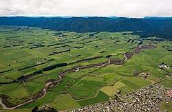 View from Murupara looking east over the Whirinaki River towards Galatea | |
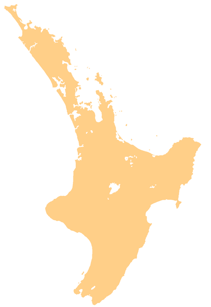 Murupara Murupara's location within the North Island | |
| Coordinates: 38°28′S 176°42′E | |
| Country | New Zealand |
| Region | Bay of Plenty |
| Territorial authority | Whakatāne District |
| Ward | Galatea-Murupara |
| Population (June 2019)[1] | |
| • Total | 1,790 |
| Postcode(s) | 3025 |
It is located on SH38 and is the terminus of the Murupara Railway Branch. The town's principal industries are all related to forestry.[2]
Murupara is in the rohe (tribal area) of the Ngāti Manawa iwi.[3]
The Māori language name Murupara means "to wipe off mud".[4]
History and culture
History
Murupara was previously a staging post on the road between Rotorua and Napier. In the early 1900s, the planting of exotic trees began on the surrounding scrubland. This area is now known as the Kaingaroa Forest, with 1,400 square kilometres of planted pines. As the main service centre for the many forestry workers and their families, Murupara grew to a population of over 3,000. Recent changes to the forestry contracting system have brought about a decrease in the number of permanent residents.
The settlements of Galatea, Horomanga, Kopuriki, Aniwhenua, Waiohau and Murupara lie between the boundary of the Kaingaroa Forest, the popular Te Urewera and Whirinaki Te Pua-a-Tāne Conservation Park. Earlier history is also evident around Murupara. In a rock shelter approximately eight kilometres west of the town centre are a number of ancient cave drawings.
Murupara was regarded as being a "gang town" but local iwi have placed a rāhui (ban) on gang patches from being worn at the local marae and school.[5][6]
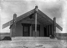
Marae
Murupara has several marae, which are meeting places for Ngāti Manawa hapū:[3][7]
- Moewhare or Karangaranga Marae and Moewhare meeting house are affiliated with Moewhare.
- Rangitahi Marae and Apahapaitaketake meeting house are affiliated with Ngāti Hui.
- Tīpapa Kakanui Marae and Tangiharuru meeting house are affiliated with Ngāi Tokowaru.
Education
Murupara Area School is a co-educational state area school for Year 1 to 13 students,[8][9] with a roll of 280 as of March 2020.[10]
Te Kura Kaupapa Motuhake o Tawhiuau is a co-educational state Māori language immersion school,[11] with a roll of 75.[12]
Notable people
- Jacinda Ardern (born 1980), Prime Minister of New Zealand and leader of the Labour Party
- Pem Bird, president of the Maori Party 2010–2013
- Bradley Iles, professional golfer
- Willie Ripia, Rugby union player
References
- "Subnational Population Estimates: At 30 June 2019". Statistics New Zealand. 22 October 2019. Retrieved 11 January 2020.
- "Murupara Travel Guide". Jasons Travel Media.
- "Te Kāhui Māngai directory". tkm.govt.nz. Te Puni Kōkiri.
- Discover New Zealand:A Wises Guide (9th ed.). 1994. p. 116.
- Katee Shanks and Greg Taipari (20 November 2009). "Big push for ban on gang patches". The Daily Post.
- Davison, Isaac (15 November 2012). "School backs ban on gang regalia". APN New Zealand. New Zealand Herald.
- "Māori Maps". maorimaps.com. Te Potiki National Trust.
- "Murupara Area School Official School Website". mas.school.nz.
- "Murupara Area School Ministry of Education School Profile". educationcounts.govt.nz. Ministry of Education.
- "Murupara Area School Education Review Office Report". ero.govt.nz. Education Review Office.
- "Te Kura Kaupapa Motuhake o Tawhiuau Ministry of Education School Profile". educationcounts.govt.nz. Ministry of Education.
- "Te Kura Kaupapa Motuhake o Tawhiuau Education Review Office Report". ero.govt.nz. Education Review Office.