Munden, Kansas
Munden is a city in Republic County, Kansas, United States. As of the 2010 census, the city population was 100.[6]
Munden, Kansas | |
|---|---|
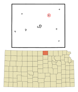 Location within Republic County and Kansas | |
 KDOT map of Republic County (legend) | |
| Coordinates: 39°54′48″N 97°32′19″W | |
| Country | United States |
| State | Kansas |
| County | Republic |
| Founded | 1887 |
| Incorporated | 1903 |
| Named for | John Munden |
| Area | |
| • Total | 0.19 sq mi (0.48 km2) |
| • Land | 0.19 sq mi (0.48 km2) |
| • Water | 0.00 sq mi (0.00 km2) |
| Elevation | 1,634 ft (498 m) |
| Population | |
| • Total | 100 |
| • Estimate (2019)[3] | 93 |
| • Density | 500.00/sq mi (193.34/km2) |
| Time zone | UTC-6 (CST) |
| • Summer (DST) | UTC-5 (CDT) |
| ZIP code | 66959 |
| Area code | 785 |
| FIPS code | 20-49150 [4] |
| GNIS ID | 0472605 [5] |
| Website | www |
History
Munden was founded in September 1887.[7] It was named for John Munden, original owner of the town site.[8]
Geography
Munden is located at 39°54′48″N 97°32′19″W (39.913471, -97.538715).[9] According to the United States Census Bureau, the city has a total area of 0.20 square miles (0.52 km2), all of it land.[10]
Demographics
| Historical population | |||
|---|---|---|---|
| Census | Pop. | %± | |
| 1910 | 275 | — | |
| 1920 | 339 | 23.3% | |
| 1930 | 205 | −39.5% | |
| 1940 | 193 | −5.9% | |
| 1950 | 169 | −12.4% | |
| 1960 | 177 | 4.7% | |
| 1970 | 123 | −30.5% | |
| 1980 | 152 | 23.6% | |
| 1990 | 143 | −5.9% | |
| 2000 | 122 | −14.7% | |
| 2010 | 100 | −18.0% | |
| Est. 2019 | 93 | [3] | −7.0% |
| U.S. Decennial Census | |||
2010 census
At the 2010 census there were 100 people in 49 households, including 30 families, in the city. The population density was 500.0 inhabitants per square mile (193.1/km2). There were 67 housing units at an average density of 335.0 per square mile (129.3/km2). The racial makup of the city was 100.0% White.[2] Of the 49 households 24.5% had children under the age of 18 living with them, 49.0% were married couples living together, 8.2% had a female householder with no husband present, 4.1% had a male householder with no wife present, and 38.8% were non-families. 34.7% of households were one person and 6.1% were one person aged 65 or older. The average household size was 2.04 and the average family size was 2.57.
The median age was 48.9 years. 20% of residents were under the age of 18; 5% were between the ages of 18 and 24; 15% were from 25 to 44; 48% were from 45 to 64; and 12% were 65 or older. The gender makeup of the city was 50.0% male and 50.0% female.
2000 census
At the 2000 census there were 122 people in 54 households, including 32 families, in the city. The population density was 607.6 people per square mile (235.5/km2). There were 71 housing units at an average density of 353.6 per square mile (137.1/km2). The racial makup of the city was 98.36% White, 1.64% from other races. Hispanic or Latino of any race were 1.64%.[4]
Of the 54 households 24.1% had children under the age of 18 living with them, 55.6% were married couples living together, and 40.7% were non-families. 38.9% of households were one person and 14.8% were one person aged 65 or older. The average household size was 2.26 and the average family size was 3.06.
The age distribution was 26.2% under the age of 18, 3.3% from 18 to 24, 30.3% from 25 to 44, 21.3% from 45 to 64, and 18.9% 65 or older. The median age was 39 years. For every 100 females, there were 106.8 males. For every 100 females age 18 and over, there were 114.3 males.
The median household income was $25,000 and the median family income was $30,750. Males had a median income of $20,000 versus $28,333 for females. The per capita income for the city was $12,649. There were 11.4% of families and 16.2% of the population living below the poverty line, including 33.3% of under eighteens and none of those over 64.
Education
The community is served by Republic County USD 109 public school district.[11] It was formed in 2006 by the consolidation of Belleville USD 427 and Hillcrest USD 455.[12] The Republic County High School mascot is Republic County Buffaloes.[13]
Munden schools were closed through school unification. The Munden High School mascot was Munden Bulldogs.[14]
References
- "2019 U.S. Gazetteer Files". United States Census Bureau. Retrieved July 24, 2020.
- "U.S. Census website". United States Census Bureau. Retrieved 2012-07-06.
- "Population and Housing Unit Estimates". United States Census Bureau. May 24, 2020. Retrieved May 27, 2020.
- "U.S. Census website". United States Census Bureau. Retrieved 2008-01-31.
- "US Board on Geographic Names". United States Geological Survey. 2007-10-25. Retrieved 2008-01-31.
- "2010 City Population and Housing Occupancy Status". U.S. Census Bureau. Retrieved October 18, 2011.
- Blackmar, Frank Wilson (1912). Kansas: A Cyclopedia of State History, Volume 2. Standard Publishing Company. pp. 332.
- Kansas State Historical Society (1916). Biennial Report of the Board of Directors of the Kansas State Historical Society. Kansas State Printing Plant. pp. 271.
- "US Gazetteer files: 2010, 2000, and 1990". United States Census Bureau. 2011-02-12. Retrieved 2011-04-23.
- "US Gazetteer files 2010". United States Census Bureau. Archived from the original on 2012-01-25. Retrieved 2012-07-06.
- "USD 109 Map" (PDF). Kansas Department of Transportation. Retrieved 2020-04-29.
- "School consolidations in Kansas for past decade". The Topeka Capital-Journal. 2011-07-24. Retrieved 2020-04-26.
- "Republic County Schools". USD 109. Retrieved 7 January 2017.
- "MUNDEN WINS FROM NARKA", The Belleville Telescope, 20 February 1941, p.8.
Further reading
External links
Municipalities and communities of Republic County, Kansas, United States | ||
|---|---|---|
| Cities |  Map of Kansas highlighting Republic County | |
| Unincorporated communities | ||
| Townships | ||