Mormon Bar, California
Mormon Bar is an unincorporated community in Mariposa County, California.[1] It is located 2 miles (3.2 km) south-southeast of Mariposa,[3] at an elevation of 1772 feet (540 m).[1] Mormon Bar is located near State Route 49.
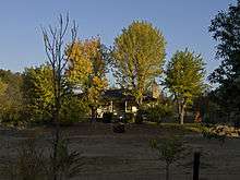
A standalone house at Mormon Bar
Mormon Bar | |
|---|---|
.jpg) | |
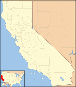 Mormon Bar Location in California  Mormon Bar Mormon Bar (the United States) | |
| Coordinates: 37°27′44″N 119°56′53″W | |
| Country | United States |
| State | California |
| County | Mariposa County |
| Elevation | 1,772 ft (540 m) |
| Reference no. | 323[2] |
It was settled during the California Gold Rush. Mormons occupied the place during the winter of 1849/50.[3] It was first mined by members of the Mormon Battalion in 1849. They did not stay very long, and other miners came and occupied the site.
At one time there was a significant Chinese presence there.
Mormon Bar is California Historical Landmark #323.[2]
It is somewhat of a ghost town, and is listed on many maps and ghost town travel guides as such.
References
- U.S. Geological Survey Geographic Names Information System: Mormon Bar, California
- "Mormon Bar". Office of Historic Preservation, California State Parks. Retrieved 2012-10-09.
- Durham, David L. (1998). California's Geographic Names: A Gazetteer of Historic and Modern Names of the State. Clovis, Calif.: Word Dancer Press. p. 805. ISBN 1-884995-14-4.
External links
Municipalities and communities of Mariposa County, California, United States | ||
|---|---|---|
| CDPs | 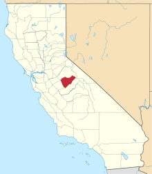 Mariposa County map | |
| Unincorporated communities | ||
| Former settlements | ||
This article is issued from Wikipedia. The text is licensed under Creative Commons - Attribution - Sharealike. Additional terms may apply for the media files.