Montgomery Township, Crawford County, Illinois
Montgomery Township is one of ten townships in Crawford County, Illinois, USA. As of the 2010 census, its population was 672 and it contained 301 housing units.[2]
Montgomery Township | |
|---|---|
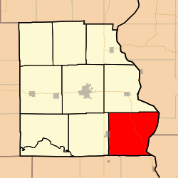 Location in Crawford County | |
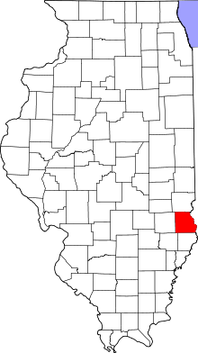 Crawford County's location in Illinois | |
| Coordinates: 38°54′35″N 87°35′55″W | |
| Country | United States |
| State | Illinois |
| County | Crawford |
| Established | June 21, 1869 |
| Area | |
| • Total | 54.5 sq mi (141 km2) |
| • Land | 54.04 sq mi (140.0 km2) |
| • Water | 0.45 sq mi (1.2 km2) 0.83% |
| Elevation | 558 ft (170 m) |
| Population (2010) | |
| • Estimate (2016)[1] | 644 |
| • Density | 12.4/sq mi (4.8/km2) |
| Time zone | UTC-6 (CST) |
| • Summer (DST) | UTC-5 (CDT) |
| ZIP codes | 62427, 62451, 62454 |
| FIPS code | 17-033-50205 |
Geography
According to the 2010 census, the township has a total area of 54.5 square miles (141 km2), of which 54.04 square miles (140.0 km2) (or 99.16%) is land and 0.45 square miles (1.2 km2) (or 0.83%) is water.[2] The Wabash River defines its eastern border.
Cities, towns, villages
- Flat Rock (east quarter)
Unincorporated towns
(This list is based on USGS data and may include former settlements.)
Cemeteries
The township contains these twenty-three cemeteries: Allen, Baker, Bartmess, Bennett, Dickerson, Ferrell, Ford, Fuller, Ganies, Green, Green Hill, Hale, Higgins, Johnson, Lackey, Maddox, Morea, Norton, Pleasant View, Seaney, Shaw, Tobey and Wesley Chapel.
Major highways
School districts
- Lawrence County Community Unit District 20
- Palestine Community Unit School District 3
- Robinson Community Unit School District 2
Political districts
- Illinois' 15th congressional district
- State House District 109
- State Senate District 55
References
- "Montgomery Township, Crawford County, Illinois". Geographic Names Information System. United States Geological Survey. Retrieved 2010-01-10.
- United States Census Bureau 2007 TIGER/Line Shapefiles
- United States National Atlas
- "Population and Housing Unit Estimates". Retrieved June 9, 2017.
- "Population, Housing Units, Area, and Density: 2010 - County -- County Subdivision and Place -- 2010 Census Summary File 1". United States Census. Archived from the original on 2020-02-12. Retrieved 2013-05-28.
- "Census of Population and Housing". Census.gov. Retrieved June 4, 2016.
External links
Places adjacent to Montgomery Township, Crawford County, Illinois | |
|---|---|
Municipalities and communities of Crawford County, Illinois, United States | ||
|---|---|---|
| City | Map of Illinois highlighting Crawford County | |
| Villages | ||
| Townships | ||
| CDPs | ||
| Other unincorporated communities | ||
| Ghost town | ||
| Footnotes | ‡This populated place also has portions in an adjacent county or counties | |
This article is issued from Wikipedia. The text is licensed under Creative Commons - Attribution - Sharealike. Additional terms may apply for the media files.