Montferland
Montferland (![]()
Montferland | |
|---|---|
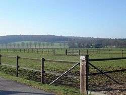 Looking towards the Montferland hills | |
Flag Coat of arms | |
.svg.png) Location in Gelderland | |
| Coordinates: 51°56′N 6°8′E | |
| Country | Netherlands |
| Province | Gelderland |
| Established | 1 January 2005[1] |
| Government | |
| • Body | Municipal council |
| • Mayor | Peter de Baat (VVD) |
| Area | |
| • Total | 106.63 km2 (41.17 sq mi) |
| • Land | 105.68 km2 (40.80 sq mi) |
| • Water | 0.95 km2 (0.37 sq mi) |
| Elevation | 13 m (43 ft) |
| Population (January 2019)[5] | |
| • Total | 36,026 |
| • Density | 341/km2 (880/sq mi) |
| Time zone | UTC+1 (CET) |
| • Summer (DST) | UTC+2 (CEST) |
| Postcode | 6940–6942, 7035–7048 |
| Area code | 0314, 0316 |
| Website | www |
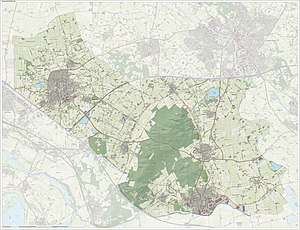
Topographic map of Montferland (June 2015)
Population centres
Formerly part of Bergh municipality:
Formerly part of Didam municipality:
- Didam
- Greffelkamp
- Holthuizen
- Loil
- Nieuw-Dijk
- Oud-Dijk
Gallery
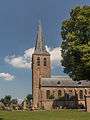 St Martin's church in Beek
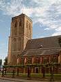 Didam church
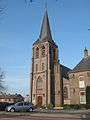 Kilder church
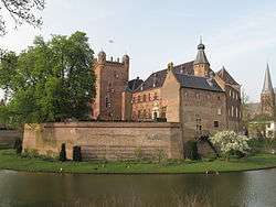 Huis Bergh castle in
's-Heerenberg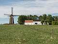 Düffels Möl in Stokkum
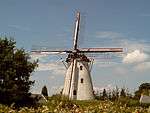 Windmill in Zeddam village
Notable people
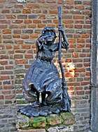
Sculpture of Mechteld ten Ham
- Willem IV van den Bergh (1537 in 's-Heerenberg – 1586) Stadtholder of Guelders and Zutphen
- Herman van den Bergh (1558 in 's-Heerenberg – 1611) a Dutch soldier in the Eighty Years' War
- Mechteld ten Ham (died 25 July 1605) an alleged Dutch witch in the city of 's-Heerenberg
- Everard Ter Laak (1868 in Didam - 1931) a Dutch Roman Catholic missionary in China
- Jozef Rulof (1898 in 's-Heerenberg – 1952) a Dutch author and psychic and trance medium or spirit medium
- Jos Som (born 1951 in Didam) a Dutch politician deputy Mayor of Didam
- Ernie Brandts (born 1956 in Nieuw-Dijk) a Dutch football manager and former player with 452 club caps
- Geert-Jan Derksen (born 1975 in Didam) a Dutch rower, silver medallist at the 2004 Summer Olympics
References
- "Gemeentelijke indeling op 1 januari 2005" [Municipal divisions on 1 January 2005]. cbs.nl (in Dutch). CBS. Retrieved 10 July 2014.
- "Samenstelling college" [Members of the board] (in Dutch). Gemeente Montferland. Retrieved 10 July 2014.
- "Kerncijfers wijken en buurten" [Key figures for neighbourhoods]. CBS Statline (in Dutch). CBS. 2 July 2013. Retrieved 12 March 2014.
- "Postcodetool for 6942GK". Actueel Hoogtebestand Nederland (in Dutch). Het Waterschapshuis. Retrieved 10 July 2014.
- "Bevolkingsontwikkeling; regio per maand" [Population growth; regions per month]. CBS Statline (in Dutch). CBS. 1 January 2019. Retrieved 1 January 2019.
External links

- Official website
Places adjacent to Montferland | ||||||||||
|---|---|---|---|---|---|---|---|---|---|---|
| ||||||||||

This article is issued from Wikipedia. The text is licensed under Creative Commons - Attribution - Sharealike. Additional terms may apply for the media files.