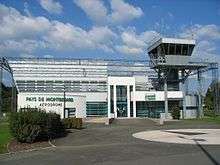
Montbéliard – Courcelles Aerodrome
Montbéliard – Courcelles Aerodrome (French: Aérodrome de Montbéliard - Courcelles) (IATA: XMF, ICAO: LFSM) is an airport serving Montbéliard,[1] a commune in the Doubs department in the Franche-Comté region in eastern France.
Montbéliard - Courcelles Aerodrome Aérodrome de Montbéliard - Courcelles | |||||||||||||||
|---|---|---|---|---|---|---|---|---|---|---|---|---|---|---|---|
 | |||||||||||||||
| Summary | |||||||||||||||
| Airport type | Public | ||||||||||||||
| Operator | Syndicat mixte de l’aérodrome de Montbéliard | ||||||||||||||
| Serves | Montbéliard, Doubs, France | ||||||||||||||
| Location | Courcelles-lès-Montbéliard | ||||||||||||||
| Elevation AMSL | 1,041 ft / 317 m | ||||||||||||||
| Coordinates | 47°29′12″N 006°47′29″E | ||||||||||||||
| Map | |||||||||||||||
 LFSM Location of airport in France | |||||||||||||||
| Runways | |||||||||||||||
| |||||||||||||||
The airport is located 2 km (1.1 NM) south of Montbéliard,[1] near Courcelles-lès-Montbéliard.
Facilities
The airport resides at an elevation of 1,041 feet (317 m) above mean sea level. It has one paved runway designated 08/26 with a bituminous surface measuring 1,700 by 20 metres (5,577 ft × 66 ft). It also has a parallel grass runway which measures 860 by 50 metres (2,822 ft × 164 ft).[1][2]
References
- LFSM – MONTBÉLIARD COURCELLES. AIP from French Service d'information aéronautique, effective 13 August 2020.
- (in French) Aérodrome de Montbéliard - Courcelles (XMF / LFSM) Archived 2010-05-24 at the Wayback Machine at Union des Aéroports Français
- Airport information for LFSM from DAFIF (effective October 2006)
External links
- (in French) Aéroclub du Pays de Montbéliard
- (in French) Club de parachutisme de Montbéliard
- (in French) Aérodrome de Montbéliard - Courcelles at Union des Aéroports Français
This article is issued from Wikipedia. The text is licensed under Creative Commons - Attribution - Sharealike. Additional terms may apply for the media files.