Missillac
Missillac (French: [misijak] (![]()
Missillac | |
|---|---|
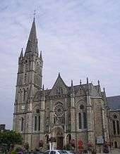 L'église Saint-Pierre-et-Saint-Paul. | |
Location of Missillac 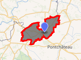
| |
 Missillac 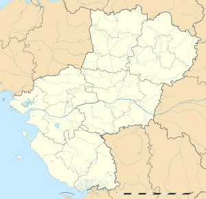 Missillac | |
| Coordinates: 47°28′59″N 2°09′28″W | |
| Country | France |
| Region | Pays de la Loire |
| Department | Loire-Atlantique |
| Arrondissement | Saint-Nazaire |
| Canton | Pontchâteau |
| Intercommunality | Pays de Pont-Château - Saint-Gildas-des-Bois |
| Government | |
| • Mayor (2020–2026) | Jean-Louis Mogan |
| Area 1 | 59.55 km2 (22.99 sq mi) |
| Population (2017-01-01)[1] | 5,342 |
| • Density | 90/km2 (230/sq mi) |
| Demonym(s) | Missillacais, Missillacaises |
| Time zone | UTC+01:00 (CET) |
| • Summer (DST) | UTC+02:00 (CEST) |
| INSEE/Postal code | 44098 /44780 |
| Elevation | 0–63 m (0–207 ft) |
| Website | www.cc-paysdepontchateau.fr |
| 1 French Land Register data, which excludes lakes, ponds, glaciers > 1 km2 (0.386 sq mi or 247 acres) and river estuaries. | |
Geography
Missillac is located at the North-Western edge of Loire-Atlantique at the limit of the Morbihan. 25 km of Saint-Nazaire, 65 km North-West of Nantes and 25 km south of Redon. The villages or communes bordering Missillac are Séverac, Saint-Gildas-des-Bois, Sainte-Reine-de-Bretagne, La Chapelle-des-Marais, Herbignac, Pontchâteau. According to the established ranking by INSEE in 1999, Missillac is a rural district which belongs to Saint-Nazaire. Missillac belongs to the traditional country of Brière. The commune is crossed by the expressway Nantes-Vannes.
See also
- La Baule - Guérande Peninsula
- Communes of the Loire-Atlantique department
- Parc naturel régional de Brière
| Wikimedia Commons has media related to Missillac. |
| Authority control |
|
|---|
- "Populations légales 2017". INSEE. Retrieved 6 January 2020.
This article is issued from Wikipedia. The text is licensed under Creative Commons - Attribution - Sharealike. Additional terms may apply for the media files.