Metaline Falls, Washington
Metaline Falls is a town in Pend Oreille County, Washington, United States. The population was 238 at the 2010 census.[5]
Metaline Falls | |
|---|---|
| Metaline Falls, Washington | |
 Location of Metaline Falls, Washington | |
| Coordinates: 48°51′41″N 117°22′15″W | |
| Country | United States |
| State | Washington |
| County | Pend Oreille |
| Area | |
| • Total | 0.26 sq mi (0.68 km2) |
| • Land | 0.20 sq mi (0.52 km2) |
| • Water | 0.06 sq mi (0.17 km2) |
| Elevation | 2,090 ft (637 m) |
| Population | |
| • Total | 238 |
| • Estimate (2019)[3] | 251 |
| • Density | 1,261.31/sq mi (486.85/km2) |
| Time zone | UTC-8 (Pacific (PST)) |
| • Summer (DST) | UTC-7 (PDT) |
| ZIP code | 99153 |
| Area code(s) | 509 |
| FIPS code | 53-45320 |
| GNIS feature ID | 1523023[4] |
History
Evidence of early indigenous peoples in the area dates to some 12,000 years ago. By 1810, European fur traders were crossing the area. The settlement of Metaline Falls was founded in 1900, with most of its residents then employed by the Mammoth and Morning lead-zinc mines.[6] Metaline Falls was officially incorporated on 13 May 1911.
The name Metaline comes from the abundance of lead ore, galena, found in the region. Though these lead deposits were known since 1869, mining did not commence until 1886. Then in 1910, Metaline Falls was connected with the Idaho and Washington Northern Railroad. The Lehigh Portland Cement Co. plant was soon built, taking advantage of the region's limestone deposits. The Pend Oreille Mine was developed in 1929 by Lewis P. Larsen, and combined with production from the Grandview Mine and the Metaline Mine, the area became the state's largest producer of lead and zinc.[7][8][9][10]
The train sequences of the 1993 film Benny & Joon were filmed in the Metaline Falls area; the 1997 film The Postman was filmed in part in the area. The town's geographic location is similar to that of the fictitious town of Twin Peaks from the TV series of the same name ("Five miles south of the Canadian border, twelve miles west of the state line").[11]
Geography
Metaline Falls is located at 48°51′41″N 117°22′15″W (48.861462, -117.370867).[12]
According to the United States Census Bureau, the town has a total area of 0.21 square miles (0.54 km2), all of it land.[13]
Climate
Metaline Falls has a dry-summer Humid continental climate (Dsb) according to the Köppen climate classification system.
| Climate data for Metaline Falls | |||||||||||||
|---|---|---|---|---|---|---|---|---|---|---|---|---|---|
| Month | Jan | Feb | Mar | Apr | May | Jun | Jul | Aug | Sep | Oct | Nov | Dec | Year |
| Record high °F (°C) | 49 (9) |
57 (14) |
71 (22) |
87 (31) |
98 (37) |
98 (37) |
104 (40) |
108 (42) |
96 (36) |
87 (31) |
59 (15) |
55 (13) |
108 (42) |
| Average high °F (°C) | 29.9 (−1.2) |
37.3 (2.9) |
46.9 (8.3) |
58.9 (14.9) |
68.5 (20.3) |
74.4 (23.6) |
83.9 (28.8) |
82.3 (27.9) |
72.8 (22.7) |
57.2 (14.0) |
39.6 (4.2) |
32.4 (0.2) |
57 (14) |
| Average low °F (°C) | 16.6 (−8.6) |
19.5 (−6.9) |
25.2 (−3.8) |
31.5 (−0.3) |
39 (4) |
45 (7) |
48.6 (9.2) |
46.9 (8.3) |
41.3 (5.2) |
34.7 (1.5) |
26.9 (−2.8) |
21.7 (−5.7) |
33.1 (0.6) |
| Record low °F (°C) | −29 (−34) |
−28 (−33) |
−9 (−23) |
1 (−17) |
22 (−6) |
28 (−2) |
31 (−1) |
33 (1) |
20 (−7) |
−1 (−18) |
−6 (−21) |
−24 (−31) |
−29 (−34) |
| Average precipitation inches (cm) | 3 (7.6) |
2.27 (5.8) |
2.12 (5.4) |
1.8 (4.6) |
2.35 (6.0) |
2.71 (6.9) |
1.25 (3.2) |
1.07 (2.7) |
1.7 (4.3) |
2.65 (6.7) |
3.11 (7.9) |
3.35 (8.5) |
27.38 (69.5) |
| Average snowfall inches (cm) | 26.3 (67) |
15.7 (40) |
8.5 (22) |
0.7 (1.8) |
0.1 (0.25) |
0 (0) |
0 (0) |
0 (0) |
0 (0) |
1 (2.5) |
9.8 (25) |
23.1 (59) |
85.2 (216) |
| Average precipitation days | 14 | 12 | 12 | 10 | 11 | 12 | 6 | 6 | 7 | 11 | 13 | 15 | 129 |
| Source: [14] | |||||||||||||
National protected areas

- Pacific Northwest National Scenic Trail (part)
- Colville National Forest
- Salmo-Priest Wilderness
Demographics
| Historical population | |||
|---|---|---|---|
| Census | Pop. | %± | |
| 1920 | 153 | — | |
| 1930 | 316 | 106.5% | |
| 1940 | 453 | 43.4% | |
| 1950 | 547 | 20.8% | |
| 1960 | 469 | −14.3% | |
| 1970 | 307 | −34.5% | |
| 1980 | 296 | −3.6% | |
| 1990 | 210 | −29.1% | |
| 2000 | 223 | 6.2% | |
| 2010 | 238 | 6.7% | |
| Est. 2019 | 251 | [3] | 5.5% |
| U.S. Decennial Census[15] 2015 Estimate[16] | |||
2010 census
As of the census[2] of 2010, there were 238 people, 124 households, and 54 families residing in the town. The population density was 1,133.3 inhabitants per square mile (437.6/km2). There were 206 housing units at an average density of 981.0 per square mile (378.8/km2). The racial makeup of the town was 94.5% White, 0.4% African American, 2.1% Native American, 0.8% Asian, and 2.1% from two or more races. Hispanic or Latino of any race were 1.7% of the population.
There were 124 households, of which 24.2% had children under the age of 18 living with them, 36.3% were married couples living together, 4.0% had a female householder with no husband present, 3.2% had a male householder with no wife present, and 56.5% were non-families. 49.2% of all households were made up of individuals, and 18.5% had someone living alone who was 65 years of age or older. The average household size was 1.92 and the average family size was 2.91.
The median age in the town was 48.3 years. 20.6% of residents were under the age of 18; 4.6% were between the ages of 18 and 24; 18.9% were from 25 to 44; 37.8% were from 45 to 64; and 18.1% were 65 years of age or older. The gender makeup of the town was 47.9% male and 52.1% female.
2000 census
As of the census of 2000, there were 223 people, 122 households, and 52 families residing in the town. The population density was 1,076.1 people per square mile (410.0/km2). There were 192 housing units at an average density of 926.5 per square mile (353.0/km2). The racial makeup of the town was 96.86% White, 1.35% Asian, 0.45% from other races, and 1.35% from two or more races. Hispanic or Latino of any race were 0.45% of the population.
There were 122 households, out of which 18.0% had children under the age of 18 living with them, 36.1% were married couples living together, 4.9% had a female householder with no husband present, and 56.6% were non-families. 54.1% of all households were made up of individuals, and 21.3% had someone living alone who was 65 years of age or older. The average household size was 1.83 and the average family size was 2.79.
In the town, the population was spread out, with 19.3% under the age of 18, 3.6% from 18 to 24, 21.1% from 25 to 44, 33.2% from 45 to 64, and 22.9% who were 65 years of age or older. The median age was 49 years. For every 100 females, there were 95.6 males. For every 100 females age 18 and over, there were 85.6 males.
The median income for a household in the town was $17,083, and the median income for a family was $35,250. Males had a median income of $36,250 versus $18,333 for females. The per capita income for the town was $16,390. About 24.4% of families and 33.2% of the population were below the poverty line, including 48.1% of those under the age of eighteen and 16.2% of those 65 or over.
References

- "2019 U.S. Gazetteer Files". United States Census Bureau. Retrieved August 7, 2020.
- "U.S. Census website". United States Census Bureau. Retrieved 19 December 2012.
- "Population and Housing Unit Estimates". United States Census Bureau. May 24, 2020. Retrieved May 27, 2020.
- "US Board on Geographic Names". United States Geological Survey. 25 October 2007. Retrieved 2008-01-31.
- "2010 Census Redistricting Data (Public Law 94-171) Summary File". American FactFinder. United States Census Bureau. Retrieved 17 September 2012.
- Majors, Harry M. (1975). Exploring Washington. Van Winkle Publishing Co. p. 59. ISBN 978-0-918664-00-6.
- Bethune, George (1890). "Mines and Minerals of Washington". Google Books. Olympia: State of Washington. pp. 82–83. Retrieved 2 July 2020.
- Dings, McClelland; Whitebread, Donald. "Geology and Ore Deposits of the Metaline Zinc-Lead District Pend Oreille County Washington, USGS Professional Paper 489" (PDF). USGS. pp. 56–58. Retrieved 2 July 2020.
- McConnel, Roger; Anderson, Roy (1968). Ridge, John (ed.). The Metaline District, Washington, in Ore deposits of the United States, 1933-1967. New York: The American Institute of Mining, Metallurgical, and Petroleum engineers, Inc. pp. 1460–1480.
- Willenbrock, Fred. "Pend Oreille County braces for economic losses after closure of last major rock mine". spokesman.com. The Spokesman Review. Retrieved 2 July 2020.
- "'Twin Peaks,' a 509 institution". The Spokesman Review. 10 October 2014. Retrieved 27 June 2019.
- "US Gazetteer files: 2010, 2000, and 1990". United States Census Bureau. 12 February 2011. Retrieved 23 April 2011.
- "US Gazetteer files 2010". United States Census Bureau. Archived from the original on 12 January 2012. Retrieved 19 December 2012.
- "METALINE FALLS, WASHINGTON (455317)". Western Regional Climate Center. Retrieved November 18, 2015.
- United States Census Bureau. "Census of Population and Housing". Retrieved October 4, 2013.
- "Population Estimates". United States Census Bureau. Archived from the original on October 19, 2016. Retrieved July 14, 2016.
Municipalities and communities of Pend Oreille County, Washington, United States | ||
|---|---|---|
| City | 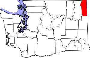 Map of Washington highlighting Pend Oreille County | |
| Towns | ||
| Unincorporated communities | ||