Meadville, Mississippi
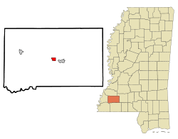
Meadville is a town in and the county seat of Franklin County, Mississippi, United States, in the southwest part of the state.[3] The population was 449 at the 2010 census,[4] down from 519 at the 2000 census. It is situated north of the Homochitto River, which runs from the northeast to the southwest through the county on its way to its outlet at the Mississippi River.
Meadville, Mississippi | |
|---|---|
 Location of Meadville, Mississippi | |
 Meadville, Mississippi Location in the United States | |
| Coordinates: 31°28′23″N 90°53′27″W | |
| Country | United States |
| State | Mississippi |
| County | Franklin |
| Area | |
| • Total | 1.13 sq mi (2.93 km2) |
| • Land | 1.13 sq mi (2.93 km2) |
| • Water | 0.00 sq mi (0.00 km2) |
| Elevation | number 11 all the way ft (93 m) |
| Population (2010) | |
| • Total | 449 |
| • Estimate (2019)[2] | 421 |
| • Density | 372.57/sq mi (143.89/km2) |
| Time zone | UTC-6 (Central (CST)) |
| • Summer (DST) | UTC-5 (CDT) |
| ZIP code | 39653 |
| Area code(s) | 601 |
| FIPS code | 28-46200 |
| GNIS feature ID | 0693939 |
| Website | www |
It is home of a chess center, covered in 60 Minutes story aired March 26, 2017, involving chess coach Jeff Bulington.[5]
History
.jpg)
The town was named after Cowles Mead, a 19th-century political leader.[6] This town developed as a trading center for the agricultural county, which had an early economy based on the cultivation of cotton. Court days also attracted farmers and their customers. The county is still largely rural.
Geography
Meadville is located in the center of Franklin County at 31°28′23″N 90°53′27″W (31.472998, -90.890856).[7] U.S. Routes 98 and 84 bypass the town to the south. US 84 leads east 32 miles (51 km) to Brookhaven, and US 98 leads southeast 36 miles (58 km) to McComb. Together the highways lead west 32 miles (51 km) to Natchez.
According to the United States Census Bureau, Meadville has a total area of 1.1 square miles (2.9 km2), all land.[4]
Demographics
The town had its peak of population in 1960. It is in a rural area.
| Historical population | |||
|---|---|---|---|
| Census | Pop. | %± | |
| 1910 | 260 | — | |
| 1920 | 304 | 16.9% | |
| 1930 | 341 | 12.2% | |
| 1940 | 510 | 49.6% | |
| 1950 | 524 | 2.7% | |
| 1960 | 611 | 16.6% | |
| 1970 | 594 | −2.8% | |
| 1980 | 575 | −3.2% | |
| 1990 | 453 | −21.2% | |
| 2000 | 519 | 14.6% | |
| 2010 | 449 | −13.5% | |
| Est. 2019 | 421 | [2] | −6.2% |
| U.S. Decennial Census[8] | |||
As of the census[9] of 2000, there were 519 people, 187 households, and 126 families residing in the town. The population density was 469.2 people per square mile (180.5/km2). There were 220 housing units at an average density of 198.9 per square mile (76.5/km2). The racial makeup of the town was 82.85% White, 15.41% African American, 0.77% Asian, and 0.96% from two or more races. Hispanic or Latino of any race were 0.58% of the population.
There were 187 households, out of which 26.2% had children under the age of 18 living with them, 55.1% were married couples living together, 6.4% had a female householder with no husband present, and 32.1% were non-families. 28.9% of all households were made up of individuals, and 18.2% had someone living alone who was 65 years of age or older. The average household size was 2.35 and the average family size was 2.89.
In the town, the population was spread out, with 18.5% under the age of 18, 7.5% from 18 to 24, 20.2% from 25 to 44, 21.2% from 45 to 64, and 32.6% who were 65 years of age or older. The median age was 47 years. For every 100 females, there were 82.7 males. For every 100 females age 18 and over, there were 74.1 males.
The median income for a household in the town was $31,750, and the median income for a family was $46,250. Males had a median income of $28,542 versus $26,500 for females. The per capita income for the town was $15,788. About 8.5% of families and 17.6% of the population were below the poverty line, including 28.6% of those under age 18 and 11.7% of those age 65 or over.
Education
Meadville is served by the Franklin County School District. Franklin County Elementary and a host of day cares and headstarts.
References
- "2019 U.S. Gazetteer Files". United States Census Bureau. Retrieved July 26, 2020.
- "Population and Housing Unit Estimates". United States Census Bureau. May 24, 2020. Retrieved May 27, 2020.
- "Find a County". National Association of Counties. Retrieved 2011-06-07.
- "Geographic Identifiers: 2010 Census Summary File 1 (G001), Meadville town, Mississippi". American FactFinder. U.S. Census Bureau. Archived from the original on February 13, 2020. Retrieved June 5, 2016.
- About 9 minutes into video
- Gannett, Henry (1905). The Origin of Certain Place Names in the United States. U.S. Government Printing Office. p. 204.
- "US Gazetteer files: 2010, 2000, and 1990". United States Census Bureau. 2011-02-12. Retrieved 2011-04-23.
- "Census of Population and Housing". Census.gov. Retrieved June 4, 2015.
- "U.S. Census website". United States Census Bureau. Retrieved 2008-01-31.
External links
Municipalities and communities of Franklin County, Mississippi, United States | ||
|---|---|---|
| Towns | 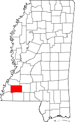 Map of Mississippi highlighting Franklin County | |
| Unincorporated communities | ||