Maldá
Malda or English Bazar is a metropolitan city in the Indian state of West Bengal. It is the sixth largest city in West Bengal.[4] It is the district headquarters of Malda district. It consists of two municipalities, viz. English Bazar Municipality and Old Malda Municipality, under English Bazar Metropolitan Area. Malda was an undeveloped city which was enlarging from 1925 to 1930. The city is growing rapidly nowadays with its population inching towards half a million.
Malda English Bazar | |
|---|---|
Metropolitan City / Urban Agglomeration | |
 Malda City Skyline view | |
| Nickname(s): Mango City | |
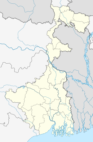 Malda Location in West Bengal, India  Malda Malda (India) 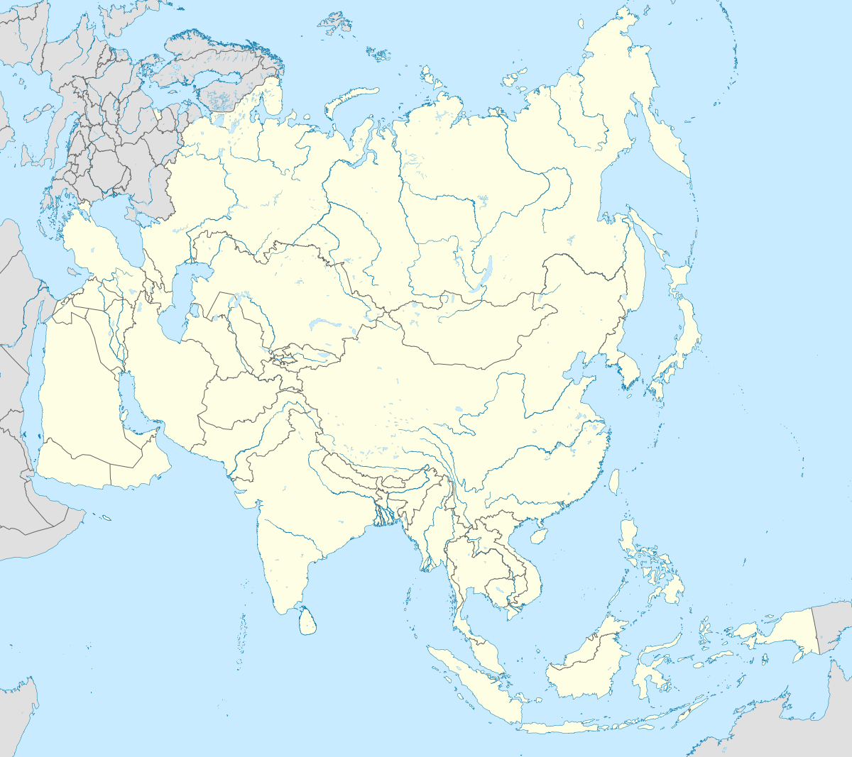 Malda Malda (Asia) | |
| Coordinates: 25.0119°N 88.1433°E | |
| Country | India |
| State | West Bengal |
| District | Malda |
| Division | Malda |
| Railway Station | Malda Town railway station |
| Total Wards | 49 |
| Government | |
| • Type | Municipality |
| • Body | English Bazar Municipality Old Malda Municipality |
| • Chairman | Nihar Ranjan Ghosh |
| • Chairman | Kartick Ghosh |
| Area 13.25 km²(Town) | |
| • Metropolitan City / Urban Agglomeration | 81 km2 (31 sq mi) |
| Elevation | 17 m (56 ft) |
| Population (2011)[1] | |
| • Metropolitan City / Urban Agglomeration | 324,237 |
| • Rank | 6th in West Bengal |
| • Density | 4,000/km2 (10,000/sq mi) |
| • Metro | 216,083 |
| Demonym(s) | Maldabasi |
| Languages | |
| • Official | Bengali[2][3] |
| • Additional official | English[2] |
| Time zone | UTC+5:30 (IST) |
| PIN | 732101, 732102, 732103, 732141, 732142, 732128 |
| Telephone code | 91-3512-2xxxxx |
| Vehicle registration | WB-65/WB-66 |
| Lok Sabha constituency | Maldaha Dakshin, Maldaha Uttar |
| Vidhan Sabha constituency | English Bazar, Malda |
| River | Mahananda River |
| Website | www |

Geography
Malda is located at 25.0119°N 88.1433°E Malda district, West Bengal.[5] It has an average elevation of 17 metres (56 feet). It is on the western bank of the river Mahananda. As in much of Bengal, the weather is usually extremely humid and tropical. Temperatures can reach as high as 46 °C during the day in May and June and fall as low as 4 °C overnight in December and January.
In Malda, the average annual temperature is 25.4 °C (77.7 °F). Precipitation is about 1,349 mm (53.1 in) per year.[6] The driest month is December. There is 1 mm (0.039 in) of precipitation in December. The greatest amount of precipitation occurs in July, with an average of 319 mm (12.6 in).
Civic administration
There are two municipalities in Malda, i.e. the English Bazar Municipality and the Old Malda Municipality.
The municipality of English Bazar is divided into 29 wards. The Trinamool Congress with 15 councillors holds the power in this municipality (as of 2015).

The municipality of Old Malda is divided into 20 wards.[7]
Transport
Road

![]()
Rail

There are four railway stations which serves the metropolitan city. The Malda Town railway station serves the English Bazar area; the Old Malda Junction railway station serves the Old Malda area; the Malda Court railway station serves Mangalbari and Naldubi area, and the Gour Malda railway station serves Mahadipur and Gauḍa (Gour) area.

Air
Malda Airport (IATA: LDA, ICAO: VEMH) was closed in 1972 due to the Bangladesh War. Before that there were direct daily flights from Malda to Kolkata, Delhi, and Guwahati. In 2014, direct helicopter services were started between Malda and Kolkata, by the government of West Bengal. As of 2017, the airport is under construction and the flight service will start very soon.
Demographics
As of the 2011 census, Malda metropolitan city had a total population of 324,237.[8]
As of the 2011 census, English Bazar municipality had a population of 216,083.[1] The municipality had a sex ratio of 877 females per 1,000 males and 14.9% of the population were under six years old.[1] Effective literacy was 84.69%; male literacy was 85.44% and female literacy was 83.86%.[1]
As of 2001 India census,[9] Old Malda Municipality had a population of 62,944. Males constitute 52% of the population and females 48%. Old Malda has an average literacy rate of 61%, higher than the national average of 59.5%: male literacy is 67%, and female literacy is 54%. In Old Malda, 15% of the population is under 6 years of age. Most of the people are Hindu. Some Muslim, Shikh, Christian people live here.
Education

University
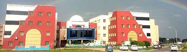
- The University of Gour Banga, established in 2008. Almost all the 28 colleges in Malda, Dakshin Dinajpur and Uttar Dinajpur districts (except for Raiganj University College), are affiliated with it.
General degree Colleges
Engineering colleges
- Ghani Khan Choudhury Institute of Engineering & Technology (GKCIET)
- IMPS College of Engineering and Technology
Polytechnic colleges
Medical colleges
Boys' high schools

Girls' high schools
Rail schools
English medium schools
Hospitals and health care
Malda is becoming the medical hub of this region. Malda Medical College and Hospital is a top class hospital in the district and also nearby district. There many primary healthcare centers in the city. Private nursing homes, a pathology centre, clinics, and medical stores are present.
Malda Medical College and Hospital
The Government of West Bengal decided to set up a new medical college at the strategically located district of Malda, which is easily accessible to the districts in the region of North Bengal.

Malda Railway Hospital
Malda Railway Hospital is established to serve health care for railway needs. It is near the Malda Town Railway Station.
Media And Newspapers
All national channels and also some local media channels like Malda Today, High TV, Sabar Cable, Sabar Monoranjan, MCN News, CCN and DAM's TV are local channels which are operated throughout the city. And also serves nearby districts news like North Dinajpur, South Dinajpur, and Murshidabad
Newspapers
- Aamader Malda
- Jaruree Guide
- Rupantare Pathe
- Uttarbanga Sambad
Notable people
- A. B. A. Ghani Khan Choudhury - (1927 – 2006) politician and a senior leader of the Indian National Congress party.
- Abu Nasar Khan Choudhury
- Shibram Chakraborty - (1903 – 1980) Bengali writer, humorist and revolutionary.
- Asim Dasgupta - (b. October 1945) former Minister for Finance and Excise in the Left Front ministry in the Indian state of West Bengal.[10]
- Benoy Kumar Sarkar - (1887-1949) Indian social scientist, professor, nationalist and founder of several institutes in Kolkata.
- Subhash Bhowmick - born in Malda West Bengal is a retired Indian football international player and club level coach and manager.
- Subhamita Banerjee - Bengali singer who specializes in modern songs, Ghazals. She has many Bengali albums to her credit .[11]
- Mausam Noor
- Sreerupa Mitra Chaudhury
- Sukhendu Sekhar Roy
- Sabina Yeasmin
- Nihar Ranjan Ghosh
- Krishnendu Narayan Choudhury
See also
- English Bazar (community development block)
- Malda Museum
- List of cities in West Bengal
- List of metropolitan area in West Bengal
References
- "Provisional Population Totals, Census of India 2011; Cities having population 1 lakh and above" (PDF). Office of the Registrar General & Census Commissioner, India. Retrieved 27 March 2012.
- "Fact and Figures". www.wb.gov.in. Retrieved 15 January 2019.
- "52nd REPORT OF THE COMMISSIONER FOR LINGUISTIC MINORITIES IN INDIA" (PDF). nclm.nic.in. Ministry of Minority Affairs. p. 85. Archived from the original (PDF) on 25 May 2017. Retrieved 15 January 2019.
- "Urban Agglomerations/Cities having population 1 lakh and above" (PDF). Provisional Population Totals, Census of India 2011. Retrieved 10 October 2011.
- "Maps, Weather, and Airports for Ingraj Bazar,India". fallingrain.com.
- "Malda climate: Average Temperature, weather by month, Malda weather averages - Climate-Data.org". en.climate-data.org. Retrieved 19 April 2020.
- "Battle of couples in Malda civic polls | Kolkata News - Times of India". The Times of India.
- "Provisional Population Totals, Census of India 2011; Urban Agglomerations/Cities having population 1 lakh and above" (PDF). Office of the Registrar General & Census Commissioner, India. Retrieved 27 March 2012.
- "Census of India 2001: Data from the 2001 Census, including cities, villages and towns (Provisional)". Census Commission of India. Archived from the original on 16 June 2004. Retrieved 1 November 2008.
- "English is must-learn, says Asim". The Telegraph. 18 December 2008. Retrieved 19 August 2019.
- "BASC Puja 2009: Entertainment". Bascweb.org. Retrieved 3 April 2016.
Further reading
- Chakrabarti D.K. (1992). Notes on the archaeology of Maldaha and West Dinajpur districts, West Bengal. South Asian Studies, 9:pp. 123–135
External links
![]()
Cities, towns and locations in Malda district | |||||
|---|---|---|---|---|---|
| Cities, municipal and census towns |
| ||||
| Locations other than cities and towns |
| ||||
| Related topics |
| ||||