Mahlberg
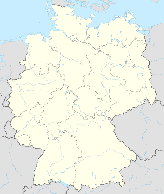
Mahlberg is a town in the Ortenaukreis, in western Baden-Württemberg, Germany. It is situated 8 km southwest of Lahr, near the Europa-Park Rust. It is about 30 kilometres (20 mi) north of Freiburg im Breisgau and 30 km (20 mi) south of Strasbourg. It is in the Upper rhine Metropolitan Region, a region combining Alsace, Switzerland and Southwest-Germany.
Mahlberg | |
|---|---|
 Coat of arms | |
Location of Mahlberg within Ortenaukreis district  | |
 Mahlberg 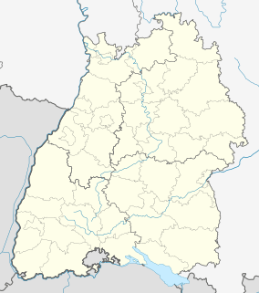 Mahlberg | |
Coordinates: 48°17′13″N 07°48′41″E
 | |
| Country | Germany |
| State | Baden-Württemberg |
| Admin. region | Freiburg |
| District | Ortenaukreis |
| Government | |
| • Mayor | Dietmar Benz |
| Area | |
| • Total | 16.59 km2 (6.41 sq mi) |
| Elevation | 180 m (590 ft) |
| Population (2018-12-31)[1] | |
| • Total | 5,061 |
| • Density | 310/km2 (790/sq mi) |
| Time zone | CET/CEST (UTC+1/+2) |
| Postal codes | 77972 |
| Dialling codes | 07825 |
| Vehicle registration | OG |
| Website | www.mahlberg.de |
20th century
In 1935, Mahlberg lost its city rights in the course of the National Socialist central administrative “cleanup”, but was given it back in 1950 after the then Prime Minister of Baden, Leo Wohleb (before Baden-Wuerttemberg was founded). With the dissolution of the district of Lahr, Mahlberg fell to the new Ortenaukreis.
Geography
Incorporations
The previously independent municipality of Orschweier was incorporated into the city of Mahlberg on October 1, 1973 as part of the municipal reform in Baden-Württemberg. This was preceded by - ultimately unsuccessful - negotiations with the neighboring communities of Ettenheim and Kippenheim.
Neighboring Communities
Immediate neighboring municipalities are Kippenheim in the north (followed by Lahr), Kappel-Grafenhausen in the west beyond the federal highway 5 and Ettenheim in the southeast (with Altdorf).
City Arrangement
Mahlberg includes the formerly independent municipality of Orschweier, in which about a third of the total population lives. The town of Mahlberg and the Allmendhöfe homestead belong to the town of Mahlberg in the boundaries of September 30, 1973. The former municipality of Orschweier includes the village of Orschweier south of Mahlberg and the Orschweier train station. In the district of Mahlberg was the village of Altenmahlberg, which emerged in Mahlberg.
A few years ago, an inter-communal industrial area called "DYNA5" was also identified and developed with the neighboring community of Ettenheim.
Climate
Mahlberg is in a zone with warm and humid oceanic climate. The climate in this region shows slight differences between highs and lows, and there is sufficient rainfall throughout the year. However, it quickly becomes a "humid subtropical climate" since the average temperatures in July and August are just under 22°C. Most precipitation falls in May, while late summer months almost have a Mediterranean climate with light rainfall. Mahlberg currently falls in one of the warmest regions in Germany with an average annual temperature of 11.9 ° C.
| Climate data for Mahlberg (CFB Lahr) 2015-2020 Extremes; High, Low, Mean Temperatures with precipitation + Sunny days | |||||||||||||
|---|---|---|---|---|---|---|---|---|---|---|---|---|---|
| Month | Jan | Feb | Mar | Apr | May | Jun | Jul | Aug | Sep | Oct | Nov | Dec | Year |
| Record high °C (°F) | 15.7 (60.3) |
20.5 (68.9) |
24.4 (75.9) |
29.8 (85.6) |
32.8 (91.0) |
37.0 (98.6) |
38.4 (101.1) |
39.5 (103.1) |
32.2 (90.0) |
27.7 (81.9) |
23.0 (73.4) |
16.9 (62.4) |
39.5 (103.1) |
| Average high °C (°F) | 6.1 (43.0) |
7.8 (46.0) |
12.5 (54.5) |
17.0 (62.6) |
20.7 (69.3) |
25.2 (77.4) |
28.0 (82.4) |
27.2 (81.0) |
22.5 (72.5) |
16.3 (61.3) |
10.5 (50.9) |
7.6 (45.7) |
16.8 (62.2) |
| Daily mean °C (°F) | 3.1 (37.6) |
3.7 (38.7) |
7.3 (45.1) |
11.0 (51.8) |
15.1 (59.2) |
19.5 (67.1) |
21.7 (71.1) |
20.5 (68.9) |
16.0 (60.8) |
11.1 (52.0) |
6.8 (44.2) |
4.5 (40.1) |
11.65 (52.97) |
| Average low °C (°F) | −0.3 (31.5) |
−0.4 (31.3) |
2 (36) |
4.7 (40.5) |
9.3 (48.7) |
13.5 (56.3) |
15.0 (59.0) |
14.1 (57.4) |
10.0 (50.0) |
6.3 (43.3) |
2.8 (37.0) |
1.1 (34.0) |
6.5 (43.7) |
| Record low °C (°F) | −11.8 (10.8) |
−12.6 (9.3) |
−4.9 (23.2) |
−2.8 (27.0) |
1.1 (34.0) |
6.1 (43.0) |
6.4 (43.5) |
6.5 (43.7) |
1.2 (34.2) |
−2.1 (28.2) |
−7.2 (19.0) |
−6.7 (19.9) |
−12.6 (9.3) |
| Average precipitation mm (inches) | 60 (2.4) |
40 (1.6) |
42 (1.7) |
66 (2.6) |
108 (4.3) |
69 (2.7) |
58 (2.3) |
49 (1.9) |
45 (1.8) |
44 (1.7) |
49 (1.9) |
46 (1.8) |
676 (26.6) |
| Average rainy days (≥ 0.2 mm) | 18 | 13 | 13 | 14 | 15 | 13 | 12 | 11 | 10 | 11 | 14 | 16 | 160 |
| Average snowy days (≥ 0.2 cm) | 2 | 1 | 1 | 1 | 0 | 0 | 0 | 0 | 0 | 0 | 1 | 1 | 7 |
| Average relative humidity (%) | 87 | 84 | 77 | 72 | 73 | 73 | 73 | 76 | 80 | 86 | 85 | 87 | 79 |
| Mean monthly sunshine hours | 53 | 95 | 152 | 193 | 216 | 244 | 274 | 244 | 196 | 109 | 63 | 56 | 1,895 |
| Source: Wetterdienst[2] | |||||||||||||
Personalities
Sons and daughters of the town
- Friedrich Karl of Landolin Blittersdorf (1792–1861), Baden official
- Fidel Binz (1850–1920), sculptor Baden
- Karl Kromer (1865–1939), composer and musician
- Josef Loreye (1767–1844), Roman Catholic priest, director of Lyceum in Rastatt
Other famous residents
- Johann Heinrich David Henn Hofer (1793–1850), Baden diplomat, lived retired temporarily in Mahlberg.
- Wolfram Siebeck (1928–2016), columnist and food critic, had one of his residences in Mahlberg castle since the late 1980s.
- Christina Obergföll (born 1981), javelin thrower, world champion 2013 World Championships in Athletics in Moscow, European record in the javelin
References
- "Bevölkerung nach Nationalität und Geschlecht am 31. Dezember 2018". Statistisches Landesamt Baden-Württemberg (in German). July 2019.
- "Lahr". Principal Station Data. Wetterdienst. Retrieved 2 February 2020.

| Authority control |
|
|---|