Lytle, Texas
Lytle is a city in Atascosa, Bexar, and Medina counties in the U.S. state of Texas. The population was 2,492 at the 2010 census. It is part of the San Antonio Metropolitan Statistical Area.
Lytle, Texas | |
|---|---|
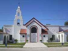 St. Andrew the Apostle Catholic Church in Lytle (established December 8, 1948) | |
| Motto(s): A city on the grow! | |
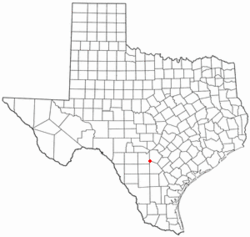 Location of Lytle in Texas | |
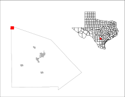 Location of Lytle in Atascosa County | |
| Coordinates: 29°13′59″N 98°48′0″W | |
| Country | United States |
| State | Texas |
| Counties | Atascosa, Medina, Bexar |
| Area | |
| • Total | 4.81 sq mi (12.45 km2) |
| • Land | 4.76 sq mi (12.33 km2) |
| • Water | 0.05 sq mi (0.12 km2) |
| Elevation | 722 ft (220 m) |
| Population (2010) | |
| • Total | 2,492 |
| • Estimate (2019)[2] | 3,066 |
| • Density | 644.25/sq mi (248.73/km2) |
| Time zone | UTC-6 (Central (CST)) |
| • Summer (DST) | UTC-5 (CDT) |
| ZIP code | 78052 |
| Area code(s) | 830 |
| FIPS code | 48-45288 |
| GNIS feature ID | 1362011 |
| Website | www |
| [3] | |
History
Lytle was founded in 1882 by cattleman Captain Juan T. Lytle[4] after a railroad station was established in the area. It was incorporated on October 27, 1951.[5] An undated newspaper clipping entitled "Pioneer of Lytle" reads, "...W. J. Garnand was the first man to locate in the town of Lytle. That was in 1883. He was the first postmaster there and has been a leading citizen all the time."[6][7]
Geography
Lytle is located in the northern corner of Atascosa County. Most of the city lies in Atascosa County; only small portions extend into Bexar and Medina counties.[8]
Interstate 35 passes through the southeast part of the city, with access from Exit 131. Lytle's Main Street is Texas State Highway 132, following the route of the former U.S. Route 81 southwest to Natalia and Devine, before rejoining I-35. Downtown San Antonio is 25 miles (40 km) northeast via I-35, and Laredo is 133 miles (214 km) to the south.
According to the United States Census Bureau, the city has a total area of 4.5 square miles (12 km2), of which, 4.45 square miles (11.5 km2) of it is land and 0.04 square miles (0.10 km2) is water.[9]
Climate
The area's climate is characterized by hot, humid summers and generally mild to cool winters. According to the Köppen Climate Classification system, Lytle has a humid subtropical climate.[10]
Demographics
| Historical population | |||
|---|---|---|---|
| Census | Pop. | %± | |
| 1960 | 798 | — | |
| 1970 | 1,298 | 62.7% | |
| 1980 | 1,920 | 47.9% | |
| 1990 | 2,255 | 17.4% | |
| 2000 | 2,383 | 5.7% | |
| 2010 | 2,492 | 4.6% | |
| Est. 2019 | 3,066 | [11] | 23.0% |
| U.S. Decennial Census[12] | |||
As of the census[2] of 2000, there were 2,383 people, 811 households, and 633 families residing in the city. The population density was 593.4 people per square mile (228.9/km2). There were 898 housing units at an average density of 223.6/sq mi (86.2/km2). The racial makeup of the city was 73.81% White, 0.46% African American, 0.92% Native American, 0.29% Asian, 0.04% Pacific Islander, 21.57% from other races, and 2.90% from two or more races. Hispanic or Latino of any race were 61.18% of the population. There were 811 households, out of which 39.6% had children under the age of 18 living with them, 60.8% were married couples living together, 13.6% had a female householder with no husband present, and 21.9% were non-families. 19.9% of all households were made up of individuals, and 9.4% had someone living alone who was 65 years of age or older. The average household size was 2.94 and the average family size was 3.38.
In the city, the population was spread out, with 30.5% under the age of 18, 9.3% from 18 to 24, 26.6% from 25 to 44, 21.4% from 45 to 64, and 12.2% who were 65 years of age or older. The median age was 34 years. For every 100 females, there were 91.6 males. For every 100 females age 18 and over, there were 85.1 males.
The median income for a household in the city was $34,857, and the median income for a family was $40,699. Males had a median income of $27,734 versus $21,129 for females. The per capita income for the city was $14,826. About 15.0% of families and 16.6% of the population were below the poverty line, including 21.8% of those under age 18 and 20.0% of those age 65 or over.
Education
The Lytle Independent School District serves almost all of Lytle and is home to the Lytle High School Pirates. A small sliver of Lytle (the portion in Bexar County) is served by the Southwest Independent School District. Another portion is in the Natalia Independent School District.
In popular culture
English artist Cornelia Parker retrieved charcoal from a Baptist church which had been struck by lightning in Lytle and reassembled the pieces in her 1997 installation, Mass (Colder Darker Matter), which was displayed in the Frith Street Gallery in London, England.[13][14]
Gallery
 U.S. Post Office in Lytle
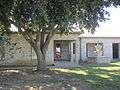 Lytle Community Center
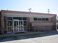 Lytle City Hall
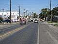 Downtown Lytle
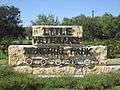 Veterans Memorial Park in Lytle
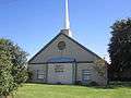 Trinity Baptist Church in Lytle
References
- "2019 U.S. Gazetteer Files". United States Census Bureau. Retrieved August 7, 2020.
- "U.S. Census website". United States Census Bureau. Retrieved 2008-01-31.
- "US Board on Geographic Names". United States Geological Survey. 2007-10-25. Retrieved 2008-01-31.
- Juan T. Lytle; Texas Handbook online; accessed August 2020
- "City of Lytle, Texas - Official Website". Retrieved 15 December 2013.
- Undated newspaper clipping. "Pioneer of Lytle"; includes a photo of Garnand; [Dubious]
- Ancestrylibrary.com, Appointments of U.S. Postmasters, 1832-1971, database. See Atascosa County, Lytle, William J. Garnand, appointed 10 September 1883; retrieved 8 May 2020.
- "Geographic Identifiers: 2010 Demographic Profile Data (G001): Lytle city, Texas". U.S. Census Bureau, American Factfinder. Archived from the original on February 12, 2020. Retrieved August 23, 2013.
- "US Gazetteer Files 2016-Places-Texas". US Census. Retrieved 11 January 2017.
- Climate Summary for Lytle, Texas
- "Population and Housing Unit Estimates". United States Census Bureau. May 24, 2020. Retrieved May 27, 2020.
- "Census of Population and Housing". Census.gov. Retrieved June 4, 2015.
- "Tate Gallery, London: Turner Prize Artists 1984-2005". Retrieved 23 August 2003.
- "Sculptor Cornelia Parker's Multidimensional Charcoal 'Drawings' Leave Us to Ponder Burned Churches from Which Her Pieces are Made". Retrieved 14 January 2014.
| Wikimedia Commons has media related to Lytle, Texas. |
External links
Municipalities and communities of Atascosa County, Texas, United States | ||
|---|---|---|
| Cities |  Atascosa County map | |
| Town | ||
| CDP | ||
| Other unincorporated communities | ||
| Footnotes | ‡This populated place also has portions in an adjacent county or counties | |
Municipalities and communities of Bexar County, Texas, United States | ||
|---|---|---|
| Cities | 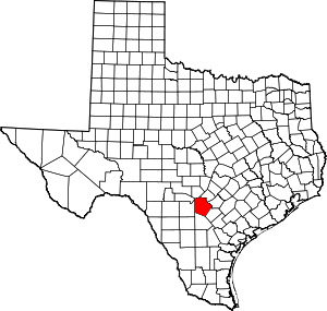 Bexar County map | |
| Towns | ||
| CDPs | ||
| Other unincorporated communities | ||
| Footnotes | ‡This populated place also has portions in an adjacent county or counties | |
Municipalities and communities of Medina County, Texas, United States | ||
|---|---|---|
| Cities | 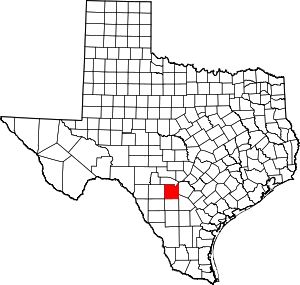 Medina County map | |
| CDPs | ||
| Other unincorporated communities | ||
| Ghost towns |
| |
| Footnotes | ‡This city also has portions in an adjacent county or counties | |
| Authority control |
|---|