List of state highways in Nebraska
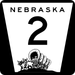
In the U.S. state of Nebraska, the Nebraska Department of Transportation (NDOT) maintains a system of state highways. Every significant section of roadway maintained by the state is assigned a number, officially State Highway No. X[2] but also commonly referred to as Nebraska Highway X, as well as N-X. State highways are signed with a white trapezoidal field on a black background with the state, route number and oxen pulled covered wagon displayed in black (see Nebraska State Highway System § Signage). Along with the state highways are a system of spurs and links which provide additional access points for the state highway system. In addition, the Nebraska Game and Parks Commission has designated some roads as Recreational Roads which are maintained by NDOT but are mostly unsigned.
| State Highway System | |
|---|---|
   Highway markers from different years for former N-38 (1932), former N-28 (1950s) and current N-2 | |
| System information | |
| Maintained by NDOT | |
| Formed | 1917[1] |
| Highway names | |
| State | State Highway No. X (N-X) |
| System links | |
State highways
| Number | Length (mi)[2] | Length (km) | Southern or western terminus | Northern or eastern terminus | Formed | Removed | Notes | |
|---|---|---|---|---|---|---|---|---|
| — | — | — | — | 1922 | 1926 | |||
| 26.88 | 43.26 | US 34 south of Elmwood | US 34/US 75 near Murray | 1926 | current | |||
| — | — | — | — | — | — | |||
| — | — | — | — | — | — | |||
| — | — | — | — | — | — | |||
| — | — | — | — | — | — | |||
| — | — | — | — | — | — | |||
| — | — | — | — | — | — | |||
| 422.29 | 679.61 | SD-71/N-71 at South Dakota state line near Crawford US 77 in Lincoln | I-80 near Grand Island Iowa 2 at Iowa state line on Missouri River in Nebraska City |
1922 | current | Highway is split into two segments | ||
| — | — | — | — | — | — | |||
| — | — | — | — | — | — | |||
| — | — | — | — | 1922 | 1960 | |||
| — | — | — | — | — | — | |||
| — | — | — | — | — | — | |||
| — | — | — | — | — | — | |||
| — | — | — | — | — | — | |||
| — | — | — | — | 1922 | 1926 | |||
| 205.48 | 330.69 | US 6/US 34 southwest of Atlanta | US 75 north of Dawson | 1926 | current | |||
| — | — | — | — | 1922 | 1934 | |||
| 11.04 | 17.77 | US 136 in Deshler | N-4 east of Davenport | 1934 | current | |||
| — | — | — | — | — | — | |||
| — | — | — | — | — | — | |||
| — | — | — | — | 1922 | 1926 | |||
| — | — | — | — | 1926 | 1928 | |||
| — | — | — | — | 1928 | 1932 | Renumbered to avoid duplication with US 6 | ||
| — | — | — | — | — | — | |||
| — | — | — | — | 1922 | 1926 | |||
| 84.34 | 135.73 | N-91 in Brewster | US 183 south of Springview | 1926 | current | |||
| — | — | — | — | — | — | |||
| — | — | — | — | — | — | |||
| — | — | — | — | — | — | |||
| — | — | — | — | 1922 | 1957 | |||
| 148.89 | 239.62 | N-14 in Superior | US 73 in Falls City | 1958 | current | |||
| — | — | — | — | 1922 | 1926 | |||
| 60.83 | 97.90 | US 275 north of West Point | N-12 south of Ponca | 1922 | current | |||
| — | — | — | — | — | — | |||
| — | — | — | — | — | — | |||
| 102.18 | 164.44 | K-8 at Kansas state line south of Franklin | N-58/N-92 at Loup City | 1925 | current | |||
| 183.66 | 295.57 | I-80/S-40D south of Wood River | SD 43 at South Dakota state line north of Butte | 1926 | current | |||
| — | — | — | — | — | — | |||
| — | — | — | — | — | — | |||
| — | — | — | — | — | — | |||
| 231.26 | 372.18 | US 83 in Valentine | US 20 west of Jackson | 1925 | current | |||
| — | — | — | — | 1925 | 1934 | |||
| — | — | — | — | 1934 | 1944 | |||
| 48.54 | 78.12 | US 81 east of Hadar | N-84 south of Center | 1944 | current | |||
| — | — | — | — | — | — | |||
| — | — | — | — | — | — | |||
| — | — | — | — | — | — | |||
| 203.53 | 327.55 | K-14 at Kansas state line southwest of Superior | SD 37 at South Dakota state line northeast of Niobrara | 1925 | current | |||
| — | — | — | — | — | — | |||
| 210.11 | 338.14 | K-15 at Kansas state line south of Fairbury | SD 19 at South Dakota state line northeast of Maskell | 1925 | current | |||
| — | — | — | — | 1925 | 1936 | |||
| 28.15 | 45.30 | N-51 southeast of Bancroft | N-35 south of Wakefield | 1936 | current | |||
| — | — | — | — | — | — | |||
| 17.43 | 28.05 | K-117 at Kansas state line southwest of McCook | US 6/US 34 in Culbertson | 1925 | current | |||
| — | — | — | — | 1925 | 1926 | |||
| — | — | — | — | 1926 | 1932 | |||
| — | — | — | — | 1932 | 1964 | |||
| 39.01 | 62.78 | N-23 in Curtis | US 283 south of Elwood | 1976 | current | Eastern section of this highway is gravel surface; former NE 23S | ||
| — | — | — | — | — | — | |||
| 10.91 | 17.56 | CO 113 at Colorado state line south of Lorenzo | US 30 west of Sidney | 1925 | current | |||
| — | — | — | — | 1925 | 1926 | Renumbered to avoid duplication with US 20 | ||
| — | — | — | — | — | — | |||
| — | — | — | — | — | — | |||
| — | — | — | — | — | — | |||
| — | — | — | — | — | — | |||
| — | — | — | — | — | — | |||
| 73.37 | 118.08 | N-23 near Eustis | N-2/N-92 in Broken Bow | 1925 | current | |||
| — | — | — | — | 1925 | 1934 | |||
| 89.25 | 143.63 | N-70 south of Ord | US 81 northwest of Columbus | 1934 | current | |||
| — | — | — | — | 1925 | 1928 | |||
| — | — | — | — | 1928 | 1932 | |||
| 159.91 | 257.35 | CO 23 in Venango | US 6/US 34 in Holdrege | 1932 | current | |||
| — | — | — | — | — | — | |||
| — | — | — | — | — | — | |||
| — | — | — | — | 1925 | 1933 | |||
| 10.38 | 16.70 | US 275/N-35 in Norfolk | N-57 in Stanton | 1933 | current | |||
| — | — | — | — | — | — | |||
| 87.56 | 140.91 | K-25 at Kansas state line south of Trenton | US 30 in Sutherland | — | — | |||
| 6.03 | 9.70 | US 6 in Palisade | N-25 northeast of Palisade | — | — | |||
| — | — | — | — | 1925 | 1926 | Renumbered to avoid duplication with US 26 | ||
| — | — | — | — | — | — | |||
| — | — | — | — | 1925 | 1933 | |||
| 96.61 | 155.48 | K-27 at Kansas state line south of Haigler I-80 near Chappell N-2 in Ellsworth | US 34 in Haigler US 26 in Oshkosh SD 391 at South Dakota state line north of Gordon |
1933 | current | Highway is split into three segments | ||
| — | — | — | — | 1926 | 1933 | |||
| — | — | — | — | 1933 | 1957 | |||
| 55.81 | 89.82 | US 26 in Mitchell | US 20 in Harrison | 1925 | current | |||
| — | — | — | — | — | — | Renumbered to avoid duplication with US 30 | ||
| — | — | — | — | — | — | |||
| 36.33 | 58.47 | N-50 north of Louisville | US 30 southwest of Kennard | 1925 | current | |||
| 100.93 | 162.43 | N-14 in Petersburg | US 75 in Tekamah | 1925 | current | |||
| — | — | — | — | 1925 | 1926 | |||
| 25.56 | 41.13 | US 6/N-15 west of Dorchester | US 77 west of Roca | 1926 | current | |||
| — | — | — | — | 1925 | 1933 | |||
| — | — | — | — | 1933 | 1936 | Renumbered to avoid duplication with US 34 | ||
| 69.51 | 111.87 | US 275/N-24 in Norfolk | US 75/US 77 in Dakota City | 1926 | current | |||
| 23.70 | 38.14 | Reichmuth Road near Fremont | US 75 in Omaha | 1926 | current | |||
| — | — | — | — | 1925 | 1955 | |||
| — | — | — | — | — | — | |||
| — | — | — | — | 1925 | 1926 | |||
| 10.8 | 17.4 | US 275/N-92 in Omaha | I-480/US 75 in Omaha | 1936 | 2003 | |||
| — | — | — | — | — | — | |||
| — | — | — | — | — | — | |||
| — | — | — | — | — | — | |||
| 42.05 | 67.67 | N-92 west of Osceola | N-14 southeast of Albion | 1926 | current | |||
| 85.72 | 137.95 | N-92 in Arnold | N-10 north of Kearney | 1926 | current | |||
| 103.57 | 166.68 | N-14/S-18D in Clay Center | N-50 north of Tecumseh | 1926 | current | |||
| — | — | — | — | 1926 | 1957 | |||
| 30.22 | 48.63 | N-41 northeast of Adams | US 34 in Eagle | 1926 | current | |||
| 31.51 | 50.71 | N-4 south of Wilcox | US 30 in Kearney | 1926 | current | |||
| — | — | — | — | 1926 | 1933 | |||
| — | — | — | — | 1933 | 1957 | |||
| 27.08 | 43.58 | N-91 south of Newman Grove | US 275 in Tilden | 1974 | current | |||
| 12.00 | 19.31 | N-89 west of Stamford | US 6/US 34 north of Oxford | 1926 | current | |||
| 52.14 | 83.91 | N-89 west of Wilsonville N-23 east of Farnam | US 6/US 34 in Cambridge N-40 south of Arnold |
1926 | current | Highway is split into two segments | ||
| — | — | — | — | 1926 | 1957 | |||
| — | — | — | — | 1926 | 1957 | |||
| 91.45 | 147.17 | K-63 at Kansas state line south of Du Bois | US 275/N-92 in Omaha | 1932 | current | |||
| — | — | — | — | — | — | |||
| 36.63 | 58.95 | US 275 northwest of Wisner | Iowa 175 at Iowa state line on Missouri River in Decatur | 1932 | current | |||
| 25.89 | 41.67 | N-14 north of Fullerton | N-91 east of Spalding | 1926 | current | |||
| — | — | — | — | 1926 | 1954 | |||
| 12.04 | 19.38 | US 136 east of Gilead | N-4 west of Daykin | 1977 | current | |||
| — | — | — | — | 1926 | 1933 | |||
| — | — | — | — | 1933 | 1957 | |||
| — | — | — | — | 1926 | 1957 | |||
| 35.28 | 56.78 | US 281 south of Greeley | N-39 west of St. Edward | 1926 | current | |||
| — | — | — | — | 1926 | 1947 | |||
| 58.17 | 93.62 | N-91 east of Leigh N-98 south of Carroll | US 275 north of Stanton N-12 north of Hartington |
1957 | current | Highway is split into two segments | ||
| 52.73 | 84.86 | US 281 south of St. Paul | N-70 east of Arcadia | 1926 | current | |||
| 37.49 | 60.33 | N-14 west of Creighton N-57 south of Coleridge | US 81 east of Magnet US 20/N-15 north of Laurel |
1926 | current | Highway is split into two segments | ||
| — | — | — | — | 1926 | 1932 | |||
| — | — | — | — | 1932 | 1963 | |||
| 234.82 | 377.91 | K-161 at Kansas state line south of Benkelman | SD 73 at South Dakota state line north of Merriman | 1926 | current | |||
| — | — | — | — | 1926 | 1933 | |||
| 18.21 | 29.31 | N-50 south of Tecumseh US 75 west of Stella | N-105 east of Elk Creek N-67 east of Shubert |
1933 | current | Highway is split into two segments | ||
| — | — | — | — | 1926 | 1933 | |||
| 13.96 | 22.47 | US 34 east of Eagle | US 6 southwest of Ashland | 1936 | current | |||
| 44.57 | 71.73 | US 81 south of Columbus US 77 south of Fremont | N-15 north of David City US 75 in Omaha |
1926 | current | Highway is split into two segments | ||
| — | — | — | — | 1926 | 1933 | |||
| 15.23 | 24.51 | Bailey-Pawnee Road at Kansas state line south of Pawnee City | N-4 in Table Rock | 1933 | current | Southern section of this highway is gravel surface | ||
| 83.55 | 134.46 | N-14 south of Central City N-15 west of Dwight US 77 south of Wahoo Walnut Street in Louisville | US 81 south of Stromsburg N-79 in Valparaiso Main Street in Louisville US 34/US 75 west of Plattsmouth |
1926 | current | Highway is split into four segments | ||
| 66.49 | 107.01 | US 73 east of Verdon | US 34 southwest of Nehawka | 1926 | current | |||
| — | — | — | — | 1926 | 1933 | |||
| 11.34 | 18.25 | N-2 south of Ravenna | N-58 in Rockville | 1933 | current | |||
| — | — | — | — | 1926 | 1957 | |||
| 20.87 | 33.59 | US 34 east of Waco | US 81/N-92 in Shelby | 1977 | current | |||
| — | — | — | — | 1926 | 1951 | |||
| 115.78 | 186.33 | N-2/N-92 east of Broken Bow | N-14 in Elgin | 1960 | current | |||
| — | — | — | — | 1926 | 1957 | |||
| 170.12 | 273.78 | CO 71 at Colorado state line south of Kimball | SD 71 at South Dakota state line northwest of Crawford | 1962 | current | |||
| — | — | — | — | 1926 | 1957 | |||
| — | — | — | — | — | — | |||
| 97.71 | 157.25 | N-10 in Minden | N-15 east of Tobias | 1926 | current | |||
| — | — | — | — | — | — | |||
| — | — | — | — | 1926 | 1977 | |||
| — | — | — | — | — | — | |||
| — | — | — | — | — | — | |||
| — | — | — | — | — | — | |||
| 20.02 | 32.22 | K-128 at Kansas state line south of Guide Rock | N-4 west of Lawrence | 1934 | current | |||
| 60.36 | 97.14 | US 34 northwest of Lincoln | N-91 in Snyder | 1934 | current | |||
| — | — | — | — | 1934 | 1951 | |||
| — | — | — | — | 1951 | 1960 | |||
| — | — | — | — | — | — | |||
| — | — | — | — | 1934 | 1970 | |||
| — | — | — | — | — | — | |||
| 51.57 | 82.99 | N-14 in Verdigre | N-15 east of Hartington | 1934 | current | |||
| — | — | — | — | 1934 | 1969 | |||
| 5.01 | 8.06 | N-370 in Papillion | US 275/N-92 in Ralston and Omaha | 1960 | current | |||
| — | — | — | — | — | — | |||
| — | — | — | — | — | — | |||
| — | — | — | — | 1934 | 1964 | |||
| — | — | — | — | — | — | |||
| 76.76 | 123.53 | N-2 in Alliance | SD 407 at South Dakota state line north of Whiteclay | 1934 | current | |||
| 59.00 | 94.95 | WYO 151 northwest of Harrisburg | US 385/N-92 in Bridgeport | 1934 | current | |||
| 72.51 | 116.69 | US 83 west of Danbury | US 183 south of Alma | 1934 | current | |||
| — | — | — | — | 1934 | 1957 | |||
| 230.36 | 370.73 | N-2 north of Dunning | US 30/US 75 in Blair | 1934 | current | |||
| — | — | — | — | 1934 | 1939 | |||
| 489.46 | 787.71 | WYO 92 at Wyoming state line west of Lyman | US 275/Iowa 92 at Iowa state line on Missouri River in Omaha | 1939 | current | Longest highway in Nebraska | ||
| — | — | — | — | — | — | |||
| — | — | — | — | 1934 | 1947 | |||
| — | — | — | — | 1947 | 1957 | |||
| 17.92 | 28.84 | N-9/N-16 in Pender | US 75 northwest of Macy | 1934 | current | |||
| 16.54 | 26.62 | N-11 west of Chambers | US 281 east of Chambers | 1934 | current | |||
| — | — | — | — | 1935 | 1961 | |||
| 20.05 | 32.27 | US 183 north of Taylor | N-91 south of Burwell | 1997 | current | |||
| 140.78 | 226.56 | US 83 north of North Platte | US 20 in Valentine | 1935 | current | |||
| 20.46 | 32.93 | N-13 in Pierce | N-35 west of Wayne | 1935 | current | |||
| 13.05 | 21.00 | K-99 at Kansas state line south of Burchard | N-4 north of Burchard | 1935 | current | |||
| — | — | — | — | 1935 | 1974 | |||
| — | — | — | — | 1935 | 1957 | |||
| — | — | — | — | 1935 | 1957 | |||
| 50.59 | 81.42 | N-8 south of Diller N-4 east of Plymouth | US 136 north of Diller I-80 north of Pleasant Dale |
1935 | current | Highway is split into two segments | ||
| — | — | — | — | 1935 | 1950 | |||
| — | — | — | — | 1950 | 1957 | |||
| 32.85 | 52.87 | N-8 south of Humboldt | N-67 west of Brock | 1935 | current | |||
| — | — | — | — | 1935 | 1957 | |||
| — | — | — | — | 1935 | 1957 | |||
| — | — | — | — | 1935 | 1957 | |||
| 16.07 | 25.86 | US 77/N-92 in Wahoo | US 77 south of Fremont | 1935 | current | |||
| 2.26 | 3.64 | N-35 west of Dakota City | US 20 west of South Sioux City | 1936 | current | |||
| — | — | — | — | 1936 | 1947 | |||
| 15.69 | 25.25 | K-148 at Kansas state line southwest of Odell | US 77 west of Blue Springs | 1939 | current | |||
| — | — | — | — | 1941 | 1957 | |||
| — | — | — | — | 1941 | 1957 | |||
| — | — | — | — | 1941 | 1957 | |||
| 6.60 | 10.62 | N-15 west of Concord | US 20 north of Dixon | 1941 | current | |||
| — | — | — | — | 1941 | 1957 | |||
| — | — | — | — | 1941 | 1957 | |||
| — | — | — | — | 1941 | 1957 | |||
| — | — | — | — | 1957 | 1973 | |||
| 55.03 | 88.56 | N-32 west of Madison N-13 northwest of Pierce N-12 west of Crofton | US 275 north of Battle Creek N-84 east of Bloomfield US 81 northeast of Crofton |
1941 | current | Highway is split into three segments | ||
| — | — | — | — | 1941 | 1957 | |||
| — | — | — | — | 1941 | 1969 | |||
| 16.84 | 27.10 | N-50 south of Syracuse | US 75 south of Nebraska City | 1941 | current | |||
| — | — | — | — | 1941 | 1970 | |||
| — | — | — | — | 1941 | 1957 | |||
| 1.4 | 2.3 | N-370 in Bellevue | US 75 in Bellevue | 1965 | 1990 | |||
| — | — | — | — | 1947 | 1957 | |||
| 19.18 | 30.87 | US 6 in Omaha | US 30 in Blair | 1947 | current | |||
| — | — | — | — | 1941 | 1957 | |||
| — | — | — | — | 1950 | 1957 | |||
| 29.74 | 47.86 | US 20 in Newport | SD 47 at South Dakota state line west of Naper | 1950 | current | |||
| — | — | — | — | 1950 | 1957 | |||
| 48.64 | 78.28 | N-2 east of Ellsworth | US 20 in Rushville | 1960 | current | |||
| 16.16 | 26.01 | US 6/N-31 in Gretna | US 75 in Bellevue | — | — | |||
| — | — | — | — | 1957 | 1960 | |||
| ||||||||
See also

References
- George E. Koster; Nebraska Department of Roads - Human Resources Division (2016). "A History of the Principal Executives of the Nebraska State Highway Department" (PDF). Nebraska Department of Roads. p. 7. Retrieved January 3, 2017.
- Nebraska Department of Roads (2015). "Nebraska Highway Reference Log Book" (PDF). Nebraska Department of Roads. Retrieved January 1, 2017.