List of National Natural Landmarks in South Dakota
From List of National Natural Landmarks, these are the National Natural Landmarks in South Dakota.
Bijou Hills
Mammoth Site of Hot Springs
Buffalo Slough
The Castles
Cottonwood Slough- Dry Run
Red Lake
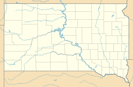
South Dakota National Natural Landmarks (clickable map)
| Name | Image | Date | Location | County | Ownership | Description | |
|---|---|---|---|---|---|---|---|
| 1 | Ancient River Warren Channel | 1965 | Grant | mixed- state, private | A channel cut by the Ancient River Warren during the Ice Age. | ||
| 2 | Bear Butte |  |
1965 | 44.475833°N 103.426944°W | Meade | mixed- state, tribal, private | A cone-shaped mass of igneous rock standing alone 1,300 feet (400 m) above the surrounding plains. |
| 3 | Bijou Hills | 1976 | 43.517778°N 99.147222°W | Charles Mix | private | An excellent example of an erosional remnant of soft clays and shales capped by a channel sandstone and quartzite. | |
| 4 | Buffalo Slough | 1980 | 43.874308°N 96.939013°W | Lake | state | Excellent examples of a prairie pothole with native emergent vegetation, and a native bluestem prairie. | |
| 5 | The Castles | 1976 | 45.527583°N 103.170965°W | Harding | federal (Custer National Forest) | Steep-walled, flat-topped buttes standing 200 to 400 feet (61 to 122 m) above the surrounding prairie. | |
| 6 | Cathedral Spires and Limber Pine Natural Area | 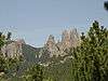 |
1976 | 43.841111°N 103.544444°W | Custer | state (Custer State Park) | An excellent, rare example of joint-controlled weathering of granite. |
| 7 | Cottonwood Slough- Dry Run | 1975 | 44.957077°N 97.193497°W | Roberts | mixed- state, private | A completely undisturbed wetland complex including potholes, streams, shallow open water, lakes, and marsh. | |
| 8 | Fort Randall Eagle Roost | 1967 | Gregory | federal (Missouri National Recreational River) | A prime winter roosting area for bald and golden eagles. | ||
| 9 | Lake Thompson | 1975 | 44.285°N 97.461944°W | Kingsbury | state | Contains a large undisturbed and unmanipulated marsh, an outstanding waterfowl breeding and resting area. | |
| 10 | Mammoth Site of Hot Springs |  |
1980 | 43.42471°N 103.48313°W | Fall River | private | One of the largest concentrations of mammoth remains in the United States. |
| 11 | Red Lake | 1975 | 43.726352°N 99.22518°W | Brule | state | One of the largest remaining natural and unmanipulated prairie pothole lakes. | |
| 12 | Sica Hollow | 1967 | 45.741944°N 97.2425°W | Marshall | state | Displays many facets of natural history. | |
| 13 | Snake Butte | 1967 | Jackson | tribal (Oglala Sioux) | Illustrates one of two types of sand calcite deposits in the world. | ||
This article is issued from Wikipedia. The text is licensed under Creative Commons - Attribution - Sharealike. Additional terms may apply for the media files.